

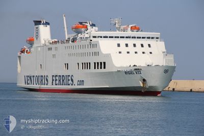
RIGEL VII
Passenger

Current Trip
| Time Travelled | 5 h, 48 mins |
|---|---|
| Remaining Time | 2 h, 13 mins |
| Distance Travelled | 86.67 nm |
| Remaining Distance | --- |
| AVG Speed | 15.6 Knop |
| MAX Speed | 15.9 Knop |
| AVG Wind | 9.1 knots |
| MAX Wind | 16.4 knots |
| MIN Temp | 7.4°C / 45.32°F |
| MAX Temp | 11°C / 51.8°F |
| Djupgående | 5.5 m |
| Position mottagen | Nu |
Current Position
| Longitud | --- |
|---|---|
| Latitude | --- |
| Status | Under way using engine |
| Fart | 13.9 Knop |
| Kurs | 266.6° |
| Område | Adriatic Sea |
| Station | T-AIS |
| Position mottagen | Nu |
Information
The current position of RIGEL VII is in Adriatic Sea with coordinates 41.20937° / 17.52275° as reported on 2025-02-19 03:51 by AIS to our vessel tracker app. The vessel's current speed is 13.9 Knop and is heading at the port of BARI. The estimated time of arrival as calculated by MyShipTracking vessel tracking app is 2025-02-19 06:05 LT
The vessel RIGEL VII (IMO: 9087726, MMSI: 209481000) is a Passenger It's sailing under the flag of [CY] Cyprus.
In this page you can find informations about the vessels current position, last detected port calls, and current voyage information. If the vessels is not in coverage by AIS you will find the latest position.
The current position of RIGEL VII is detected by our AIS receivers and we are not responsible for the reliability of the data. The last position was recorded while the vessel was in Coverage by the Ais receivers of our vessel tracking app.
The current draught of RIGEL VII as reported by AIS is 5.5 meters
Weather
| Temperature | 10.8°C / 51.44°F |
|---|---|
| Wind Speed | 17 knots |
| Direction | 348° NNW |
| Pressure | 1022.8 hPa |
| Humidity | 64.4 % |
| Cloud Coverage | 100 % |


Featured Company
Last Port Calls
| Port | Arrival | Departure | Time In Port |
|---|---|---|---|
| 2025-02-18 06:00 | 2025-02-18 22:04 | 16 h | |
| 2025-02-17 06:33 | 2025-02-17 22:01 | 15 h | |
| 2025-02-16 06:16 | 2025-02-16 22:20 | 16 h | |
| 2025-02-15 07:20 | 2025-02-15 22:10 | 14 h | |
| 2025-02-14 06:25 | 2025-02-14 21:42 | 15 h | |
| 2025-02-13 08:08 | 2025-02-13 22:12 | 14 h | |
| 2025-02-12 06:12 | 2025-02-12 23:40 | 17 h | |
| 2025-02-11 06:37 | 2025-02-11 22:00 | 15 h | |
| 2025-02-10 06:09 | 2025-02-10 22:38 | 16 h | |
| 2025-02-09 06:32 | 2025-02-09 22:16 | 15 h |
Most Visited Ports (Last year)
| Port | Arrivals | |
|---|---|---|
| 191 | ||
| 138 | ||
| 54 | ||
| 16 |
Last Trips
| Origin | Departure | Destination | Arrival | Distance | |
|---|---|---|---|---|---|
| 2025-02-17 23:01 | 2025-02-18 07:00 | 121.07 nm | |||
| 2025-02-16 23:20 | 2025-02-17 07:33 | 122.83 nm | |||
| 2025-02-15 23:10 | 2025-02-16 07:16 | 121.09 nm | |||
| 2025-02-14 22:42 | 2025-02-15 08:20 | 139.89 nm | |||
| 2025-02-13 23:12 | 2025-02-14 07:25 | 124.27 nm | |||
| 2025-02-13 00:40 | 2025-02-13 09:08 | 123.68 nm | |||
| 2025-02-11 23:00 | 2025-02-12 07:12 | 120.89 nm | |||
| 2025-02-10 23:38 | 2025-02-11 07:37 | 122.27 nm | |||
| 2025-02-09 23:16 | 2025-02-10 07:09 | 120.01 nm | |||
| 2025-02-08 23:03 | 2025-02-09 07:32 | 122.42 nm |
Events
| Tid | Event | Detaljer | Position / Dest | Information |
|---|---|---|---|---|
| 2025-02-19 03:04 | Upptäckt i hav | Italian part of the Adriatic Sea |
41.21614 / 17.77394
Adriatic Sea
BARI-DURRES-BARI
|
Fart: 15.5 kn Kurs: 266.5° |
| 2025-02-19 03:03 | Status ändrad | Under way using engine Default |
41.21632 / 17.78013
BARI-DURRES-BARI
|
Fart: 15.4 kn Kurs: 267° |
| 2025-02-19 02:56 | I täckningsområde |
41.21614 / 17.77394
Adriatic Sea
BARI-DURRES-BARI
|
Fart: 15.5 kn Kurs: 266.5° |
|
| 2025-02-18 22:40 | Status ändrad | Default Under way using engine |
41.24869 / 19.29472
BARI-DURRES-BARI
|
Fart: 15.9 kn Kurs: 267.4° |
| 2025-02-18 22:39 | UTANFÖR täckningsområde |
41.24900 / 19.30101
Adriatic Sea
BARI-DURRES-BARI
|
Fart: 15.9 kn Kurs: 267.4° |
|
| 2025-02-18 22:04 | AVGÅTT HAMN |
|
41.30113 / 19.45786
BARI-DURRES-BARI
|
Fart: 11.2 kn Kurs: 151° |
| 2025-02-18 21:59 | STARTAR förflyttning |
41.31174 / 19.45359
[AL] DURRES
|
Fart: 5.5 kn Kurs: 189° |
|
| 2025-02-18 21:37 | Status ändrad | Under way using engine Moored |
41.31368 / 19.45339
[AL] DURRES
|
Fart: Kurs: 204° |
| 2025-02-18 20:51 | Status ändrad | Moored Default |
41.31356 / 19.45331
[AL] DURRES
|
Fart: Kurs: 204° |
| 2025-02-18 20:48 | Status ändrad | Default Moored |
41.31364 / 19.45337
[AL] DURRES
|
Fart: Kurs: 204° |