
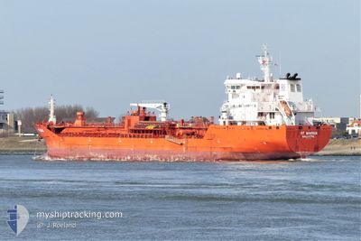
RF MARINA
Oil/Chemical Tanker
Current Trip
| Time Travelled | 4 days |
|---|---|
| Remaining Time | --- |
| Distance Travelled | 1305.04 nm |
| Remaining Distance | --- |
| AVG Speed | 12.7 Knop |
| MAX Speed | 18 Knop |
| AVG Wind | 12.3 knots |
| MAX Wind | 22 knots |
| MIN Temp | 4.5°C / 40.1°F |
| MAX Temp | 21.7°C / 71.06°F |
| Djupgående | 7.3 m |
| Position mottagen | 3 d sen |
Current Position
| Longitud | -70.54179° |
|---|---|
| Latitude | 47.26665° |
| Status | Under way using engine |
| Fart | 14.8 Knop |
| Kurs | 28.8° |
| Område | Gulf of St-Lawrence |
| Station | T-AIS |
| Position mottagen | 3 d sen |
Info
Information
The current position of RF MARINA is in Gulf of St-Lawrence with coordinates 47.26665° / -70.54179° as reported on 2024-05-17 21:37 by AIS to our vessel tracker app. The vessel's current speed is 14.8 Knop and is heading at the port of HOUSTON. The estimated time of arrival as calculated by MyShipTracking vessel tracking app is 2024-05-28 23:59 LT
The vessel RF MARINA (IMO: 9580986, MMSI: 256770000) is a Oil/Chemical Tanker that was built in 2011 ( 13 År gammal ). It's sailing under the flag of [MT] Malta.
In this page you can find informations about the vessels current position, last detected port calls, and current voyage information. If the vessels is not in coverage by AIS you will find the latest position.
The current position of RF MARINA is detected by our AIS receivers and we are not responsible for the reliability of the data. The last position was recorded while the vessel was in Coverage by the Ais receivers of our vessel tracking app.
The current draught of RF MARINA as reported by AIS is 7.3 meters
Weather
| Temperature | 21.5°C / 70.7°F |
|---|---|
| Wind Speed | 15 knots |
| Direction | 54° NE |
| Pressure | 1013.5 hPa |
| Humidity | 79.7 % |
| Cloud Coverage | 86 % |
Featured Company
Last Port Calls
| Port | Arrival | Departure | Time In Port |
|---|---|---|---|
| 2024-05-16 21:59 | 2024-05-17 08:58 | 10 h | |
| 2024-05-15 14:13 | 2024-05-15 14:48 | 34 m | |
| 2024-05-10 05:50 | 2024-05-10 06:25 | 34 m | |
| 2024-05-08 22:09 | 2024-05-08 23:02 | 53 m | |
| 2024-05-06 06:50 | 2024-05-08 16:57 | 2 d | |
| 2024-04-22 09:15 | 2024-04-24 06:39 | 1 d | |
| 2024-04-13 19:28 | 2024-04-15 19:42 | 2 d | |
| 2024-03-30 04:49 | 2024-04-01 18:22 | 2 d | |
| 2024-03-16 16:55 | 2024-03-18 12:16 | 1 d | |
| 2024-03-09 12:57 | 2024-03-11 10:16 | 1 d |
Last Trips
| Origin | Departure | Destination | Arrival | Distance | |
|---|---|---|---|---|---|
| 2024-05-15 10:48 | 2024-05-16 17:59 | 300.32 nm | |||
| 2024-05-10 02:25 | 2024-05-15 10:13 | 573.20 nm | |||
| 2024-05-08 19:02 | 2024-05-10 01:50 | 297.15 nm | |||
| 2024-05-08 12:57 | 2024-05-08 18:09 | 9.94 nm | |||
| 2024-04-24 01:39 | 2024-05-06 02:50 | 3503.21 nm | |||
| 2024-04-15 14:42 | 2024-04-22 04:15 | 602.63 nm | |||
| 2024-04-01 14:22 | 2024-04-13 14:28 | 3469.27 nm | |||
| 2024-03-18 13:16 | 2024-03-30 00:49 | 3354.78 nm | |||
| 2024-03-11 11:16 | 2024-03-16 17:55 | 1484.29 nm | |||
| 2024-03-02 05:16 | 2024-03-09 13:57 | 1869.27 nm |
Events
| Tid | Event | Detaljer | Position / Dest | Information |
|---|---|---|---|---|
| 2024-05-17 21:42 | Status ändrad | Default Under way using engine |
47.28500 / -70.52666
CASNI-USHOU
|
Fart: 14.8 kn Kurs: 28.8° |
| 2024-05-17 21:37 | UTANFÖR täckningsområde |
47.26665 / -70.54179
Gulf of St-Lawrence
CASNI-USHOU
|
Fart: 14.8 kn Kurs: 28.8° |
|
| 2024-05-17 21:30 | Status ändrad | Under way using engine Default |
47.24247 / -70.56285
CASNI-USHOU
|
Fart: 14.3 kn Kurs: 33° |
| 2024-05-17 21:12 | Status ändrad | Default Under way using engine |
47.18500 / -70.62666
CASNI-USHOU
|
Fart: 13.8 kn Kurs: 37.7° |
| 2024-05-17 21:02 | Status ändrad | Under way using engine Default |
47.15593 / -70.66134
CASNI-USHOU
|
Fart: 14 kn Kurs: 33° |
| 2024-05-17 20:57 | Status ändrad | Default Under way using engine |
47.13667 / -70.67667
CASNI-USHOU
|
Fart: 13.9 kn Kurs: 32.7° |
| 2024-05-17 17:29 | Status ändrad | Under way using engine Default |
46.72257 / -71.37945
CASNI-USHOU
|
Fart: 11 kn Kurs: 77° |
| 2024-05-17 17:23 | Status ändrad | Default Under way using engine |
46.71790 / -71.40942
CASNI-USHOU
|
Fart: 10.9 kn Kurs: 76° |
| 2024-05-17 17:06 | Status ändrad | Under way using engine Default |
46.70653 / -71.48186
CASNI-USHOU
|
Fart: 11.8 kn Kurs: 71° |
| 2024-05-17 17:03 | Status ändrad | Default Under way using engine |
46.70343 / -71.49703
CASNI-USHOU
|
Fart: 11.8 kn Kurs: 63.6° |