
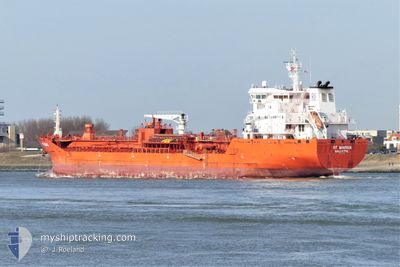
RF MARINA
Oil/Chemical Tanker
Current Trip
| Time Travelled | 7 days |
|---|---|
| Remaining Time | --- |
| Distance Travelled | 2113.52 nm |
| Remaining Distance | --- |
| AVG Speed | 11.7 Noeuds |
| MAX Speed | 14.9 Noeuds |
| AVG Wind | 13.8 knots |
| MAX Wind | 24.9 knots |
| MIN Temp | 18.8°C / 65.84°F |
| MAX Temp | 25.9°C / 78.62°F |
| Tirant d eau | 9.6 m |
| Position reçue | 3 d depuis |
Current Position
| Longitude | -79.44558° |
|---|---|
| Latitude | 26.23729° |
| Etat | Under way using engine |
| Vitesse | 13.6 Noeuds |
| Parcours | 18.8° |
| Zone | North Atlantic Ocean |
| Station | T-AIS |
| Position reçue | 3 d depuis |
Info
Information
The current position of RF MARINA is in North Atlantic Ocean with coordinates 26.23729° / -79.44558° as reported on 2024-04-28 00:03 by AIS to our vessel tracker app. The vessel's current speed is 13.6 Noeuds and is heading at the port of MONTREAL. The estimated time of arrival as calculated by MyShipTracking vessel tracking app is 2024-05-05 08:00 LT
The vessel RF MARINA (IMO: 9580986, MMSI: 256770000) is a Oil/Chemical Tanker that was built in 2011 ( 13 Age ). It's sailing under the flag of [MT] Malta.
In this page you can find informations about the vessels current position, last detected port calls, and current voyage information. If the vessels is not in coverage by AIS you will find the latest position.
The current position of RF MARINA is detected by our AIS receivers and we are not responsible for the reliability of the data. The last position was recorded while the vessel was in Coverage by the Ais receivers of our vessel tracking app.
The current draught of RF MARINA as reported by AIS is 9.6 meters
Weather
| Temperature | 21.3°C / 70.34°F |
|---|---|
| Wind Speed | 17 knots |
| Direction | 261° W |
| Pressure | 1014.3 hPa |
| Humidity | 79.9 % |
| Cloud Coverage | 83 % |
Featured Company
Last Port Calls
| Port | Arrival | Departure | Time In Port |
|---|---|---|---|
| 2024-04-22 09:15 | 2024-04-24 06:39 | 1 d | |
| 2024-04-13 19:28 | 2024-04-15 19:42 | 2 d | |
| 2024-03-30 04:49 | 2024-04-01 18:22 | 2 d | |
| 2024-03-16 16:55 | 2024-03-18 12:16 | 1 d | |
| 2024-03-09 12:57 | 2024-03-11 10:16 | 1 d | |
| 2024-03-02 04:16 |
Last Trips
| Origin | Departure | Destination | Arrival | Distance | |
|---|---|---|---|---|---|
| 2024-04-15 14:42 | 2024-04-22 04:15 | 602.63 nm | |||
| 2024-04-01 14:22 | 2024-04-13 14:28 | 3469.27 nm | |||
| 2024-03-18 13:16 | 2024-03-30 00:49 | 3354.78 nm | |||
| 2024-03-11 11:16 | 2024-03-16 17:55 | 1484.29 nm | |||
| 2024-03-02 05:16 | 2024-03-09 13:57 | 1869.27 nm |
Events
| Heure | Evenement | Détails | Position/ Destination | Info |
|---|---|---|---|---|
| 2024-04-28 00:08 | Etat Changé | Default Under way using engine |
26.25500 / -79.43833
USPOA>CAMTR
|
Vitesse: 13.6 kn Parcours: 18.8° |
| 2024-04-28 00:03 | Hors de la zone couverte |
26.23729 / -79.44558
North Atlantic Ocean
USPOA>CAMTR
|
Vitesse: 13.6 kn Parcours: 18.8° |
|
| 2024-04-27 23:54 | Etat Changé | Under way using engine Default |
26.20291 / -79.45843
USPOA>CAMTR
|
Vitesse: 13.8 kn Parcours: 19° |
| 2024-04-27 23:43 | Etat Changé | Default Under way using engine |
26.16570 / -79.47227
USPOA>CAMTR
|
Vitesse: 13.8 kn Parcours: 18.5° |
| 2024-04-27 21:14 | Changement d'ETA | 2024/05/05 08:00 2025/03/19 12:30 |
25.56721 / -79.57370
USPOA>CAMTR
|
Vitesse: 14.8 kn Parcours: 354° |
| 2024-04-27 20:56 | Changement de zone | Bahamas part of the North Atlantic Ocean United States part of the Gulf of Mexico |
25.49505 / -79.56510
North Atlantic Ocean
|
Vitesse: 14.5 kn Parcours: 354.5° |
| 2024-04-27 20:55 | Etat Changé | Under way using engine Default |
25.49302 / -79.56489
USPOA>CAMTR
|
Vitesse: 14 kn Parcours: 351° |
| 2024-04-27 20:55 | Dans la zone couverte |
25.49505 / -79.56510
North Atlantic Ocean
|
Vitesse: 14.5 kn Parcours: 354.5° |
|
| 2024-04-24 10:20 | Etat Changé | Default Under way using engine |
29.25333 / -93.67834
USPOA>CAMTR
|
Vitesse: 11.5 kn Parcours: 180.7° |
| 2024-04-24 10:15 | Hors de la zone couverte |
29.26853 / -93.67962
Gulf of Mexico
|
Vitesse: 11.5 kn Parcours: 180.7° |