
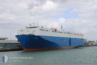
PIRANHA
Vehicles Carrier
Current Trip
| Time Travelled | 7 days |
|---|---|
| Remaining Time | --- |
| Distance Travelled | 2853.14 nm |
| Remaining Distance | --- |
| AVG Speed | 16.2 Knop |
| MAX Speed | 20.1 Knop |
| AVG Wind | 14.4 knots |
| MAX Wind | 27.8 knots |
| MIN Temp | 15.7°C / 60.26°F |
| MAX Temp | 26.8°C / 80.24°F |
| Djupgående | 8.5 m |
| Position mottagen | 5 d sen |
Current Position
| Longitud | 17.70308° |
|---|---|
| Latitude | -33.88312° |
| Status | Under way using engine |
| Fart | 14.9 Knop |
| Kurs | 324.5° |
| Område | South Atlantic Ocean |
| Station | T-AIS |
| Position mottagen | 5 d sen |
Info
Information
The current position of PIRANHA is in South Atlantic Ocean with coordinates -33.88312° / 17.70308° as reported on 2024-05-11 04:16 by AIS to our vessel tracker app. The vessel's current speed is 14.9 Knop and is heading at the port of EMDEN. The estimated time of arrival as calculated by MyShipTracking vessel tracking app is 2024-05-27 15:00 LT
The vessel PIRANHA (IMO: 9088249, MMSI: 215938000) is a Vehicles Carrier that was built in 1997 ( 27 År gammal ). It's sailing under the flag of [MT] Malta.
In this page you can find informations about the vessels current position, last detected port calls, and current voyage information. If the vessels is not in coverage by AIS you will find the latest position.
The current position of PIRANHA is detected by our AIS receivers and we are not responsible for the reliability of the data. The last position was recorded while the vessel was in Coverage by the Ais receivers of our vessel tracking app.
The current draught of PIRANHA as reported by AIS is 8.5 meters
Weather
| Temperature | 26.8°C / 80.24°F |
|---|---|
| Wind Speed | 13 knots |
| Direction | 129° SE |
| Pressure | 1014.3 hPa |
| Humidity | 69.7 % |
| Cloud Coverage | 100 % |
Featured Company
Last Port Calls
| Port | Arrival | Departure | Time In Port |
|---|---|---|---|
| 2024-05-07 18:51 | 2024-05-09 00:39 | 1 d | |
| 2024-05-04 23:53 | 2024-05-06 06:11 | 1 d | |
| 2024-04-30 17:27 | 2024-05-01 15:15 | 21 h | |
| 2024-04-22 15:37 | 2024-04-23 20:07 | 1 d | |
| 2024-04-20 09:02 | 2024-04-21 08:14 | 23 h | |
| 2024-04-11 19:08 | 2024-04-13 08:45 | 1 d | |
| 2024-04-09 21:24 | 2024-04-11 01:50 | 1 d | |
| 2024-04-07 12:02 | 2024-04-08 14:14 | 1 d | |
| 2024-04-04 15:15 | 2024-04-05 16:31 | 1 d | |
| 2024-03-13 11:24 | 2024-03-14 18:42 | 1 d |
Most Visited Ports (Last year)
| Port | Arrivals | |
|---|---|---|
| 6 | ||
| 6 | ||
| 5 | ||
| 5 | ||
| 5 | ||
| 5 |
Last Trips
| Origin | Departure | Destination | Arrival | Distance | |
|---|---|---|---|---|---|
| 2024-05-06 08:11 | 2024-05-07 20:51 | 414.54 nm | |||
| 2024-05-01 17:15 | 2024-05-05 01:53 | 1150.70 nm | |||
| 2024-04-23 20:07 | 2024-04-30 19:27 | 2620.27 nm | |||
| 2024-04-21 08:14 | 2024-04-22 15:37 | 477.34 nm | |||
| 2024-04-13 10:45 | 2024-04-20 09:02 | 2637.04 nm | |||
| 2024-04-11 02:50 | 2024-04-11 21:08 | 260.63 nm | |||
| 2024-04-08 16:14 | 2024-04-09 22:24 | 467.77 nm | |||
| 2024-04-05 18:31 | 2024-04-07 14:02 | 132.93 nm | |||
| 2024-03-14 20:42 | 2024-04-04 17:15 | 7155.36 nm | |||
| 2024-03-09 11:37 | 2024-03-13 13:24 | 1537.34 nm |
Events
| Tid | Event | Detaljer | Position / Dest | Information |
|---|---|---|---|---|
| 2024-05-11 04:19 | Status ändrad | Default Under way using engine |
-33.87140 / 17.69273
ZA DUR>DE EME
|
Fart: 14.9 kn Kurs: 324.5° |
| 2024-05-11 04:16 | UTANFÖR täckningsområde |
-33.88312 / 17.70308
South Atlantic Ocean
ZA DUR>DE EME
|
Fart: 14.9 kn Kurs: 324.5° |
|
| 2024-05-11 04:01 | Status ändrad | Under way using engine Default |
-33.93155 / 17.74666
ZA DUR>DE EME
|
Fart: 15 kn Kurs: 324° |
| 2024-05-11 03:49 | I täckningsområde |
-33.93123 / 17.74634
South Atlantic Ocean
ZA DUR>DE EME
|
Fart: 14.9 kn Kurs: 320.9° |
|
| 2024-05-11 02:42 | Status ändrad | Default Under way using engine |
-34.19350 / 17.99218
ZA DUR>DE EME
|
Fart: 15.2 kn Kurs: 318.9° |
| 2024-05-11 02:38 | Status ändrad | Under way using engine Default |
-34.20368 / 18.00357
ZA DUR>DE EME
|
Fart: 15.4 kn Kurs: 321° |
| 2024-05-11 02:38 | UTANFÖR täckningsområde |
-34.20368 / 18.00357
South Atlantic Ocean
ZA DUR>DE EME
|
Fart: 15.2 kn Kurs: 318.9° |
|
| 2024-05-11 02:22 | Status ändrad | Default Under way using engine |
-34.25730 / 18.05517
ZA DUR>DE EME
|
Fart: 15.6 kn Kurs: 320.4° |
| 2024-05-11 02:18 | Status ändrad | Under way using engine Default |
-34.27196 / 18.06909
ZA DUR>DE EME
|
Fart: 15.9 kn Kurs: 320° |
| 2024-05-11 02:14 | Status ändrad | Default Under way using engine |
-34.28615 / 18.08246
ZA DUR>DE EME
|
Fart: 15.8 kn Kurs: 322.5° |