
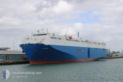
PIRANHA
Vehicles Carrier
Current Trip
| Time Travelled | 2 h, 49 mins |
|---|---|
| Remaining Time | 17 days |
| Distance Travelled | 2.99 nm |
| Remaining Distance | 3090.78 nm |
| AVG Speed | 5.1 Noeuds |
| MAX Speed | 6.9 Noeuds |
| AVG Wind | 10.6 knots |
| MAX Wind | 11.8 knots |
| MIN Temp | 25.2°C / 77.36°F |
| MAX Temp | 28.1°C / 82.58°F |
| Tirant d eau | 8.4 m |
| Position reçue | 10 d depuis |
Current Position
| Longitude | -17.40003° |
|---|---|
| Latitude | 13.60435° |
| Etat | Under way using engine |
| Vitesse | 16.8 Noeuds |
| Parcours | 185.3° |
| Zone | North Atlantic Ocean |
| Station | T-AIS |
| Position reçue | 10 d depuis |
Info
Information
The current position of PIRANHA is in North Atlantic Ocean with coordinates 13.60435° / -17.40003° as reported on 2024-04-21 12:19 by AIS to our vessel tracker app. The vessel's current speed is 16.8 Noeuds and is heading at the port of DAKAR. The estimated time of arrival as calculated by MyShipTracking vessel tracking app is 2024-05-19 08:38 LT
The vessel PIRANHA (IMO: 9088249, MMSI: 215938000) is a Vehicles Carrier that was built in 1997 ( 27 Age ). It's sailing under the flag of [MT] Malta.
In this page you can find informations about the vessels current position, last detected port calls, and current voyage information. If the vessels is not in coverage by AIS you will find the latest position.
The current position of PIRANHA is detected by our AIS receivers and we are not responsible for the reliability of the data. The last position was recorded while the vessel was in Coverage by the Ais receivers of our vessel tracking app.
The current draught of PIRANHA as reported by AIS is 8.4 meters
Weather
| Temperature | 25.1°C / 77.18°F |
|---|---|
| Wind Speed | 12 knots |
| Direction | 195° SSW |
| Pressure | 1008.4 hPa |
| Humidity | 39.1 % |
| Cloud Coverage | --- |
Featured Company
Last Port Calls
| Port | Arrival | Departure | Time In Port |
|---|---|---|---|
| 2024-04-30 17:27 | 2024-05-01 15:15 | 21 h | |
| 2024-04-22 15:37 | 2024-04-23 20:07 | 1 d | |
| 2024-04-20 09:02 | 2024-04-21 08:14 | 23 h | |
| 2024-04-11 19:08 | 2024-04-13 08:45 | 1 d | |
| 2024-04-09 21:24 | 2024-04-11 01:50 | 1 d | |
| 2024-04-07 12:02 | 2024-04-08 14:14 | 1 d | |
| 2024-04-04 15:15 | 2024-04-05 16:31 | 1 d | |
| 2024-03-13 11:24 | 2024-03-14 18:42 | 1 d | |
| 2024-03-08 12:18 | 2024-03-09 09:37 | 21 h | |
| 2024-03-03 05:24 |
Most Visited Ports (Last year)
| Port | Arrivals | |
|---|---|---|
| 6 | ||
| 6 | ||
| 5 | ||
| 5 | ||
| 4 | ||
| 4 |
Last Trips
| Origin | Departure | Destination | Arrival | Distance | |
|---|---|---|---|---|---|
| 2024-04-23 20:07 | 2024-04-30 19:27 | 2620.27 nm | |||
| 2024-04-21 08:14 | 2024-04-22 15:37 | 477.34 nm | |||
| 2024-04-13 10:45 | 2024-04-20 09:02 | 2637.04 nm | |||
| 2024-04-11 02:50 | 2024-04-11 21:08 | 260.63 nm | |||
| 2024-04-08 16:14 | 2024-04-09 22:24 | 467.77 nm | |||
| 2024-04-05 18:31 | 2024-04-07 14:02 | 132.93 nm | |||
| 2024-03-14 20:42 | 2024-04-04 17:15 | 7155.36 nm | |||
| 2024-03-09 11:37 | 2024-03-13 13:24 | 1537.34 nm | |||
| 2024-03-02 23:03 | 2024-03-03 06:24 | 85.43 nm | |||
| 2024-02-28 19:50 | 2024-03-02 14:41 | 1174.56 nm |
Events
| Heure | Evenement | Détails | Position/ Destination | Info |
|---|---|---|---|---|
| 2024-05-01 16:07 | Arret | 3.69 nm, North West of WALVIS BAY |
-22.88724 / 14.46526
BE ANR>SN DKR
|
Vitesse: 0.1 kn Parcours: 211° |
| 2024-05-01 15:15 | PORT DE DEPART |
|
-22.92581 / 14.49796
BE ANR>SN DKR
|
Vitesse: 8.8 kn Parcours: 4° |
| 2024-05-01 15:03 | Démarrage |
-22.95004 / 14.49492
[NA] WALVIS BAY
|
Vitesse: 4.1 kn Parcours: 42° |
|
| 2024-04-30 18:00 | Arret |
-22.95346 / 14.49142
[NA] WALVIS BAY
|
Vitesse: 0.3 kn Parcours: 65° |
|
| 2024-04-30 17:27 | Port d'arrivée |
|
-22.93841 / 14.49678
[NA] WALVIS BAY
|
Vitesse: 6.1 kn Parcours: 184° |
| 2024-04-23 20:07 | Démarrage | 0.59 nm, North West of CONAKRY |
9.50596 / -13.72572
BE ANR>SN DKR
|
Vitesse: 5 kn Parcours: 195° |
| 2024-04-23 20:07 | PORT DE DEPART |
|
9.50596 / -13.72572
BE ANR>SN DKR
|
Vitesse: 2.9 kn Parcours: 201° |
| 2024-04-22 15:41 | Arret |
9.51256 / -13.72138
[GN] CONAKRY
|
Vitesse: Parcours: 34° |
|
| 2024-04-22 15:37 | Port d'arrivée |
|
9.51276 / -13.72152
[GN] CONAKRY
|
Vitesse: 1.2 kn Parcours: 39° |