

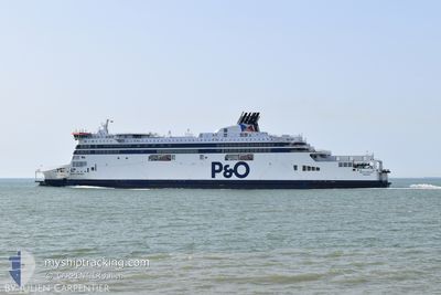
OSCAR WILDE
Ro-Ro/Passenger Ship

Current Trip
GBDVR <-> FRCQF
| Time Travelled | 3 mins |
|---|---|
| Remaining Time | --- |
| Distance Travelled | --- |
| Remaining Distance | --- |
| AVG Speed | --- |
| MAX Speed | --- |
| AVG Wind | --- |
| MAX Wind | --- |
| MIN Temp | --- |
| MAX Temp | --- |
| Djupgående | 6.1 m |
| Position mottagen | Nu |
Current Position
| Longitud | --- |
|---|---|
| Latitude | --- |
| Status | Under way using engine |
| Fart | 12.4 Knop |
| Kurs | 271.5° |
| Område | North Sea |
| Station | T-AIS |
| Position mottagen | Nu |
Information
The current position of OSCAR WILDE is in North Sea with coordinates 50.97334° / 1.83150° as reported on 2025-03-29 17:20 by AIS to our vessel tracker app. The vessel's current speed is 12.4 Knop
The vessel OSCAR WILDE (IMO: 9524231, MMSI: 209479000) is a Ro-Ro/Passenger Ship that was built in 2011 ( 14 År gammal ). It's sailing under the flag of [CY] Cyprus.
In this page you can find informations about the vessels current position, last detected port calls, and current voyage information. If the vessels is not in coverage by AIS you will find the latest position.
The current position of OSCAR WILDE is detected by our AIS receivers and we are not responsible for the reliability of the data. The last position was recorded while the vessel was in Coverage by the Ais receivers of our vessel tracking app.
The current draught of OSCAR WILDE as reported by AIS is 6.1 meters
Weather
| Temperature | 8.4°C / 47.12°F |
|---|---|
| Wind Speed | 19 knots |
| Direction | 239° WSW |
| Pressure | 1022.2 hPa |
| Humidity | 77.2 % |
| Cloud Coverage | 19 % |


Featured Company
Last Port Calls
| Port | Arrival | Departure | Time In Port |
|---|---|---|---|
| 2025-03-29 17:25 | 2025-03-29 18:18 | 53 m | |
| 2025-03-29 14:08 | 2025-03-29 15:05 | 57 m | |
| 2025-03-29 12:39 | 2025-03-29 13:49 | 1 h | |
| 2025-03-29 09:15 | 2025-03-29 10:21 | 1 h | |
| 2025-03-29 07:46 | 2025-03-29 08:56 | 1 h | |
| 2025-03-29 04:14 | 2025-03-29 05:17 | 1 h | |
| 2025-03-29 02:47 | 2025-03-29 03:57 | 1 h | |
| 2025-03-28 23:32 | 2025-03-29 00:26 | 54 m | |
| 2025-03-28 22:01 | 2025-03-28 23:21 | 1 h | |
| 2025-03-28 18:43 | 2025-03-28 19:39 | 55 m |
Last Trips
| Origin | Departure | Destination | Arrival | Distance | |
|---|---|---|---|---|---|
| 2025-03-29 15:05 | 2025-03-29 17:25 | 21.96 nm | |||
| 2025-03-29 13:49 | 2025-03-29 14:08 | 22.23 nm | |||
| 2025-03-29 10:21 | 2025-03-29 12:39 | 22.22 nm | |||
| 2025-03-29 08:56 | 2025-03-29 09:15 | 21.72 nm | |||
| 2025-03-29 05:17 | 2025-03-29 07:46 | 21.74 nm | |||
| 2025-03-29 03:57 | 2025-03-29 04:14 | 21.65 nm | |||
| 2025-03-29 00:26 | 2025-03-29 02:47 | 21.85 nm | |||
| 2025-03-28 23:21 | 2025-03-28 23:32 | 22.09 nm | |||
| 2025-03-28 19:39 | 2025-03-28 22:01 | 21.83 nm | |||
| 2025-03-28 18:17 | 2025-03-28 18:43 | 21.63 nm |
Events
| Tid | Event | Detaljer | Position / Dest | Information |
|---|---|---|---|---|
| 2025-03-29 17:18 | AVGÅTT HAMN |
|
50.97261 / 1.83748
GBDVR <-> FRCQF
|
Fart: 10.9 kn Kurs: 290° |
| 2025-03-29 17:13 | STARTAR förflyttning |
50.96815 / 1.85087
[FR] CALAIS
|
Fart: 4.9 kn Kurs: 111° |
|
| 2025-03-29 17:09 | Status ändrad | Under way using engine Moored |
50.96729 / 1.85358
[FR] CALAIS
|
Fart: Kurs: 111° |
| 2025-03-29 17:09 | Djupgående ändrat | 6.1 6.3 |
50.96729 / 1.85358
[FR] CALAIS
|
Fart: Kurs: 111° |
| 2025-03-29 16:37 | ETA ändrat | 2025/03/29 18:50 2025/03/29 16:25 |
50.96728 / 1.85358
[FR] CALAIS
|
Fart: Kurs: 111° |
| 2025-03-29 16:34 | STOPPAR förflyttning |
50.96729 / 1.85356
[FR] CALAIS
|
Fart: 0.1 kn Kurs: 113° |
|
| 2025-03-29 16:31 | Status ändrad | Moored Under way using engine |
50.96753 / 1.85278
[FR] CALAIS
|
Fart: 1.7 kn Kurs: 114° |
| 2025-03-29 16:25 | ANLÄNDER HAMN |
|
50.97210 / 1.84019
[FR] CALAIS
|
Fart: 11.4 kn Kurs: 104.3° |
| 2025-03-29 15:58 | Byter havsområde | French part of the North Sea French part of the English Channel |
50.97815 / 1.65683
North Sea
GBDVR <-> FRCQF
|
Fart: 16.6 kn Kurs: 106.6° |
| 2025-03-29 15:41 | Byter havsområde | French part of the English Channel United Kingdom part of the English Channel |
51.02793 / 1.55284
English Channel
GBDVR <-> FRCQF
|
Fart: 17 kn Kurs: 134.9° |