
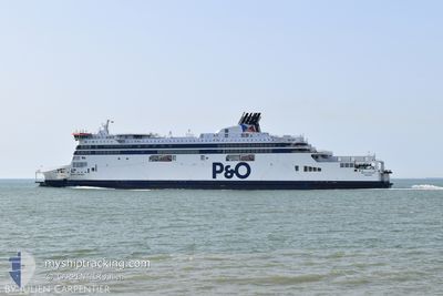
OSCAR WILDE
Ro-Ro/Passenger Ship
Current Trip
| Trip Time | 1 h, 1 mins |
|---|---|
| Trip Distance | 22.26 nm |
| AVG Speed | 20.3 Knots |
| MAX Speed | 23.6 Knots |
| Dybgang | 6.2 m |
| AVG Wind | 12.5 knots |
| MAX Wind | 12.9 knots |
| MIN Temp | 14.6°C / 58.28°F |
| MAX Temp | 14.8°C / 58.64°F |
| Position Modtaget | 4 m siden |
Current Position
| Longitude | 1.85358° |
|---|---|
| Latitude | 50.96729° |
| Status | Under way sailing |
| Fart | |
| Kurs | 110° |
| Område | North Sea |
| Station | T-AIS |
| Position Modtaget | 4 m siden |
Info
Information
The current position of OSCAR WILDE is in North Sea with coordinates 50.96729° / 1.85358° as reported on 2024-07-04 10:18 by AIS to our vessel tracker app. The vessel's current speed is 0 Knots and is currently inside the port of CALAIS.
The vessel OSCAR WILDE (IMO: 9524231, MMSI: 209479000) is a Ro-Ro/Passenger Ship that was built in 2011 ( 13 år gamle ). It's sailing under the flag of [CY] Cyprus.
In this page you can find informations about the vessels current position, last detected port calls, and current voyage information. If the vessels is not in coverage by AIS you will find the latest position.
The current position of OSCAR WILDE is detected by our AIS receivers and we are not responsible for the reliability of the data. The last position was recorded while the vessel was in Coverage by the Ais receivers of our vessel tracking app.
The current draught of OSCAR WILDE as reported by AIS is 6.2 meters
Weather
| Temperature | 14.8°C / 58.64°F |
|---|---|
| Wind Speed | 13 knots |
| Direction | 259° W |
| Pressure | 1010.2 hPa |
| Humidity | 60.5 % |
| Cloud Coverage | 40 % |
Featured Company
Last Port Calls
| Port | Arrival | Departure | Time In Port |
|---|---|---|---|
| 2024-07-04 10:03 | |||
| 2024-07-04 07:51 | 2024-07-04 09:02 | 1 h | |
| 2024-07-04 05:24 | 2024-07-04 06:36 | 1 h | |
| 2024-07-04 03:05 | 2024-07-04 04:13 | 1 h | |
| 2024-07-04 00:50 | 2024-07-04 01:52 | 1 h | |
| 2024-07-03 22:41 | 2024-07-03 23:42 | 1 h | |
| 2024-07-03 20:23 | 2024-07-03 21:26 | 1 h | |
| 2024-07-03 18:12 | 2024-07-03 19:14 | 1 h | |
| 2024-07-03 15:37 | 2024-07-03 17:05 | 1 h | |
| 2024-07-03 12:28 | 2024-07-03 14:27 | 1 h |
Last Trips
| Origin | Departure | Destination | Arrival | Distance | |
|---|---|---|---|---|---|
| 2024-07-04 10:02 | 2024-07-04 12:03 | 22.26 nm | |||
| 2024-07-04 08:36 | 2024-07-04 08:51 | 23.43 nm | |||
| 2024-07-04 05:13 | 2024-07-04 07:24 | 22.23 nm | |||
| 2024-07-04 03:52 | 2024-07-04 04:05 | 21.90 nm | |||
| 2024-07-04 00:42 | 2024-07-04 02:50 | 22.21 nm | |||
| 2024-07-03 23:26 | 2024-07-03 23:41 | 23.34 nm | |||
| 2024-07-03 20:14 | 2024-07-03 22:23 | 22.17 nm | |||
| 2024-07-03 19:05 | 2024-07-03 19:12 | 21.58 nm | |||
| 2024-07-03 15:27 | 2024-07-03 17:37 | 22.26 nm | |||
| 2024-07-03 13:13 | 2024-07-03 13:28 | 22.28 nm |
Events
| Tid | Hændelsen | Detaljer | Position / Dest | Info |
|---|---|---|---|---|
| 2024-07-04 10:11 | STOP Sejllads |
50.96739 / 1.85329
[FR] CALAIS
|
Fart: 0.3 kn Kurs: 111° |
|
| 2024-07-04 10:03 | Skibe i havn |
|
50.97205 / 1.83980
[FR] CALAIS
|
Fart: 11.6 kn Kurs: 113.7° |
| 2024-07-04 09:47 | Ændre havområde | French part of the North Sea French part of the English Channel |
50.96895 / 1.68883
North Sea
DOVER CALAIS DOVER
|
Fart: 23.1 kn Kurs: 105.9° |
| 2024-07-04 09:29 | Ændre havområde | French part of the English Channel United Kingdom part of the English Channel |
51.02028 / 1.53475
English Channel
DOVER CALAIS DOVER
|
Fart: 21.2 kn Kurs: 139.8° |
| 2024-07-04 09:10 | Dybgangen er ændret | 6.2 5.4 |
51.09242 / 1.39358
DOVER CALAIS DOVER
|
Fart: 21 kn Kurs: 128.5° |
| 2024-07-04 09:10 | ETA er ændret | 2024/07/04 11:00 2024/07/04 08:35 |
51.09242 / 1.39358
DOVER CALAIS DOVER
|
Fart: 21 kn Kurs: 128.5° |
| 2024-07-04 09:02 | Afsejlet fra sidste havn |
|
51.11975 / 1.34597
DOVER CALAIS DOVER
|
Fart: 12 kn Kurs: 118° |
| 2024-07-04 09:00 | START Sejllads |
51.12234 / 1.33758
[GB] DOVER
|
Fart: 6.4 kn Kurs: 120° |
|
| 2024-07-04 08:59 | Status er ændret | Under way sailing Default |
51.12280 / 1.33659
[GB] DOVER
|
Fart: Kurs: 138° |
| 2024-07-04 07:59 | Udenfor Dækning |
51.12265 / 1.33665
English Channel
[GB] DOVER
|
Fart: 2.2 kn Kurs: 332.6° |