

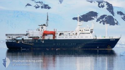
ORTELIUS
Passengers Ship

Current Trip
ICE SHELF
| Time Travelled | 9 days |
|---|---|
| Remaining Time | --- |
| Distance Travelled | 2132.83 nm |
| Remaining Distance | --- |
| AVG Speed | 10.2 Knop |
| MAX Speed | 15.4 Knop |
| AVG Wind | 15.5 knots |
| MAX Wind | 27.9 knots |
| MIN Temp | -1.8°C / 28.76°F |
| MAX Temp | 5°C / 41°F |
| Djupgående | 5.5 m |
| Position mottagen | 2 m sen |
Current Position
| Longitud | --- |
|---|---|
| Latitude | --- |
| Status | Under way using engine |
| Fart | 11.3 Knop |
| Kurs | 146.4° |
| Område | Southern Ocean |
| Station | T-AIS |
| Position mottagen | 2 m sen |
Information
The current position of ORTELIUS is in Southern Ocean with coordinates -65.18856° / -19.49271° as reported on 2025-02-21 06:37 by AIS to our vessel tracker app. The vessel's current speed is 11.3 Knop
The vessel ORTELIUS (IMO: 8509181, MMSI: 244180151) is a Passengers Ship that was built in 1989 ( 36 År gammal ). It's sailing under the flag of [NL] Netherlands.
In this page you can find informations about the vessels current position, last detected port calls, and current voyage information. If the vessels is not in coverage by AIS you will find the latest position.
The current position of ORTELIUS is detected by our AIS receivers and we are not responsible for the reliability of the data. The last position was recorded while the vessel was in Coverage by the Ais receivers of our vessel tracking app.
The current draught of ORTELIUS as reported by AIS is 5.5 meters
Weather
| Temperature | -1.5°C / 29.3°F |
|---|---|
| Wind Speed | 16 knots |
| Direction | 181° S |
| Pressure | 981.1 hPa |
| Humidity | 68.6 % |
| Cloud Coverage | 100 % |


Featured Company
Last Port Calls
| Port | Arrival | Departure | Time In Port |
|---|---|---|---|
| 2025-02-11 02:34 | 2025-02-11 18:43 | 16 h | |
| 2025-02-01 01:22 | 2025-02-01 20:19 | 18 h | |
| 2025-01-22 01:22 | 2025-01-22 20:06 | 18 h | |
| 2025-01-10 09:22 | 2025-01-10 20:42 | 11 h | |
| 2024-12-29 09:00 | 2024-12-29 20:14 | 11 h | |
| 2024-12-10 09:24 | 2024-12-10 20:13 | 10 h |
Most Visited Ports (Last year)
| Port | Arrivals | |
|---|---|---|
| 13 | ||
| 2 | ||
| 2 | ||
| 2 | ||
| 1 | ||
| 1 |
Last Trips
| Origin | Departure | Destination | Arrival | Distance | |
|---|---|---|---|---|---|
| 2025-02-01 17:19 | 2025-02-10 23:34 | 1646.09 nm | |||
| 2025-01-22 17:06 | 2025-01-31 22:22 | 1632.16 nm | |||
| 2025-01-10 17:42 | 2025-01-21 22:22 | 1710.08 nm | |||
| 2024-12-29 17:14 | 2025-01-10 06:22 | 1717.62 nm | |||
| 2024-12-10 17:13 | 2024-12-29 06:00 | 3611.04 nm | |||
| 2024-11-30 17:46 | 2024-12-10 06:24 | 1630.47 nm |
Events
| Tid | Event | Detaljer | Position / Dest | Information |
|---|---|---|---|---|
| 2025-02-20 13:10 | Byter havsområde | High seas of the Southern Ocean South Georgian part of the Southern Ocean |
-62.30455 / -23.58070
Southern Ocean
ICE SHELF
|
Fart: 12.2 kn Kurs: 149.7° |
| 2025-02-20 03:10 | Destination ändrad | ICE SHELF THULE ISLAND |
-60.62563 / -25.77197
ICE SHELF
|
Fart: 11.3 kn Kurs: 148.9° |
| 2025-02-20 03:10 | ETA ändrat | 2025/02/22 19:00 2025/02/19 20:00 |
-60.62563 / -25.77197
ICE SHELF
|
Fart: 11.3 kn Kurs: 148.9° |
| 2025-02-19 23:17 | Byter havsområde | South Georgian part of the Southern Ocean South Georgian part of the South Atlantic Ocean |
-60.00429 / -26.61823
Southern Ocean
THULE ISLAND
|
Fart: 12.3 kn Kurs: 153.2° |
| 2025-02-19 18:32 | STARTAR förflyttning |
-59.42737 / -27.31275
THULE ISLAND
|
Fart: 3.5 kn Kurs: 171° |
|
| 2025-02-19 17:02 | STOPPAR förflyttning |
-59.42652 / -27.32122
THULE ISLAND
|
Fart: 0.3 kn Kurs: 213° |
|
| 2025-02-19 11:55 | Status ändrad | Under way using engine Default |
-58.66646 / -26.65466
THULE ISLAND
|
Fart: 11.5 kn Kurs: 192° |
| 2025-02-19 11:54 | Status ändrad | Default Under way using engine |
-58.66123 / -26.65269
THULE ISLAND
|
Fart: 11.4 kn Kurs: 192.3° |
| 2025-02-19 07:06 | ETA ändrat | 2025/02/19 20:00 2025/02/18 20:00 |
-57.84792 / -26.32238
THULE ISLAND
|
Fart: 10.1 kn Kurs: 191.3° |
| 2025-02-19 07:02 | Destination ändrad | THULE ISLAND ZAVADLE FRANCE |
-57.83837 / -26.31871
THULE ISLAND
|
Fart: 9.3 kn Kurs: 190.8° |