
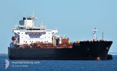
MERSEY
Tanker
Current Trip
| Trip Time | 21 days |
|---|---|
| Trip Distance | 3579.77 nm |
| AVG Speed | 9.7 Knop |
| MAX Speed | 14 Knop |
| Djupgående | 10 m |
| AVG Wind | 10 knots |
| MAX Wind | 30 knots |
| MIN Temp | 20.9°C / 69.62°F |
| MAX Temp | 33.2°C / 91.76°F |
| Position mottagen | 7 d sen |
Current Position
| Longitud | -42.78338° |
|---|---|
| Latitude | -23.08867° |
| Status | Under way using engine |
| Fart | 11.1 Knop |
| Kurs | 103° |
| Område | South Atlantic Ocean |
| Station | T-AIS |
| Position mottagen | 7 d sen |
Info
Information
The current position of MERSEY is in South Atlantic Ocean with coordinates -23.08867° / -42.78338° as reported on 2024-04-27 18:46 by AIS to our vessel tracker app. The vessel's current speed is 11.1 Knop and is currently inside the port of ITAQUI.
The vessel MERSEY (IMO: 9865752, MMSI: 538008664) is a Tanker It's sailing under the flag of [MH] Marshall Is.
In this page you can find informations about the vessels current position, last detected port calls, and current voyage information. If the vessels is not in coverage by AIS you will find the latest position.
The current position of MERSEY is detected by our AIS receivers and we are not responsible for the reliability of the data. The last position was recorded while the vessel was in Coverage by the Ais receivers of our vessel tracking app.
The current draught of MERSEY as reported by AIS is 10 meters
Weather
| Temperature | 30.1°C / 86.18°F |
|---|---|
| Wind Speed | 7 knots |
| Direction | 62° ENE |
| Pressure | 1009.8 hPa |
| Humidity | 70.3 % |
| Cloud Coverage | 71 % |
Featured Company
Last Port Calls
| Port | Arrival | Departure | Time In Port |
|---|---|---|---|
| 2024-05-05 08:20 | |||
| 2024-04-10 18:30 | 2024-04-13 19:31 | 3 d | |
| 2024-04-03 17:10 | 2024-04-05 01:02 | 1 d | |
| 2024-03-29 21:32 | 2024-04-02 05:38 | 3 d | |
| 2024-03-13 07:00 | 2024-03-14 17:38 | 1 d | |
| 2024-03-10 03:32 | 2024-03-11 10:07 | 1 d |
Last Trips
| Origin | Departure | Destination | Arrival | Distance | |
|---|---|---|---|---|---|
| 2024-04-13 16:31 | 2024-05-05 05:20 | 3579.77 nm | |||
| 2024-04-04 22:02 | 2024-04-10 15:30 | 463.89 nm | |||
| 2024-04-02 02:38 | 2024-04-03 14:10 | 4.47 nm | |||
| 2024-03-14 14:38 | 2024-03-29 18:32 | 560.51 nm | |||
| 2024-03-11 07:07 | 2024-03-13 04:00 | 416.69 nm | |||
| 2024-02-28 09:14 | 2024-03-10 00:32 | 168.82 nm |
Events
| Tid | Event | Detaljer | Position / Dest | Information |
|---|---|---|---|---|
| 2024-05-05 08:37 | STOPPAR förflyttning |
-2.57248 / -44.37510
[BR] ITAQUI
|
Fart: 0.2 kn Kurs: 117° |
|
| 2024-05-05 08:20 | ANLÄNDER HAMN |
|
-2.57211 / -44.37863
[BR] ITAQUI
|
Fart: 1.3 kn Kurs: 118° |
| 2024-05-05 06:19 | STARTAR förflyttning | 5.18 nm, North of SAO LUIS |
-2.43546 / -44.29390
BR ITQ
|
Fart: 5.3 kn Kurs: 301° |
| 2024-05-04 11:39 | STOPPAR förflyttning | 5.31 nm, North of SAO LUIS |
-2.43615 / -44.28293
BR ITQ
|
Fart: 0.1 kn Kurs: 217° |
| 2024-04-27 18:49 | Status ändrad | Default Under way using engine |
-23.09060 / -42.77113
BR ITQ
|
Fart: 11.1 kn Kurs: 103° |
| 2024-04-27 18:46 | UTANFÖR täckningsområde |
-23.08867 / -42.78338
South Atlantic Ocean
BR ITQ
|
Fart: 11.1 kn Kurs: 103° |
|
| 2024-04-27 15:25 | STARTAR förflyttning | 4.69 nm, North of NITEROI |
-22.80752 / -43.14886
BR ITQ
|
Fart: 3.7 kn Kurs: 186° |
| 2024-04-27 15:06 | Djupgående ändrat | 10 8.5 |
-22.80529 / -43.15069
BR ITQ
|
Fart: Kurs: 3° |
| 2024-04-27 15:06 | Destination ändrad | BR ITQ BR RIO |
-22.80529 / -43.15069
BR ITQ
|
Fart: Kurs: 3° |
| 2024-04-27 15:06 | ETA ändrat | 2024/05/04 15:00 2024/04/22 15:00 |
-22.80529 / -43.15069
BR ITQ
|
Fart: Kurs: 3° |