
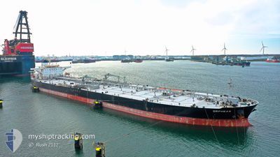
ORPHEAS
Crude Oil Tanker
Current Trip
US CRP
| Time Travelled | 1 day |
|---|---|
| Remaining Time | --- |
| Distance Travelled | 249.41 nm |
| Remaining Distance | --- |
| AVG Speed | 9.9 Knop |
| MAX Speed | 14.3 Knop |
| AVG Wind | 21.6 knots |
| MAX Wind | 27.8 knots |
| MIN Temp | 23.4°C / 74.12°F |
| MAX Temp | 25°C / 77°F |
| Djupgående | 9.5 m |
| Position mottagen | 6 d sen |
Current Position
| Longitud | -84.14689° |
|---|---|
| Latitude | 23.73992° |
| Status | Under way using engine |
| Fart | 12.9 Knop |
| Kurs | 283.3° |
| Område | Gulf of Mexico |
| Station | T-AIS |
| Position mottagen | 6 d sen |
Info
Information
The current position of ORPHEAS is in Gulf of Mexico with coordinates 23.73992° / -84.14689° as reported on 2024-04-20 22:37 by AIS to our vessel tracker app. The vessel's current speed is 12.9 Knop
The vessel ORPHEAS (IMO: 9318149, MMSI: 636013157) is a Crude Oil Tanker that was built in 2007 ( 17 År gammal ). It's sailing under the flag of [LR] Liberia.
In this page you can find informations about the vessels current position, last detected port calls, and current voyage information. If the vessels is not in coverage by AIS you will find the latest position.
The current position of ORPHEAS is detected by our AIS receivers and we are not responsible for the reliability of the data. The last position was recorded while the vessel was in Coverage by the Ais receivers of our vessel tracking app.
The current draught of ORPHEAS as reported by AIS is 9.5 meters
Weather
| Temperature | 24.6°C / 76.28°F |
|---|---|
| Wind Speed | 25 knots |
| Direction | 129° SE |
| Pressure | 1012.4 hPa |
| Humidity | 88.5 % |
| Cloud Coverage | 6 % |
Featured Company
Last Port Calls
| Port | Arrival | Departure | Time In Port |
|---|---|---|---|
| 2024-04-23 17:50 | 2024-04-26 12:46 | 2 d | |
| 2024-04-14 17:40 | 2024-04-16 16:46 | 1 d | |
| 2024-04-11 05:51 | 2024-04-12 22:25 | 1 d |
Most Visited Ports (Last year)
| Port | Arrivals | |
|---|---|---|
| 2 | ||
| 2 | ||
| 1 | ||
| 1 | ||
| 1 | ||
| 1 |
Last Trips
| Origin | Departure | Destination | Arrival | Distance | |
|---|---|---|---|---|---|
| 2024-04-16 12:46 | 2024-04-23 12:50 | 2161.12 nm | |||
| 2024-04-12 18:25 | 2024-04-14 13:40 | 148.21 nm | |||
| 2024-01-29 18:36 | 2024-04-11 01:51 | 5978.74 nm |
Events
| Tid | Event | Detaljer | Position / Dest | Information |
|---|---|---|---|---|
| 2024-04-26 12:46 | AVGÅTT HAMN |
|
27.81018 / -97.37285
US CRP
|
Fart: 7.1 kn Kurs: 93° |
| 2024-04-26 12:26 | STARTAR förflyttning |
27.81377 / -97.40762
[US] CORPUS CHRISTI
|
Fart: 3.4 kn Kurs: 93° |
|
| 2024-04-26 04:02 | STOPPAR förflyttning |
27.81445 / -97.41172
[US] CORPUS CHRISTI
|
Fart: Kurs: 89° |
|
| 2024-04-26 03:58 | STARTAR förflyttning |
27.81445 / -97.41174
[US] CORPUS CHRISTI
|
Fart: 3.4 kn Kurs: 89° |
|
| 2024-04-23 18:10 | STOPPAR förflyttning |
27.81418 / -97.40833
[US] CORPUS CHRISTI
|
Fart: 0.2 kn Kurs: 219° |
|
| 2024-04-23 17:50 | ANLÄNDER HAMN |
|
27.81080 / -97.38542
[US] CORPUS CHRISTI
|
Fart: 8.5 kn Kurs: 268° |
| 2024-04-23 13:30 | STARTAR förflyttning | 10.97 nm, East of PORT ARANSAS |
27.80438 / -96.86510
US CRP
|
Fart: 3.7 kn Kurs: 234° |
| 2024-04-23 03:30 | STOPPAR förflyttning | 10.72 nm, East of PORT ARANSAS |
27.80886 / -96.86899
US CRP
|
Fart: 0.2 kn Kurs: 59° |
| 2024-04-20 22:42 | Status ändrad | Default Under way using engine |
23.74359 / -84.16417
US CRP
|
Fart: 12.9 kn Kurs: 283.3° |
| 2024-04-20 22:37 | UTANFÖR täckningsområde |
23.73992 / -84.14689
Gulf of Mexico
US CRP
|
Fart: 12.9 kn Kurs: 283.3° |