
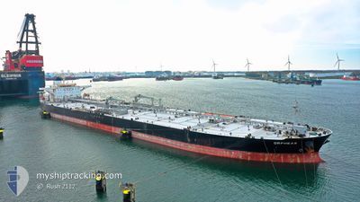
ORPHEAS
Crude Oil Tanker
Current Trip
US GULF
| Time Travelled | 1 day |
|---|---|
| Remaining Time | --- |
| Distance Travelled | 631.65 nm |
| Remaining Distance | --- |
| AVG Speed | 12.6 Knopen |
| MAX Speed | 15.1 Knopen |
| AVG Wind | 8.7 knots |
| MAX Wind | 13 knots |
| MIN Temp | 11.3°C / 52.34°F |
| MAX Temp | 23.4°C / 74.12°F |
| Diepgang | 9.5 M |
| Positie ontvangen | 1 d geleden |
Current Position
| Lengtegraad | -74.08835° |
|---|---|
| Breedtegraat | 37.48955° |
| Status | Under way using engine |
| Snelheid | 14.9 Knopen |
| Koers | 172.3° |
| Gebied | North Atlantic Ocean |
| Station | T-AIS |
| Positie ontvangen | 1 d geleden |
Info
Information
The current position of ORPHEAS is in North Atlantic Ocean with coordinates 37.48955° / -74.08835° as reported on 2024-04-17 05:38 by AIS to our vessel tracker app. The vessel's current speed is 14.9 Knopen
The vessel ORPHEAS (IMO: 9318149, MMSI: 636013157) is a Crude Oil Tanker that was built in 2007 ( 17 Jaar oud ). It's sailing under the flag of [LR] Liberia.
In this page you can find informations about the vessels current position, last detected port calls, and current voyage information. If the vessels is not in coverage by AIS you will find the latest position.
The current position of ORPHEAS is detected by our AIS receivers and we are not responsible for the reliability of the data. The last position was recorded while the vessel was in Coverage by the Ais receivers of our vessel tracking app.
The current draught of ORPHEAS as reported by AIS is 9.5 meters
Weather
| Temperature | 21.4°C / 70.52°F |
|---|---|
| Wind Speed | 6 knots |
| Direction | 204° SSW |
| Pressure | 1020.4 hPa |
| Humidity | 66.8 % |
| Cloud Coverage | 100 % |
Featured Company
Last Port Calls
| Port | Arrival | Departure | Time In Port |
|---|---|---|---|
| 2024-04-14 17:40 | 2024-04-16 16:46 | 1 d | |
| 2024-04-11 05:51 | 2024-04-12 22:25 | 1 d |
Most Visited Ports (Last year)
| Port | Arrivals | |
|---|---|---|
| 2 | ||
| 2 | ||
| 1 | ||
| 1 | ||
| 1 | ||
| 1 |
Last Trips
| Origin | Departure | Destination | Arrival | Distance | |
|---|---|---|---|---|---|
| 2024-04-12 18:25 | 2024-04-14 13:40 | 148.21 nm | |||
| 2024-01-29 18:36 | 2024-04-11 01:51 | 5978.74 nm |
Events
| Tijd | Evenement | Details | Positie / Bestemming | Info |
|---|---|---|---|---|
| 2024-04-17 05:43 | Status Changed | Default Under way using engine |
37.46667 / -74.08334
US GULF
|
Snelheid: 14.9 kn Koers: 172.3° |
| 2024-04-17 05:38 | Buitenbereik |
37.48955 / -74.08835
North Atlantic Ocean
US GULF
|
Snelheid: 14.9 kn Koers: 172.3° |
|
| 2024-04-17 03:54 | Destination Changed | US GULF CORPUS CHRISTI |
37.90896 / -74.17549
US GULF
|
Snelheid: 14.9 kn Koers: 166.6° |
| 2024-04-17 03:54 | ETA Changed | 2024/04/23 00:01 2024/04/22 13:30 |
37.90896 / -74.17549
US GULF
|
Snelheid: 14.9 kn Koers: 166.6° |
| 2024-04-17 03:48 | Status Changed | Under way using engine Default |
37.93148 / -74.18550
CORPUS CHRISTI
|
Snelheid: 14 kn Koers: 140° |
| 2024-04-17 03:31 | Status Changed | Default Under way using engine |
37.98333 / -74.23834
CORPUS CHRISTI
|
Snelheid: 14.4 kn Koers: 140.9° |
| 2024-04-17 03:28 | Status Changed | Under way using engine Default |
37.99435 / -74.24972
CORPUS CHRISTI
|
Snelheid: 14 kn Koers: 139° |
| 2024-04-17 03:22 | Status Changed | Default Under way using engine |
38.01167 / -74.26833
CORPUS CHRISTI
|
Snelheid: 14.5 kn Koers: 138.3° |
| 2024-04-17 01:55 | Status Changed | Under way using engine Default |
38.28103 / -74.55934
CORPUS CHRISTI
|
Snelheid: 14 kn Koers: 140° |
| 2024-04-17 00:52 | Buitenbereik |
38.48254 / -74.76295
North Atlantic Ocean
CORPUS CHRISTI
|
Snelheid: 14.1 kn Koers: 145.8° |