
OPTIMAR
General Cargo
Current Trip
| Time Travelled | 7 h, 25 mins |
|---|---|
| Remaining Time | 1 day |
| Distance Travelled | 70.79 nm |
| Remaining Distance | 353.29 nm |
| AVG Speed | 9.6 Knop |
| MAX Speed | 10.3 Knop |
| AVG Wind | 13.5 knots |
| MAX Wind | 18 knots |
| MIN Temp | 9.6°C / 49.28°F |
| MAX Temp | 11.4°C / 52.52°F |
| Djupgående | 4.7 m |
| Position mottagen | 1 m sen |
Current Position
| Longitud | 21.70101° |
|---|---|
| Latitude | 57.89868° |
| Status | Under way using engine |
| Fart | 9.8 Knop |
| Kurs | 331.2° |
| Område | Baltic Sea |
| Station | T-AIS |
| Position mottagen | 1 m sen |
Info
Information
The current position of OPTIMAR is in Baltic Sea with coordinates 57.89868° / 21.70101° as reported on 2024-05-21 01:32 by AIS to our vessel tracker app. The vessel's current speed is 9.8 Knop and is heading at the port of HUSUM. The estimated time of arrival as calculated by MyShipTracking vessel tracking app is 2024-05-22 14:17 LT
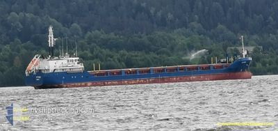
The vessel OPTIMAR (IMO: 9199402, MMSI: 209730000) is a General Cargo that was built in 2000 ( 24 År gammal ). It's sailing under the flag of [CY] Cyprus.
In this page you can find informations about the vessels current position, last detected port calls, and current voyage information. If the vessels is not in coverage by AIS you will find the latest position.
The current position of OPTIMAR is detected by our AIS receivers and we are not responsible for the reliability of the data. The last position was recorded while the vessel was in Coverage by the Ais receivers of our vessel tracking app.
The current draught of OPTIMAR as reported by AIS is 4.7 meters
Weather
| Temperature | 9.8°C / 49.64°F |
|---|---|
| Wind Speed | 11 knots |
| Direction | 47° NE |
| Pressure | 1020.6 hPa |
| Humidity | 67.4 % |
| Cloud Coverage | 8 % |
Featured Company
Last Port Calls
| Port | Arrival | Departure | Time In Port |
|---|---|---|---|
| 2024-05-19 07:00 | 2024-05-20 21:08 | 1 d | |
| 2024-05-16 08:43 | 2024-05-17 16:06 | 1 d | |
| 2024-05-15 11:16 | 2024-05-16 01:32 | 14 h | |
| 2024-05-13 14:03 | 2024-05-14 17:59 | 1 d | |
| 2024-05-10 07:32 | 2024-05-11 14:32 | 1 d | |
| 2024-05-07 12:28 | 2024-05-08 06:48 | 18 h | |
| 2024-05-05 20:44 | 2024-05-06 14:20 | 17 h | |
| 2024-04-30 23:47 | 2024-05-02 19:16 | 1 d | |
| 2024-04-29 09:24 | 2024-04-29 21:47 | 12 h | |
| 2024-04-26 07:20 | 2024-04-27 20:12 | 1 d |
Last Trips
| Origin | Departure | Destination | Arrival | Distance | |
|---|---|---|---|---|---|
| 2024-05-17 16:06 | 2024-05-19 07:00 | 62.90 nm | |||
| 2024-05-16 01:32 | 2024-05-16 08:43 | 63.04 nm | |||
| 2024-05-14 17:59 | 2024-05-15 11:16 | 190.05 nm | |||
| 2024-05-11 14:32 | 2024-05-13 14:03 | 354.50 nm | |||
| 2024-05-08 06:48 | 2024-05-10 07:32 | 458.05 nm | |||
| 2024-05-06 14:20 | 2024-05-07 12:28 | 270.18 nm | |||
| 2024-05-02 19:16 | 2024-05-05 20:44 | 667.20 nm | |||
| 2024-04-29 21:47 | 2024-04-30 23:47 | 226.14 nm | |||
| 2024-04-27 20:12 | 2024-04-29 09:24 | 427.21 nm | |||
| 2024-04-25 13:08 | 2024-04-26 07:20 | 188.13 nm |
Events
| Tid | Event | Detaljer | Position / Dest | Information |
|---|---|---|---|---|
| 2024-05-21 00:50 | Status ändrad | Under way using engine Default |
57.80766 / 21.82718
SEHUS
|
Fart: 10 kn Kurs: 300° |
| 2024-05-21 00:45 | Status ändrad | Default Under way using engine |
57.79993 / 21.85186
SEHUS
|
Fart: 10.2 kn Kurs: 299.2° |
| 2024-05-21 00:39 | Byter havsområde | Estonian part of the Baltic Sea Estonian part of the Gulf of Riga |
57.79175 / 21.87870
Baltic Sea
SEHUS
|
Fart: 10.2 kn Kurs: 299.2° |
| 2024-05-21 00:39 | Status ändrad | Under way using engine Default |
57.79175 / 21.87870
SEHUS
|
Fart: 10.2 kn Kurs: 298° |
| 2024-05-21 00:29 | Status ändrad | Default Under way using engine |
57.77824 / 21.92678
SEHUS
|
Fart: 10.2 kn Kurs: 274° |
| 2024-05-21 00:10 | Upptäckt i hav | Estonian part of the Gulf of Riga |
57.77371 / 22.02390
Gulf of Riga
SEHUS
|
Fart: 10.3 kn Kurs: 254.6° |
| 2024-05-21 00:10 | Status ändrad | Under way using engine Default |
57.77371 / 22.02390
SEHUS
|
Fart: 10.3 kn Kurs: 254° |
| 2024-05-20 23:41 | Status ändrad | Default Under way using engine |
57.79469 / 22.17363
SEHUS
|
Fart: 10.3 kn Kurs: 256.4° |
| 2024-05-20 23:22 | Status ändrad | Under way using engine Default |
57.80697 / 22.27037
SEHUS
|
Fart: 10.1 kn Kurs: 256° |
| 2024-05-20 23:20 | Status ändrad | Default Under way using engine |
57.80796 / 22.27811
SEHUS
|
Fart: 10 kn Kurs: 256.6° |