
OPTIMAR
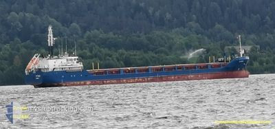
General Cargo
Current Trip
FIOUL
| Time Travelled | 16 h, 17 mins |
|---|---|
| Remaining Time | --- |
| Distance Travelled | 161.90 nm |
| Remaining Distance | --- |
| AVG Speed | 10.5 Noeuds |
| MAX Speed | 12 Noeuds |
| AVG Wind | 5.3 knots |
| MAX Wind | 7 knots |
| MIN Temp | -0.2°C / 31.64°F |
| MAX Temp | 3.3°C / 37.94°F |
| Tirant d eau | 3.6 m |
| Position reçue | 3 d depuis |
Current Position
| Longitude | 20.52568° |
|---|---|
| Latitude | 63.40625° |
| Etat | Under way using engine |
| Vitesse | 12.2 Noeuds |
| Parcours | 61.5° |
| Zone | Gulf of Bothnia |
| Station | T-AIS |
| Position reçue | 3 d depuis |
Info
Information
The current position of OPTIMAR is in Gulf of Bothnia with coordinates 63.40625° / 20.52568° as reported on 2024-04-29 23:05 by AIS to our vessel tracker app. The vessel's current speed is 12.2 Noeuds
The vessel OPTIMAR (IMO: 9199402, MMSI: 209730000) is a General Cargo that was built in 2000 ( 24 Age ). It's sailing under the flag of [CY] Cyprus.
In this page you can find informations about the vessels current position, last detected port calls, and current voyage information. If the vessels is not in coverage by AIS you will find the latest position.
The current position of OPTIMAR is detected by our AIS receivers and we are not responsible for the reliability of the data. The last position was recorded while the vessel was in Coverage by the Ais receivers of our vessel tracking app.
The current draught of OPTIMAR as reported by AIS is 3.6 meters
Weather
| Temperature | 1°C / 33.8°F |
|---|---|
| Wind Speed | 7 knots |
| Direction | 355° N |
| Pressure | 1020.7 hPa |
| Humidity | 98.5 % |
| Cloud Coverage | 100 % |
Featured Company
Last Port Calls
| Port | Arrival | Departure | Time In Port |
|---|---|---|---|
| 2024-04-30 20:47 | 2024-05-02 16:16 | 1 d | |
| 2024-04-29 07:24 | 2024-04-29 19:47 | 12 h | |
| 2024-04-26 04:20 | 2024-04-27 17:12 | 1 d | |
| 2024-04-23 16:22 | 2024-04-25 10:08 | 1 d | |
| 2024-04-21 09:56 | 2024-04-22 17:05 | 1 d | |
| 2024-04-17 12:28 | 2024-04-19 15:56 | 2 d | |
| 2024-04-12 05:16 | 2024-04-12 20:30 | 15 h | |
| 2024-04-06 20:24 | 2024-04-08 22:09 | 2 d | |
| 2024-04-05 04:21 | 2024-04-06 06:33 | 1 d | |
| 2024-04-02 03:24 | 2024-04-02 18:13 | 14 h |
Last Trips
| Origin | Departure | Destination | Arrival | Distance | |
|---|---|---|---|---|---|
| 2024-04-29 21:47 | 2024-04-30 23:47 | 226.14 nm | |||
| 2024-04-27 20:12 | 2024-04-29 09:24 | 427.21 nm | |||
| 2024-04-25 13:08 | 2024-04-26 07:20 | 188.13 nm | |||
| 2024-04-22 19:05 | 2024-04-23 19:22 | 256.88 nm | |||
| 2024-04-19 17:56 | 2024-04-21 11:56 | 418.24 nm | |||
| 2024-04-12 23:30 | 2024-04-17 14:28 | 436.57 nm | |||
| 2024-04-09 01:09 | 2024-04-12 08:16 | 598.53 nm | |||
| 2024-04-06 08:33 | 2024-04-06 23:24 | 124.04 nm | |||
| 2024-04-02 21:13 | 2024-04-05 06:21 | 426.32 nm | |||
| 2024-04-01 21:09 | 2024-04-02 06:24 | 76.88 nm |
Events
| Heure | Evenement | Détails | Position/ Destination | Info |
|---|---|---|---|---|
| 2024-05-03 06:29 | Démarrage |
63.75468 / 21.87435
FIOUL
|
Vitesse: 4.5 kn Parcours: 249° |
|
| 2024-05-03 06:04 | Arret |
63.75520 / 21.87857
FIOUL
|
Vitesse: 0.3 kn Parcours: 265° |
|
| 2024-05-02 16:16 | Démarrage | 2.78 nm, West of OULU |
65.02021 / 25.34032
FIOUL
|
Vitesse: 9.5 kn Parcours: 310° |
| 2024-05-02 16:16 | PORT DE DEPART |
|
65.02021 / 25.34032
FIOUL
|
Vitesse: 4.8 kn Parcours: 303° |
| 2024-04-30 20:53 | Arret |
65.00020 / 25.40370
[FI] OULU
|
Vitesse: 0.2 kn Parcours: 111° |
|
| 2024-04-30 20:47 | Port d'arrivée |
|
65.00166 / 25.39833
[FI] OULU
|
Vitesse: 10.3 kn Parcours: 124° |
| 2024-04-30 18:35 | Démarrage |
65.16612 / 24.61200
FIOUL
|
Vitesse: 9.1 kn Parcours: 142° |
|
| 2024-04-30 18:20 | Arret |
65.17257 / 24.59983
FIOUL
|
Vitesse: 0.3 kn Parcours: 138° |
|
| 2024-04-30 18:08 | Démarrage |
65.18150 / 24.54051
FIOUL
|
Vitesse: 9.7 kn Parcours: 91° |
|
| 2024-04-30 17:23 | Arret |
65.18155 / 24.47925
FIOUL
|
Vitesse: Parcours: 82° |