
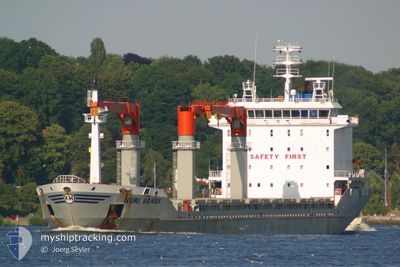
NURI SONAY
General Cargo
Current Trip
| Time Travelled | 3 days |
|---|---|
| Remaining Time | --- |
| Distance Travelled | 617.34 nm |
| Remaining Distance | --- |
| AVG Speed | 11.8 Knop |
| MAX Speed | 12.7 Knop |
| AVG Wind | 9.3 knots |
| MAX Wind | 21.4 knots |
| MIN Temp | 19°C / 66.2°F |
| MAX Temp | 21.1°C / 69.98°F |
| Djupgående | 9.2 m |
| Position mottagen | 16 h, 21 m sen |
Current Position
| Longitud | 15.10099° |
|---|---|
| Latitude | 35.88394° |
| Status | Not under command |
| Fart | 0.8 Knop |
| Kurs | 173° |
| Område | Mediterranean Sea - Eastern Basin |
| Station | T-AIS |
| Position mottagen | 16 h, 21 m sen |
Info
Information
The current position of NURI SONAY is in Mediterranean Sea - Eastern Basin with coordinates 35.88394° / 15.10099° as reported on 2024-05-20 16:05 by AIS to our vessel tracker app. The vessel's current speed is 0.8 Knop and is heading at the port of ROTTERDAM. The estimated time of arrival as calculated by MyShipTracking vessel tracking app is 2024-05-30 16:00 LT
The vessel NURI SONAY (IMO: 9310202, MMSI: 371251000) is a General Cargo that was built in 2006 ( 18 År gammal ). It's sailing under the flag of [PA] Panama.
In this page you can find informations about the vessels current position, last detected port calls, and current voyage information. If the vessels is not in coverage by AIS you will find the latest position.
The current position of NURI SONAY is detected by our AIS receivers and we are not responsible for the reliability of the data. The last position was recorded while the vessel was in Coverage by the Ais receivers of our vessel tracking app.
The current draught of NURI SONAY as reported by AIS is 9.2 meters
Weather
| Temperature | 18.6°C / 65.48°F |
|---|---|
| Wind Speed | 19 knots |
| Direction | 302° WNW |
| Pressure | 1012 hPa |
| Humidity | 93.5 % |
| Cloud Coverage | 100 % |
Featured Company
Last Port Calls
| Port | Arrival | Departure | Time In Port |
|---|---|---|---|
| 2024-05-13 10:15 | 2024-05-18 06:39 | 4 d | |
| 2024-05-07 12:46 | 2024-05-11 15:08 | 4 d | |
| 2024-04-26 13:34 | 2024-04-29 05:00 | 2 d | |
| 2024-04-16 07:08 | 2024-04-18 07:08 | 2 d | |
| 2024-04-15 06:20 | 2024-04-16 06:23 | 1 d | |
| 2024-03-30 12:33 | 2024-04-07 08:45 | 7 d | |
| 2024-03-22 05:36 | 2024-03-30 10:43 | 8 d | |
| 2024-03-01 12:49 |
Most Visited Ports (Last year)
| Port | Arrivals | |
|---|---|---|
| 5 | ||
| 3 | ||
| 3 | ||
| 2 | ||
| 2 | ||
| 2 |
Last Trips
| Origin | Departure | Destination | Arrival | Distance | |
|---|---|---|---|---|---|
| 2024-05-11 17:08 | 2024-05-13 13:15 | 483.23 nm | |||
| 2024-04-29 07:00 | 2024-05-07 14:46 | 179.74 nm | |||
| 2024-04-18 08:08 | 2024-04-26 15:34 | 2029.92 nm | |||
| 2024-04-16 07:23 | 2024-04-16 08:08 | 4.05 nm | |||
| 2024-04-07 10:45 | 2024-04-15 07:20 | 1506.36 nm | |||
| 2024-03-30 11:43 | 2024-03-30 13:33 | 23.55 nm | |||
| 2024-02-22 20:12 | 2024-03-01 15:49 | 1325.22 nm |
Events
| Tid | Event | Detaljer | Position / Dest | Information |
|---|---|---|---|---|
| 2024-05-21 04:31 | STOPPAR förflyttning | 11.13 nm, East of MARSAXLOKK |
35.87947 / 14.76457
NLRTM
|
Fart: 0.2 kn Kurs: 340° |
| 2024-05-21 02:37 | STARTAR förflyttning |
35.89849 / 15.09690
NLRTM
|
Fart: 4.3 kn Kurs: 273° |
|
| 2024-05-20 19:16 | STOPPAR förflyttning |
35.91019 / 15.06969
NLRTM
|
Fart: 0.3 kn Kurs: 169° |
|
| 2024-05-20 16:12 | Status ändrad | Default Not under command |
35.88504 / 15.09910
NLRTM
|
Fart: 0.8 kn Kurs: 173° |
| 2024-05-20 16:05 | UTANFÖR täckningsområde |
35.88394 / 15.10099
Mediterranean Sea - Eastern Basin
NLRTM
|
Fart: 0.8 kn Kurs: 302.8° |
|
| 2024-05-20 16:01 | Status ändrad | Not under command Default |
35.88350 / 15.10191
NLRTM
|
Fart: 0.8 kn Kurs: 174° |
| 2024-05-20 15:59 | Status ändrad | Default Not under command |
35.88325 / 15.10243
NLRTM
|
Fart: 0.9 kn Kurs: 173° |
| 2024-05-20 15:49 | Status ändrad | Not under command Default |
35.88202 / 15.10519
NLRTM
|
Fart: 0.8 kn Kurs: 170° |
| 2024-05-20 15:08 | Status ändrad | Default Not under command |
35.87779 / 15.11664
NLRTM
|
Fart: 0.9 kn Kurs: 156° |
| 2024-05-20 15:01 | Upptäckt i hav | Maltese part of the Mediterranean Sea - Eastern Basin |
35.87721 / 15.11881
Mediterranean Sea - Eastern Basin
NLRTM
|
Fart: 0.9 kn Kurs: 286.6° |