
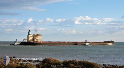
NSU YOUNG STAR
Cargo
Current Trip
| Trip Time | 3 days |
|---|---|
| Trip Distance | 712.27 nm |
| AVG Speed | 11.5 Knop |
| MAX Speed | 14.8 Knop |
| Djupgående | 11.6 m |
| AVG Wind | 8.6 knots |
| MAX Wind | 20.9 knots |
| MIN Temp | 6.7°C / 44.06°F |
| MAX Temp | 18.9°C / 66.02°F |
| Position mottagen | 2 d sen |
Current Position
| Longitud | 141.19806° |
|---|---|
| Latitude | 42.08468° |
| Status | Under way using engine |
| Fart | 11.7 Knop |
| Kurs | 311.5° |
| Område | North Pacific Ocean |
| Station | T-AIS |
| Position mottagen | 2 d sen |
Info
Information
The current position of NSU YOUNG STAR is in North Pacific Ocean with coordinates 42.08468° / 141.19806° as reported on 2024-04-29 03:46 by AIS to our vessel tracker app. The vessel's current speed is 11.7 Knop and is currently inside the port of MURORAN.
The vessel NSU YOUNG STAR (IMO: 9839026, MMSI: 636019353) is a Cargo It's sailing under the flag of [LR] Liberia.
In this page you can find informations about the vessels current position, last detected port calls, and current voyage information. If the vessels is not in coverage by AIS you will find the latest position.
The current position of NSU YOUNG STAR is detected by our AIS receivers and we are not responsible for the reliability of the data. The last position was recorded while the vessel was in Coverage by the Ais receivers of our vessel tracking app.
The current draught of NSU YOUNG STAR as reported by AIS is 11.6 meters
Weather
| Temperature | 10.1°C / 50.18°F |
|---|---|
| Wind Speed | 15 knots |
| Direction | 285° WNW |
| Pressure | 1009.4 hPa |
| Humidity | 62.7 % |
| Cloud Coverage | --- |
Featured Company
Events
| Tid | Event | Detaljer | Position / Dest | Information |
|---|---|---|---|---|
| 2024-04-30 03:40 | STOPPAR förflyttning |
42.34421 / 140.98131
[JP] MURORAN
|
Fart: 0.1 kn Kurs: 80° |
|
| 2024-04-30 02:56 | ANLÄNDER HAMN |
|
42.35202 / 140.92581
[JP] MURORAN
|
Fart: 8 kn Kurs: 66° |
| 2024-04-30 02:16 | STARTAR förflyttning | 5.14 nm, West of MURORAN |
42.33092 / 140.84418
JP NGO > JP MUR
|
Fart: 3.5 kn Kurs: 120° |
| 2024-04-29 06:55 | STOPPAR förflyttning | 5.91 nm, West of MURORAN |
42.33537 / 140.82526
JP NGO > JP MUR
|
Fart: 0.3 kn Kurs: 85° |
| 2024-04-29 03:53 | Status ändrad | Default Under way using engine |
42.09872 / 141.17674
JP NGO > JP MUR
|
Fart: 11.7 kn Kurs: 311.5° |
| 2024-04-29 03:46 | UTANFÖR täckningsområde |
42.08468 / 141.19806
North Pacific Ocean
JP NGO > JP MUR
|
Fart: 11.7 kn Kurs: 311.5° |
|
| 2024-04-29 02:47 | Status ändrad | Under way using engine Default |
41.94782 / 141.37282
JP NGO > JP MUR
|
Fart: 11.6 kn Kurs: 328° |
| 2024-04-29 02:44 | Status ändrad | Default Under way using engine |
41.94194 / 141.37767
JP NGO > JP MUR
|
Fart: 11.7 kn Kurs: 326.9° |
| 2024-04-29 02:34 | Status ändrad | Under way using engine Default |
41.91231 / 141.40242
JP NGO > JP MUR
|
Fart: 11.5 kn Kurs: 328° |
| 2024-04-29 02:32 | Status ändrad | Default Under way using engine |
41.90928 / 141.40488
JP NGO > JP MUR
|
Fart: 11.5 kn Kurs: 327.9° |