

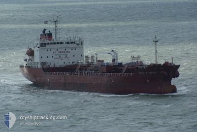
NQ ROSA
Oil/Chemical Tanker

Current Trip
| Time Travelled | 1 day |
|---|---|
| Remaining Time | 1 day |
| Distance Travelled | 249.35 nm |
| Remaining Distance | 826.42 nm |
| AVG Speed | 12.7 Knop |
| MAX Speed | 14 Knop |
| AVG Wind | 8.8 knots |
| MAX Wind | 22.5 knots |
| MIN Temp | 9.9°C / 49.82°F |
| MAX Temp | 13.5°C / 56.3°F |
| Djupgående | 5 m |
| Position mottagen | 1 d sen |
Current Position
| Longitud | --- |
|---|---|
| Latitude | --- |
| Status | Under way using engine |
| Fart | 13 Knop |
| Kurs | 348.9° |
| Område | North Atlantic Ocean |
| Station | T-AIS |
| Position mottagen | 1 d sen |
Information
The current position of NQ ROSA is in North Atlantic Ocean with coordinates 41.47548° / -9.25120° as reported on 2025-03-27 12:47 by AIS to our vessel tracker app. The vessel's current speed is 13 Knop and is heading at the port of ANTWERP. The estimated time of arrival as calculated by MyShipTracking vessel tracking app is 2025-03-30 13:52 LT
The vessel NQ ROSA (IMO: 9304318, MMSI: 256227000) is a Oil/Chemical Tanker that was built in 2004 ( 21 År gammal ). It's sailing under the flag of [MT] Malta.
In this page you can find informations about the vessels current position, last detected port calls, and current voyage information. If the vessels is not in coverage by AIS you will find the latest position.
The current position of NQ ROSA is detected by our AIS receivers and we are not responsible for the reliability of the data. The last position was recorded while the vessel was in Coverage by the Ais receivers of our vessel tracking app.
The current draught of NQ ROSA as reported by AIS is 5 meters
Weather
| Temperature | 11.7°C / 53.06°F |
|---|---|
| Wind Speed | 18 knots |
| Direction | 346° NNW |
| Pressure | 1022.4 hPa |
| Humidity | 77.3 % |
| Cloud Coverage | 99 % |


Featured Company
Last Port Calls
| Port | Arrival | Departure | Time In Port |
|---|---|---|---|
| 2025-03-25 16:42 | 2025-03-27 08:12 | 1 d | |
| 2025-03-18 13:01 | 2025-03-19 20:24 | 1 d | |
| 2025-03-16 12:05 | 2025-03-17 16:43 | 1 d | |
| 2025-03-12 10:43 | 2025-03-12 17:08 | 6 h | |
| 2025-03-04 05:39 | 2025-03-05 04:46 | 23 h | |
| 2025-02-22 07:05 | 2025-02-23 17:06 | 1 d | |
| 2025-02-15 10:38 | 2025-02-16 13:16 | 1 d | |
| 2025-02-05 20:53 | 2025-02-06 21:18 | 1 d | |
| 2025-01-20 19:59 | 2025-01-21 00:17 | 4 h | |
| 2025-01-18 19:45 | 2025-01-19 20:33 | 1 d |
Last Trips
| Origin | Departure | Destination | Arrival | Distance | |
|---|---|---|---|---|---|
| 2025-03-19 20:24 | 2025-03-25 16:42 | 1026.87 nm | |||
| 2025-03-17 16:43 | 2025-03-18 13:01 | 245.97 nm | |||
| 2025-03-12 17:08 | 2025-03-16 12:05 | 701.64 nm | |||
| 2025-03-05 04:46 | 2025-03-12 10:43 | 1754.77 nm | |||
| 2025-02-16 13:16 | 2025-02-22 07:05 | 809.60 nm | |||
| 2025-02-06 21:18 | 2025-02-15 10:38 | 2425.37 nm | |||
| 2025-01-21 00:17 | 2025-02-05 20:53 | 409.50 nm | |||
| 2025-01-19 20:33 | 2025-01-20 19:59 | 290.12 nm | |||
| 2025-01-13 17:27 | 2025-01-18 19:45 | 823.17 nm | |||
| 2025-01-10 16:59 | 2025-01-13 05:39 | 140.06 nm |
Events
| Tid | Event | Detaljer | Position / Dest | Information |
|---|---|---|---|---|
| 2025-03-27 13:05 | Status ändrad | Default Under way using engine |
41.54230 / -9.27587
BEANR
|
Fart: 13 kn Kurs: 348.9° |
| 2025-03-27 12:47 | UTANFÖR täckningsområde |
41.47548 / -9.25120
North Atlantic Ocean
BEANR
|
Fart: 13 kn Kurs: 348.9° |
|
| 2025-03-27 08:12 | AVGÅTT HAMN |
|
40.64235 / -8.76183
BEANR
|
Fart: 8.9 kn Kurs: 236° |
| 2025-03-27 07:57 | Status ändrad | Under way using engine Moored |
40.65303 / -8.72330
[PT] AVEIRO
|
Fart: 4.3 kn Kurs: 256° |
| 2025-03-27 07:57 | STARTAR förflyttning |
40.65322 / -8.72222
[PT] AVEIRO
|
Fart: 4.1 kn Kurs: 256° |
|
| 2025-03-27 07:30 | Status ändrad | Moored Default |
40.65363 / -8.72048
[PT] AVEIRO
|
Fart: Kurs: 262° |
| 2025-03-27 06:48 | Status ändrad | Default Moored |
40.65362 / -8.72047
[PT] AVEIRO
|
Fart: Kurs: 262° |
| 2025-03-27 06:06 | Status ändrad | Moored Default |
40.65363 / -8.72052
[PT] AVEIRO
|
Fart: Kurs: 262° |
| 2025-03-27 06:06 | I täckningsområde |
40.65363 / -8.72052
North Atlantic Ocean
[PT] AVEIRO
|
Fart: Kurs: 6.4° |
|
| 2025-03-27 05:03 | UTANFÖR täckningsområde |
40.65363 / -8.72050
North Atlantic Ocean
[PT] AVEIRO
|
Fart: Kurs: 6.4° |