
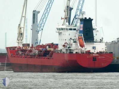
NQ MORINA
Oil/Chemical Tanker
Current Trip
| Time Travelled | 5 days |
|---|---|
| Remaining Time | 7 days |
| Distance Travelled | 1452.42 nm |
| Remaining Distance | 2455.13 nm |
| AVG Speed | 10.7 Knop |
| MAX Speed | 13.2 Knop |
| AVG Wind | 15.3 knots |
| MAX Wind | 35 knots |
| MIN Temp | 8.5°C / 47.3°F |
| MAX Temp | 16.5°C / 61.7°F |
| Djupgående | 6.8 m |
| Position mottagen | 4 d sen |
Current Position
| Longitud | --- |
|---|---|
| Latitude | --- |
| Status | Under way using engine |
| Fart | 10.8 Knop |
| Kurs | 210.2° |
| Område | Celtic Sea |
| Station | T-AIS |
| Position mottagen | 4 d sen |
Info
Information
The current position of NQ MORINA is in Celtic Sea with coordinates 48.87458° / -6.29974° as reported on 2025-02-22 19:59 by AIS to our vessel tracker app. The vessel's current speed is 10.8 Knop and is heading at the port of ABIDJAN. The estimated time of arrival as calculated by MyShipTracking vessel tracking app is 2025-03-06 19:53 LT
The vessel NQ MORINA (IMO: 9243382, MMSI: 229535000) is a Oil/Chemical Tanker that was built in 2002 ( 23 År gammal ). It's sailing under the flag of [MT] Malta.
In this page you can find informations about the vessels current position, last detected port calls, and current voyage information. If the vessels is not in coverage by AIS you will find the latest position.
The current position of NQ MORINA is detected by our AIS receivers and we are not responsible for the reliability of the data. The last position was recorded while the vessel was in Coverage by the Ais receivers of our vessel tracking app.
The current draught of NQ MORINA as reported by AIS is 6.8 meters
Weather
| Temperature | 16.5°C / 61.7°F |
|---|---|
| Wind Speed | 6 knots |
| Direction | 340° NNW |
| Pressure | 1025.6 hPa |
| Humidity | 73.9 % |
| Cloud Coverage | 81 % |
Featured Company
Last Port Calls
| Port | Arrival | Departure | Time In Port |
|---|---|---|---|
| 2025-02-16 22:01 | 2025-02-21 04:11 | 4 d | |
| 2025-02-14 10:38 | 2025-02-15 20:38 | 1 d | |
| 2025-02-06 14:32 | 2025-02-07 18:10 | 1 d | |
| 2025-01-22 13:45 | 2025-01-23 23:41 | 1 d | |
| 2025-01-15 15:41 | 2025-01-16 11:38 | 19 h | |
| 2025-01-05 07:05 | 2025-01-06 19:44 | 1 d | |
| 2025-01-02 18:18 | 2025-01-04 01:29 | 1 d | |
| 2024-12-25 14:41 | 2024-12-28 08:49 | 2 d | |
| 2024-12-22 22:44 | 2024-12-25 14:12 | 2 d | |
| 2024-12-10 23:59 | 2024-12-12 11:24 | 1 d |
Last Trips
| Origin | Departure | Destination | Arrival | Distance | |
|---|---|---|---|---|---|
| 2025-02-15 20:38 | 2025-02-16 22:01 | 199.86 nm | |||
| 2025-02-07 18:10 | 2025-02-14 10:38 | 1465.56 nm | |||
| 2025-01-23 23:41 | 2025-02-06 14:32 | 1038.93 nm | |||
| 2025-01-16 11:38 | 2025-01-22 13:45 | 1099.93 nm | |||
| 2025-01-06 19:44 | 2025-01-15 15:41 | 576.63 nm | |||
| 2025-01-04 01:29 | 2025-01-05 07:05 | 168.20 nm | |||
| 2024-12-28 08:49 | 2025-01-02 18:18 | 66.11 nm | |||
| 2024-12-25 14:12 | 2024-12-25 14:41 | 2.07 nm | |||
| 2024-12-12 11:24 | 2024-12-22 22:44 | 1811.97 nm | |||
| 2024-11-29 11:50 | 2024-12-10 23:59 | 1255.09 nm |
Events
| Tid | Event | Detaljer | Position / Dest | Information |
|---|---|---|---|---|
| 2025-02-22 20:07 | Status ändrad | Default Under way using engine |
48.85291 / -6.31971
CI ABJ
|
Fart: 10.8 kn Kurs: 210.2° |
| 2025-02-22 19:59 | UTANFÖR täckningsområde |
48.87458 / -6.29974
Celtic Sea
CI ABJ
|
Fart: 10.8 kn Kurs: 210.2° |
|
| 2025-02-22 19:57 | Status ändrad | Under way using engine Default |
48.87797 / -6.29664
CI ABJ
|
Fart: 10.8 kn Kurs: 211° |
| 2025-02-22 19:47 | I täckningsområde |
48.87458 / -6.29974
Celtic Sea
CI ABJ
|
Fart: 10.8 kn Kurs: 210.2° |
|
| 2025-02-22 16:07 | Status ändrad | Default Under way using engine |
49.19956 / -5.39056
CI ABJ
|
Fart: 11.1 kn Kurs: 244.3° |
| 2025-02-22 16:00 | Upptäckt i hav | French part of the Celtic Sea |
49.20988 / -5.35785
Celtic Sea
CI ABJ
|
Fart: 11.1 kn Kurs: 244.3° |
| 2025-02-22 16:00 | Status ändrad | Under way using engine Default |
49.20988 / -5.35785
CI ABJ
|
Fart: 10.5 kn Kurs: 245° |
| 2025-02-22 16:00 | UTANFÖR täckningsområde |
49.20988 / -5.35785
Celtic Sea
CI ABJ
|
Fart: 11.1 kn Kurs: 244.3° |
|
| 2025-02-22 15:19 | Status ändrad | Default Under way using engine |
49.26174 / -5.19122
CI ABJ
|
Fart: 11.3 kn Kurs: 242.8° |
| 2025-02-22 15:12 | Status ändrad | Under way using engine Default |
49.27190 / -5.16243
CI ABJ
|
Fart: 11 kn Kurs: 243° |