
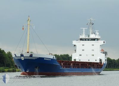
MV MANUELA S
General Cargo
Current Trip
| Time Travelled | 14 h, 29 mins |
|---|---|
| Remaining Time | 9 h, 3 mins |
| Distance Travelled | 161.84 nm |
| Remaining Distance | 106.80 nm |
| AVG Speed | 10.7 Knop |
| MAX Speed | 12.3 Knop |
| AVG Wind | 9.3 knots |
| MAX Wind | 16.5 knots |
| MIN Temp | 9.7°C / 49.46°F |
| MAX Temp | 12.6°C / 54.68°F |
| Djupgående | 4 m |
| Position mottagen | 1 m sen |
Current Position
| Longitud | 13.05269° |
|---|---|
| Latitude | 54.69384° |
| Status | Under way using engine |
| Fart | 11.6 Knop |
| Kurs | 82.1° |
| Område | Baltic Sea |
| Station | T-AIS |
| Position mottagen | 1 m sen |
Info
Information
The current position of MV MANUELA S is in Baltic Sea with coordinates 54.69384° / 13.05269° as reported on 2024-05-05 18:14 by AIS to our vessel tracker app. The vessel's current speed is 11.6 Knop and is heading at the port of SZCZECIN. The estimated time of arrival as calculated by MyShipTracking vessel tracking app is 2024-05-06 03:19 LT
The vessel MV MANUELA S (IMO: 8820107, MMSI: 210223000) is a General Cargo that was built in 1989 ( 35 År gammal ). It's sailing under the flag of [CY] Cyprus.
In this page you can find informations about the vessels current position, last detected port calls, and current voyage information. If the vessels is not in coverage by AIS you will find the latest position.
The current position of MV MANUELA S is detected by our AIS receivers and we are not responsible for the reliability of the data. The last position was recorded while the vessel was in Coverage by the Ais receivers of our vessel tracking app.
The current draught of MV MANUELA S as reported by AIS is 4 meters
Weather
| Temperature | 10.4°C / 50.72°F |
|---|---|
| Wind Speed | 6 knots |
| Direction | 203° SSW |
| Pressure | 1004.4 hPa |
| Humidity | 87.9 % |
| Cloud Coverage | 74 % |
Featured Company
Last Port Calls
| Port | Arrival | Departure | Time In Port |
|---|---|---|---|
| 2024-05-02 06:13 | 2024-05-05 03:47 | 2 d | |
| 2024-05-01 03:19 | 2024-05-01 13:01 | 9 h | |
| 2024-04-29 05:24 | 2024-04-30 18:32 | 1 d | |
| 2024-04-26 20:09 | 2024-04-27 18:52 | 22 h | |
| 2024-04-22 04:20 | 2024-04-25 08:48 | 3 d | |
| 2024-04-15 17:03 | 2024-04-18 00:14 | 2 d | |
| 2024-04-10 12:31 | 2024-04-13 01:12 | 2 d | |
| 2024-04-09 23:55 | 2024-04-10 09:36 | 9 h | |
| 2024-04-03 17:24 | 2024-04-03 18:06 | 42 m | |
| 2024-04-01 04:32 | 2024-04-03 12:53 | 2 d |
Most Visited Ports (Last year)
| Port | Arrivals | |
|---|---|---|
| 5 | ||
| 5 | ||
| 4 | ||
| 4 | ||
| 3 | ||
| 3 |
Last Trips
| Origin | Departure | Destination | Arrival | Distance | |
|---|---|---|---|---|---|
| 2024-05-01 15:01 | 2024-05-02 08:13 | 209.39 nm | |||
| 2024-04-30 20:32 | 2024-05-01 05:19 | 111.49 nm | |||
| 2024-04-27 20:52 | 2024-04-29 07:24 | 378.47 nm | |||
| 2024-04-25 11:48 | 2024-04-26 22:09 | 495.87 nm | |||
| 2024-04-18 02:14 | 2024-04-22 07:20 | 1101.68 nm | |||
| 2024-04-13 02:12 | 2024-04-15 19:03 | 736.44 nm | |||
| 2024-04-03 20:06 | 2024-04-10 13:31 | 1528.48 nm | |||
| 2024-04-03 20:06 | 2024-04-10 00:55 | 1499.82 nm | |||
| 2024-04-03 14:53 | 2024-04-03 19:24 | 49.11 nm | |||
| 2024-04-01 01:41 | 2024-04-01 06:32 | 48.88 nm |
Events
| Tid | Event | Detaljer | Position / Dest | Information |
|---|---|---|---|---|
| 2024-05-05 14:52 | Upptäckt i hav | German part of the Baltic Sea |
54.40591 / 12.10206
Baltic Sea
SZCZECIN
|
Fart: 12.2 kn Kurs: 90.7° |
| 2024-05-05 12:43 | Byter havsområde | Danish part of the Baltic Sea German part of the Baltic Sea |
54.51249 / 11.42595
Baltic Sea
SZCZECIN
|
Fart: 12.2 kn Kurs: 111.2° |
| 2024-05-05 10:58 | Byter havsområde | German part of the Baltic Sea Danish part of the Baltic Sea |
54.62723 / 10.89150
Baltic Sea
SZCZECIN
|
Fart: 11.2 kn Kurs: 131.5° |
| 2024-05-05 10:40 | Status ändrad | Under way using engine Not under command |
54.66217 / 10.81328
SZCZECIN
|
Fart: 10.7 kn Kurs: 121.7° |
| 2024-05-05 10:40 | Status ändrad | Not under command Moored |
54.66240 / 10.81262
SZCZECIN
|
Fart: 10.7 kn Kurs: 121.7° |
| 2024-05-05 10:39 | Status ändrad | Moored Under way using engine |
54.66345 / 10.80972
SZCZECIN
|
Fart: 10.6 kn Kurs: 121.3° |
| 2024-05-05 09:04 | Upptäckt i hav | Danish part of the Baltic Sea |
54.81286 / 10.36510
Baltic Sea
SZCZECIN
|
Fart: 11.1 kn Kurs: 135.8° |
| 2024-05-05 03:47 | AVGÅTT HAMN |
|
55.49316 / 9.50784
SZCZECIN
|
Fart: 5.5 kn Kurs: 87° |
| 2024-05-05 03:43 | STARTAR förflyttning |
55.49291 / 9.49793
[DK] KOLDING
|
Fart: 3.8 kn Kurs: 89° |
|
| 2024-05-05 03:39 | Status ändrad | Under way using engine Moored |
55.49287 / 9.49468
[DK] KOLDING
|
Fart: 0.2 kn Kurs: 66° |