

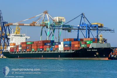
MSC ROSSELLA III
Container Ship

Current Trip
| Time Travelled | 3 days |
|---|---|
| Remaining Time | --- |
| Distance Travelled | 750.90 nm |
| Remaining Distance | --- |
| AVG Speed | 11.5 Knop |
| MAX Speed | 16.5 Knop |
| AVG Wind | 8.8 knots |
| MAX Wind | 21.6 knots |
| MIN Temp | 12.9°C / 55.22°F |
| MAX Temp | 17.3°C / 63.14°F |
| Djupgående | 11.2 m |
| Position mottagen | Nu |
Current Position
| Longitud | --- |
|---|---|
| Latitude | --- |
| Status | Under way using engine |
| Fart | 4.8 Knop |
| Kurs | 191° |
| Område | North Atlantic Ocean |
| Station | T-AIS |
| Position mottagen | Nu |
Information
The current position of MSC ROSSELLA III is in North Atlantic Ocean with coordinates 33.96055° / -7.57473° as reported on 2025-02-28 09:10 by AIS to our vessel tracker app. The vessel's current speed is 4.8 Knop
The vessel MSC ROSSELLA III (IMO: 9320025, MMSI: 255915798) is a Container Ship that was built in 2006 ( 19 År gammal ). It's sailing under the flag of [PT] Portugal.
In this page you can find informations about the vessels current position, last detected port calls, and current voyage information. If the vessels is not in coverage by AIS you will find the latest position.
The current position of MSC ROSSELLA III is detected by our AIS receivers and we are not responsible for the reliability of the data. The last position was recorded while the vessel was in Coverage by the Ais receivers of our vessel tracking app.
The current draught of MSC ROSSELLA III as reported by AIS is 11.2 meters
Weather
| Temperature | 14.9°C / 58.82°F |
|---|---|
| Wind Speed | 17 knots |
| Direction | 207° SSW |
| Pressure | 1012.3 hPa |
| Humidity | 80.2 % |
| Cloud Coverage | 100 % |


Featured Company
Last Port Calls
| Port | Arrival | Departure | Time In Port |
|---|---|---|---|
| 2025-02-22 20:00 | 2025-02-25 00:07 | 2 d | |
| 2025-02-20 04:45 | 2025-02-21 10:12 | 1 d | |
| 2025-02-16 11:12 | 2025-02-19 03:33 | 2 d | |
| 2025-02-03 16:40 | 2025-02-05 20:36 | 2 d | |
| 2025-02-01 11:45 | 2025-02-02 19:46 | 1 d | |
| 2025-01-25 02:53 | 2025-01-28 11:34 | 3 d | |
| 2025-01-23 13:19 | 2025-01-24 00:23 | 11 h | |
| 2025-01-17 09:12 | |||
| 2025-01-06 19:24 | 2025-01-07 20:10 | 1 d | |
| 2024-12-09 19:39 |
Most Visited Ports (Last year)
| Port | Arrivals | |
|---|---|---|
| 5 | ||
| 5 | ||
| 4 | ||
| 4 | ||
| 4 | ||
| 3 |
Last Trips
| Origin | Departure | Destination | Arrival | Distance | |
|---|---|---|---|---|---|
| 2025-02-21 11:12 | 2025-02-22 21:00 | 389.68 nm | |||
| 2025-02-19 04:33 | 2025-02-20 05:45 | 64.63 nm | |||
| 2025-02-05 21:36 | 2025-02-16 12:12 | 2290.54 nm | |||
| 2025-02-02 20:46 | 2025-02-03 17:40 | 173.15 nm | |||
| 2025-01-28 12:34 | 2025-02-01 12:45 | 1252.60 nm | |||
| 2025-01-24 00:23 | 2025-01-25 03:53 | 323.77 nm | |||
| 2025-01-17 10:12 | 2025-01-23 13:19 | 1520.66 nm |
Events
| Tid | Event | Detaljer | Position / Dest | Information |
|---|---|---|---|---|
| 2025-02-28 09:03 | STARTAR förflyttning | 17.8 nm, North West of MOHAMMEDIA |
33.96600 / -7.57885
MACAS
|
Fart: 3.1 kn Kurs: 128° |
| 2025-02-27 18:36 | STOPPAR förflyttning | 14.38 nm, North of CASABLANCA |
33.84571 / -7.67384
MACAS
|
Fart: 0.3 kn Kurs: 275° |
| 2025-02-27 16:52 | STARTAR förflyttning | 9.02 nm, North of CASABLANCA |
33.76413 / -7.61900
MACAS
|
Fart: 3.1 kn Kurs: 241° |
| 2025-02-27 09:31 | STOPPAR förflyttning | 12.7 nm, North of CASABLANCA |
33.81962 / -7.66116
MACAS
|
Fart: 0.3 kn Kurs: 243° |
| 2025-02-27 08:17 | STARTAR förflyttning | 15.35 nm, North West of MOHAMMEDIA |
33.87201 / -7.62832
MACAS
|
Fart: 3.2 kn Kurs: 218° |
| 2025-02-27 00:53 | STOPPAR förflyttning | 16.7 nm, North of CASABLANCA |
33.88753 / -7.66506
MACAS
|
Fart: 0.3 kn Kurs: 269° |
| 2025-02-26 20:35 | I täckningsområde |
34.22434 / -7.33987
North Atlantic Ocean
MACAS
|
Fart: 16.1 kn Kurs: 207° |
|
| 2025-02-26 13:46 | UTANFÖR täckningsområde |
35.83546 / -6.35909
North Atlantic Ocean
MACAS
|
Fart: 15.7 kn Kurs: 211.3° |
|
| 2025-02-26 13:46 | Byter havsområde | Moroccan part of the North Atlantic Ocean Spanish part of the North Atlantic Ocean |
35.83684 / -6.35799
North Atlantic Ocean
MACAS
|
Fart: 15.7 kn Kurs: 212° |
| 2025-02-26 12:19 | Byter havsområde | Spanish part of the North Atlantic Ocean Spanish part of the Strait of Gibraltar |
35.95904 / -5.97162
North Atlantic Ocean
MACAS
|
Fart: 16 kn Kurs: 274.3° |