
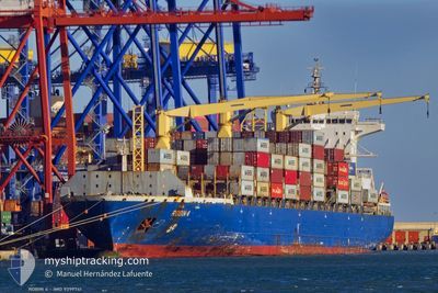
MSC MELANI III
Container Ship
Current Trip
| Trip Time | 4 days |
|---|---|
| Trip Distance | 1237.94 nm |
| AVG Speed | 14.1 Knop |
| MAX Speed | 20.7 Knop |
| Djupgående | 9.1 m |
| AVG Wind | 14.6 knots |
| MAX Wind | 31.8 knots |
| MIN Temp | 12.9°C / 55.22°F |
| MAX Temp | 19.9°C / 67.82°F |
| Position mottagen | 2 m sen |
Current Position
| Longitud | --- |
|---|---|
| Latitude | --- |
| Status | Moored |
| Fart | |
| Kurs | 179° |
| Område | Tyrrhenian Sea |
| Station | T-AIS |
| Position mottagen | 2 m sen |
Info
Information
The current position of MSC MELANI III is in Tyrrhenian Sea with coordinates 44.10863° / 9.83993° as reported on 2024-11-25 07:58 by AIS to our vessel tracker app. The vessel's current speed is 0 Knop and is currently inside the port of LA SPEZIA.
The vessel MSC MELANI III (IMO: 9399741, MMSI: 636017360) is a Container Ship that was built in 2007 ( 17 År gammal ). It's sailing under the flag of [LR] Liberia.
In this page you can find informations about the vessels current position, last detected port calls, and current voyage information. If the vessels is not in coverage by AIS you will find the latest position.
The current position of MSC MELANI III is detected by our AIS receivers and we are not responsible for the reliability of the data. The last position was recorded while the vessel was in Coverage by the Ais receivers of our vessel tracking app.
The current draught of MSC MELANI III as reported by AIS is 9.1 meters
Weather
| Temperature | 13.6°C / 56.48°F |
|---|---|
| Wind Speed | 11 knots |
| Direction | 125° SE |
| Pressure | 1028.2 hPa |
| Humidity | 69.7 % |
| Cloud Coverage | 100 % |
Featured Company
Last Port Calls
| Port | Arrival | Departure | Time In Port |
|---|---|---|---|
| 2024-11-25 04:34 | |||
| 2024-11-18 15:41 | 2024-11-20 10:28 | 1 d | |
| 2024-11-15 17:28 | 2024-11-16 04:32 | 11 h | |
| 2024-11-14 11:28 | 2024-11-15 04:16 | 16 h | |
| 2024-11-12 15:06 | 2024-11-14 00:25 | 1 d | |
| 2024-11-10 17:01 | 2024-11-11 13:18 | 20 h | |
| 2024-11-05 09:44 | 2024-11-07 20:33 | 2 d | |
| 2024-11-02 17:18 | 2024-11-03 09:34 | 16 h | |
| 2024-10-31 00:19 | 2024-10-31 18:54 | 18 h | |
| 2024-10-30 12:06 | 2024-10-30 19:23 | 7 h |
Most Visited Ports (Last year)
| Port | Arrivals | |
|---|---|---|
| 23 | ||
| 14 | ||
| 14 | ||
| 12 | ||
| 12 | ||
| 11 |
Last Trips
| Origin | Departure | Destination | Arrival | Distance | |
|---|---|---|---|---|---|
| 2024-11-20 11:28 | 2024-11-25 05:34 | 1237.94 nm | |||
| 2024-11-16 05:32 | 2024-11-18 16:41 | 626.41 nm | |||
| 2024-11-15 05:16 | 2024-11-15 18:28 | 64.04 nm | |||
| 2024-11-14 01:25 | 2024-11-14 12:28 | 143.58 nm | |||
| 2024-11-11 14:18 | 2024-11-12 16:06 | 437.09 nm | |||
| 2024-11-07 21:33 | 2024-11-10 18:01 | 1075.87 nm | |||
| 2024-11-03 10:34 | 2024-11-05 10:44 | 619.76 nm | |||
| 2024-10-31 19:54 | 2024-11-02 18:18 | 10.60 nm | |||
| 2024-10-30 20:23 | 2024-10-31 01:19 | 47.28 nm | |||
| 2024-10-29 03:30 | 2024-10-30 13:06 | 511.85 nm |
Events
| Tid | Event | Detaljer | Position / Dest | Information |
|---|---|---|---|---|
| 2024-11-25 05:16 | Status ändrad | Moored Under way using engine |
44.10869 / 9.84013
[IT] LA SPEZIA
|
Fart: 0.1 kn Kurs: 178° |
| 2024-11-25 05:07 | STOPPAR förflyttning |
44.10802 / 9.84027
[IT] LA SPEZIA
|
Fart: 0.3 kn Kurs: 181° |
|
| 2024-11-25 04:34 | ANLÄNDER HAMN |
|
44.07709 / 9.84991
[IT] LA SPEZIA
|
Fart: 7.4 kn Kurs: 342.6° |
| 2024-11-25 02:46 | Upptäckt i hav | Italian part of the Tyrrhenian Sea |
43.95257 / 9.82327
Tyrrhenian Sea
ITSPE
|
Fart: 6.3 kn Kurs: 68.2° |
| 2024-11-25 01:57 | Status ändrad | Under way using engine Default |
43.89913 / 9.72261
ITSPE
|
Fart: 6.5 kn Kurs: 52° |
| 2024-11-25 01:51 | Status ändrad | Default Under way using engine |
43.89319 / 9.71114
ITSPE
|
Fart: 6.6 kn Kurs: 54° |
| 2024-11-25 01:07 | Status ändrad | Under way using engine Default |
43.84500 / 9.62249
ITSPE
|
Fart: 6.6 kn Kurs: 52° |
| 2024-11-25 00:41 | Status ändrad | Default Under way using engine |
43.81559 / 9.56772
ITSPE
|
Fart: 6.8 kn Kurs: 52.7° |
| 2024-11-25 00:07 | Upptäckt i hav | Italian part of the Ligurian Sea |
43.77289 / 9.50476
Ligurian Sea
ITSPE
|
Fart: 6.7 kn Kurs: 40° |
| 2024-11-25 00:07 | Status ändrad | Under way using engine Default |
43.77289 / 9.50476
ITSPE
|
Fart: 6.6 kn Kurs: 40° |