
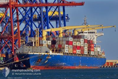
MSC MELANI III
Container Ship
Current Trip
| Time Travelled | 14 days |
|---|---|
| Remaining Time | 7 mins |
| Distance Travelled | 4614.99 nm |
| Remaining Distance | 7.71 nm |
| AVG Speed | 13.7 Noeuds |
| MAX Speed | 16.7 Noeuds |
| AVG Wind | 13.6 knots |
| MAX Wind | 32.7 knots |
| MIN Temp | 12°C / 53.6°F |
| MAX Temp | 27.9°C / 82.22°F |
| Tirant d eau | 12.7 m |
| Position reçue | 3 d depuis |
Current Position
| Longitude | --- |
|---|---|
| Latitude | --- |
| Etat | Under way using engine |
| Vitesse | 15 Noeuds |
| Parcours | 170.9° |
| Zone | North Atlantic Ocean |
| Station | T-AIS |
| Position reçue | 3 d depuis |
Info
Information
The current position of MSC MELANI III is in North Atlantic Ocean with coordinates 12.95994° / -17.63360° as reported on 2025-12-02 11:34 by AIS to our vessel tracker app. The vessel's current speed is 15 Noeuds and is heading at the port of ABIDJAN. The estimated time of arrival as calculated by MyShipTracking vessel tracking app is 2025-12-05 13:47 LT
The vessel MSC MELANI III (IMO: 9399741, MMSI: 636017360) is a Container Ship that was built in 2007 ( 18 Age ). It's sailing under the flag of [LR] Liberia.
In this page you can find informations about the vessels current position, last detected port calls, and current voyage information. If the vessels is not in coverage by AIS you will find the latest position.
The current position of MSC MELANI III is detected by our AIS receivers and we are not responsible for the reliability of the data. The last position was recorded while the vessel was in Coverage by the Ais receivers of our vessel tracking app.
The current draught of MSC MELANI III as reported by AIS is 12.7 meters
Weather
| Temperature | 27.9°C / 82.22°F |
|---|---|
| Wind Speed | 9 knots |
| Direction | 181° S |
| Pressure | 1010 hPa |
| Humidity | 72.6 % |
| Cloud Coverage | 35 % |
Featured Company
Last Port Calls
| Port | Arrival | Departure | Time In Port |
|---|---|---|---|
| 2025-11-19 20:24 | 2025-11-20 19:49 | 23 h | |
| 2025-11-17 12:29 | 2025-11-18 11:25 | 22 h | |
| 2025-11-15 10:57 | 2025-11-16 08:56 | 21 h | |
| 2025-11-11 12:55 | 2025-11-12 13:22 | 1 d | |
| 2025-11-07 21:06 | 2025-11-08 10:45 | 13 h | |
| 2025-11-06 06:44 | 2025-11-06 18:48 | 12 h | |
| 2025-10-31 15:05 | 2025-11-02 12:56 | 1 d | |
| 2025-10-30 07:00 | 2025-10-31 08:36 | 1 d | |
| 2025-10-28 14:51 | 2025-10-29 08:48 | 17 h | |
| 2025-10-26 06:19 | 2025-10-26 18:58 | 12 h |
Last Trips
| Origin | Departure | Destination | Arrival | Distance | |
|---|---|---|---|---|---|
| 2025-11-18 11:25 | 2025-11-19 20:24 | 397.48 nm | |||
| 2025-11-16 08:56 | 2025-11-17 12:29 | 97.51 nm | |||
| 2025-11-12 13:22 | 2025-11-15 10:57 | 1021.77 nm | |||
| 2025-11-08 10:45 | 2025-11-11 12:55 | 1047.70 nm | |||
| 2025-11-06 18:48 | 2025-11-07 21:06 | 111.52 nm | |||
| 2025-11-02 12:56 | 2025-11-06 06:44 | 1408.99 nm | |||
| 2025-10-31 08:36 | 2025-10-31 15:05 | 91.09 nm | |||
| 2025-10-29 08:48 | 2025-10-30 07:00 | 115.55 nm | |||
| 2025-10-26 18:58 | 2025-10-28 14:51 | 22.21 nm | |||
| 2025-10-22 13:36 | 2025-10-26 06:19 | 1409.63 nm |
Events
| Heure | Evenement | Détails | Position/ Destination | Info |
|---|---|---|---|---|
| 2025-12-02 11:43 | Etat Changé | Default Under way using engine |
12.92453 / -17.62699
CIABJ
|
Vitesse: 15 kn Parcours: 170.9° |
| 2025-12-02 11:34 | Hors de la zone couverte |
12.95994 / -17.63360
North Atlantic Ocean
CIABJ
|
Vitesse: 15 kn Parcours: 170.9° |
|
| 2025-12-02 11:11 | Etat Changé | Under way using engine Default |
13.05347 / -17.65110
CIABJ
|
Vitesse: 14.9 kn Parcours: 169° |
| 2025-12-02 11:03 | Dans la zone couverte |
13.05147 / -17.65076
North Atlantic Ocean
CIABJ
|
Vitesse: 14.9 kn Parcours: 170.3° |
|
| 2025-12-02 07:51 | Etat Changé | Default Under way using engine |
13.87944 / -17.78907
CIABJ
|
Vitesse: 14.7 kn Parcours: 171.6° |
| 2025-12-02 07:45 | Hors de la zone couverte |
13.90322 / -17.79202
North Atlantic Ocean
CIABJ
|
Vitesse: 14.7 kn Parcours: 171.6° |
|
| 2025-12-02 06:57 | Etat Changé | Under way using engine Default |
14.09872 / -17.80076
CIABJ
|
Vitesse: 14.6 kn Parcours: 180° |
| 2025-12-02 06:51 | Etat Changé | Default Under way using engine |
14.12228 / -17.80266
CIABJ
|
Vitesse: 14.7 kn Parcours: 175.1° |
| 2025-12-02 06:44 | Etat Changé | Under way using engine Default |
14.15148 / -17.80485
CIABJ
|
Vitesse: 14.7 kn Parcours: 174° |
| 2025-12-02 06:35 | Etat Changé | Default Under way using engine |
14.18727 / -17.80755
CIABJ
|
Vitesse: 14.7 kn Parcours: 178.1° |