
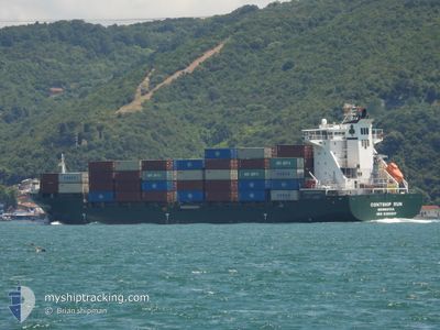
MSC ANZIO II
Container Ship
Current Trip
| Trip Time | 17 h, 45 mins |
|---|---|
| Trip Distance | 211.08 nm |
| AVG Speed | 12.2 Knop |
| MAX Speed | 15.8 Knop |
| Djupgående | 7.6 m |
| AVG Wind | 11.5 knots |
| MAX Wind | 20 knots |
| MIN Temp | 11.7°C / 53.06°F |
| MAX Temp | 16.1°C / 60.98°F |
| Position mottagen | 7 h, 1 m sen |
Current Position
| Longitud | --- |
|---|---|
| Latitude | --- |
| Status | Moored |
| Fart | |
| Kurs | 91° |
| Område | Aegean Sea |
| Station | T-AIS |
| Position mottagen | 7 h, 1 m sen |
Info
Information
The current position of MSC ANZIO II is in Aegean Sea with coordinates 38.76449° / 26.93274° as reported on 2025-12-08 14:19 by AIS to our vessel tracker app. The vessel's current speed is 0 Knop and is currently inside the port of NEMRUT.
The vessel MSC ANZIO II (IMO: 9306237, MMSI: 636019221) is a Container Ship that was built in 2007 ( 18 År gammal ). It's sailing under the flag of [LR] Liberia.
In this page you can find informations about the vessels current position, last detected port calls, and current voyage information. If the vessels is not in coverage by AIS you will find the latest position.
The current position of MSC ANZIO II is detected by our AIS receivers and we are not responsible for the reliability of the data. The last position was recorded while the vessel was in Coverage by the Ais receivers of our vessel tracking app.
The current draught of MSC ANZIO II as reported by AIS is 7.6 meters
Weather
| Temperature | 8.1°C / 46.58°F |
|---|---|
| Wind Speed | 11 knots |
| Direction | 37° NE |
| Pressure | 1020.1 hPa |
| Humidity | 77.7 % |
| Cloud Coverage | --- |
Featured Company
Last Port Calls
| Port | Arrival | Departure | Time In Port |
|---|---|---|---|
| 2025-12-08 16:49 | |||
| 2025-12-06 23:54 | 2025-12-07 22:04 | 22 h | |
| 2025-11-30 07:18 | 2025-11-30 21:16 | 13 h | |
| 2025-11-26 15:53 | 2025-11-27 23:37 | 1 d | |
| 2025-11-24 14:07 | 2025-11-24 14:11 | 3 m | |
| 2025-11-23 12:52 | 2025-11-24 14:04 | 1 d | |
| 2025-11-18 00:05 | 2025-11-19 19:48 | 1 d | |
| 2025-11-14 07:33 | 2025-11-15 13:00 | 1 d | |
| 2025-11-07 06:32 | 2025-11-07 19:41 | 13 h | |
| 2025-11-03 17:00 | 2025-11-04 19:28 | 1 d |
Last Trips
| Origin | Departure | Destination | Arrival | Distance | |
|---|---|---|---|---|---|
| 2025-12-07 22:04 | 2025-12-08 16:49 | 211.08 nm | |||
| 2025-11-30 21:16 | 2025-12-06 23:54 | 30.40 nm | |||
| 2025-11-27 23:37 | 2025-11-30 07:18 | 705.12 nm | |||
| 2025-11-24 14:11 | 2025-11-26 15:53 | 703.71 nm | |||
| 2025-11-24 14:04 | 2025-11-24 14:07 | 0.23 nm | |||
| 2025-11-19 19:48 | 2025-11-23 12:52 | 800.69 nm | |||
| 2025-11-15 13:00 | 2025-11-18 00:05 | 708.97 nm | |||
| 2025-11-07 19:41 | 2025-11-14 07:33 | 1040.37 nm | |||
| 2025-11-04 19:28 | 2025-11-07 06:32 | 377.43 nm | |||
| 2025-11-01 13:30 | 2025-11-03 17:00 | 702.15 nm |
Events
| Tid | Event | Detaljer | Position / Dest | Information |
|---|---|---|---|---|
| 2025-12-08 14:22 | Status ändrad | Default Moored |
38.76447 / 26.93272
[TR] NEMRUT
|
Fart: Kurs: 91° |
| 2025-12-08 14:19 | Status ändrad | Moored Default |
38.76449 / 26.93274
[TR] NEMRUT
|
Fart: Kurs: 90° |
| 2025-12-08 14:19 | UTANFÖR täckningsområde |
38.76449 / 26.93274
Aegean Sea
[TR] NEMRUT
|
Fart: Kurs: 82.9° |
|
| 2025-12-08 14:05 | Status ändrad | Default Under way using engine |
38.76442 / 26.93269
[TR] NEMRUT
|
Fart: 2.2 kn Kurs: 94° |
| 2025-12-08 14:05 | STOPPAR förflyttning |
38.76442 / 26.93269
[TR] NEMRUT
|
Fart: Kurs: 90° |
|
| 2025-12-08 13:53 | Status ändrad | Under way using engine Default |
38.76425 / 26.92972
[TR] NEMRUT
|
Fart: 3.6 kn Kurs: 110° |
| 2025-12-08 13:49 | ANLÄNDER HAMN |
|
38.76547 / 26.92592
[TR] NEMRUT
|
Fart: 6.9 kn Kurs: 122° |
| 2025-12-08 13:25 | Status ändrad | Default Under way using engine |
38.78542 / 26.87352
TRALI
|
Fart: 9.8 kn Kurs: 95.1° |
| 2025-12-08 13:20 | Status ändrad | Under way using engine Default |
38.78945 / 26.85831
TRALI
|
Fart: 9.9 kn Kurs: 98° |
| 2025-12-08 12:37 | Status ändrad | Default Under way using engine |
38.79852 / 26.74567
TRALI
|
Fart: 5.6 kn Kurs: 99.9° |