
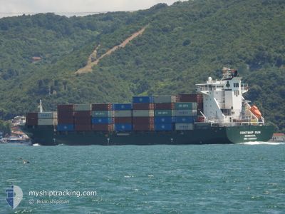
MSC ANZIO II
Container Ship
Current Trip
| Time Travelled | 2 days |
|---|---|
| Remaining Time | --- |
| Distance Travelled | 731.46 nm |
| Remaining Distance | --- |
| AVG Speed | 13.4 Knots |
| MAX Speed | 18.7 Knots |
| AVG Wind | 13.8 knots |
| MAX Wind | 30.5 knots |
| MIN Temp | 6.7°C / 44.06°F |
| MAX Temp | 17.2°C / 62.96°F |
| Draught | 9.6 m |
| Position Received | 1 d ago |
Current Position
| Longitude | --- |
|---|---|
| Latitude | --- |
| Status | Under way using engine |
| Speed | 13.2 Knots |
| Course | 248.1° |
| Area | Mediterranean Sea - Eastern Basin |
| Station | T-AIS |
| Position Received | 1 d ago |
Info
Information
The current position of MSC ANZIO II is in Mediterranean Sea - Eastern Basin with coordinates 36.33122° / 22.57514° as reported on 2025-12-09 22:54 by AIS to our vessel tracker app. The vessel's current speed is 13.2 Knots and is heading at the port of MALAGA. The estimated time of arrival as calculated by MyShipTracking vessel tracking app is 2025-12-14 07:00 LT
The vessel MSC ANZIO II (IMO: 9306237, MMSI: 636019221) is a Container Ship that was built in 2007 ( 18 years old ). It's sailing under the flag of [LR] Liberia.
In this page you can find informations about the vessels current position, last detected port calls, and current voyage information. If the vessels is not in coverage by AIS you will find the latest position.
The current position of MSC ANZIO II is detected by our AIS receivers and we are not responsible for the reliability of the data. The last position was recorded while the vessel was in Coverage by the Ais receivers of our vessel tracking app.
The current draught of MSC ANZIO II as reported by AIS is 9.6 meters
Weather
| Temperature | 15.7°C / 60.26°F |
|---|---|
| Wind Speed | 4 knots |
| Direction | 102° ESE |
| Pressure | 1023 hPa |
| Humidity | 75.9 % |
| Cloud Coverage | 1 % |
Featured Company
Last Port Calls
| Port | Arrival | Departure | Time In Port |
|---|---|---|---|
| 2025-12-08 16:49 | 2025-12-09 05:57 | 13 h | |
| 2025-12-06 23:54 | 2025-12-07 22:04 | 22 h | |
| 2025-11-30 07:18 | 2025-11-30 21:16 | 13 h | |
| 2025-11-26 15:53 | 2025-11-27 23:37 | 1 d | |
| 2025-11-24 14:07 | 2025-11-24 14:11 | 3 m | |
| 2025-11-23 12:52 | 2025-11-24 14:04 | 1 d | |
| 2025-11-18 00:05 | 2025-11-19 19:48 | 1 d | |
| 2025-11-14 07:33 | 2025-11-15 13:00 | 1 d | |
| 2025-11-07 06:32 | 2025-11-07 19:41 | 13 h | |
| 2025-11-03 17:00 | 2025-11-04 19:28 | 1 d |
Last Trips
| Origin | Departure | Destination | Arrival | Distance | |
|---|---|---|---|---|---|
| 2025-12-07 22:04 | 2025-12-08 16:49 | 211.08 nm | |||
| 2025-11-30 21:16 | 2025-12-06 23:54 | 30.40 nm | |||
| 2025-11-27 23:37 | 2025-11-30 07:18 | 705.12 nm | |||
| 2025-11-24 14:11 | 2025-11-26 15:53 | 703.71 nm | |||
| 2025-11-24 14:04 | 2025-11-24 14:07 | 0.23 nm | |||
| 2025-11-19 19:48 | 2025-11-23 12:52 | 800.69 nm | |||
| 2025-11-15 13:00 | 2025-11-18 00:05 | 708.97 nm | |||
| 2025-11-07 19:41 | 2025-11-14 07:33 | 1040.37 nm | |||
| 2025-11-04 19:28 | 2025-11-07 06:32 | 377.43 nm | |||
| 2025-11-01 13:30 | 2025-11-03 17:00 | 702.15 nm |
Events
| Time | Event | Details | Position / Dest | Info |
|---|---|---|---|---|
| 2025-12-09 23:01 | Status Changed | Default Under way using engine |
36.32124 / 22.54394
ESAGP
|
Speed: 13.2 kn Course: 248.1° |
| 2025-12-09 22:54 | OUT of Coverage |
36.33122 / 22.57514
Mediterranean Sea - Eastern Basin
ESAGP
|
Speed: 13.2 kn Course: 248.1° |
|
| 2025-12-09 20:49 | Change Sea Area | Greek part of the Mediterranean Sea - Eastern Basin Greek part of the Aegean Sea |
36.41795 / 23.10393
Mediterranean Sea - Eastern Basin
ESAGP
|
Speed: 12.9 kn Course: 282.8° |
| 2025-12-09 20:27 | Status Changed | Under way using engine Default |
36.41316 / 23.19796
ESAGP
|
Speed: 13.1 kn Course: 260° |
| 2025-12-09 20:13 | IN Coverage |
36.41269 / 23.19339
Aegean Sea
ESAGP
|
Speed: 13.1 kn Course: 262.5° |
|
| 2025-12-09 18:17 | Status Changed | Default Under way using engine |
36.80772 / 23.52994
ESAGP
|
Speed: 13 kn Course: 205.8° |
| 2025-12-09 18:09 | OUT of Coverage |
36.83392 / 23.54664
Aegean Sea
ESAGP
|
Speed: 13 kn Course: 205.8° |
|
| 2025-12-09 18:06 | Status Changed | Under way using engine Default |
36.84157 / 23.55127
ESAGP
|
Speed: 13 kn Course: 206° |
| 2025-12-09 17:49 | IN Coverage |
36.84157 / 23.55127
Aegean Sea
ESAGP
|
Speed: 13 kn Course: 206.9° |
|
| 2025-12-09 16:12 | OUT of Coverage |
37.25616 / 23.88464
Aegean Sea
ESAGP
|
Speed: 16.2 kn Course: 210.2° |