
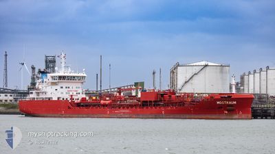
MOSTRAUM
Tanker
Current Trip
| Time Travelled | 1 day |
|---|---|
| Remaining Time | 4 h, 4 mins |
| Distance Travelled | 480.59 nm |
| Remaining Distance | 50.22 nm |
| AVG Speed | 12.3 Knop |
| MAX Speed | 14.9 Knop |
| AVG Wind | 9.4 knots |
| MAX Wind | 20 knots |
| MIN Temp | -2.1°C / 28.22°F |
| MAX Temp | 4.3°C / 39.74°F |
| Djupgående | 7.4 m |
| Position mottagen | 1 m sen |
Current Position
| Longitud | --- |
|---|---|
| Latitude | --- |
| Status | Under way using engine |
| Fart | 12.1 Knop |
| Kurs | 91.8° |
| Område | Skaggerak |
| Station | T-AIS |
| Position mottagen | 1 m sen |
Info
Information
The current position of MOSTRAUM is in Skaggerak with coordinates 57.81297° / 10.48435° as reported on 2025-02-17 00:27 by AIS to our vessel tracker app. The vessel's current speed is 12.1 Knop and is heading at the port of GOTEBORG. The estimated time of arrival as calculated by MyShipTracking vessel tracking app is 2025-02-17 04:32 LT
The vessel MOSTRAUM (IMO: 9829784, MMSI: 257071620) is a Tanker It's sailing under the flag of [NO] Norway.
In this page you can find informations about the vessels current position, last detected port calls, and current voyage information. If the vessels is not in coverage by AIS you will find the latest position.
The current position of MOSTRAUM is detected by our AIS receivers and we are not responsible for the reliability of the data. The last position was recorded while the vessel was in Coverage by the Ais receivers of our vessel tracking app.
The current draught of MOSTRAUM as reported by AIS is 7.4 meters
Weather
| Temperature | 1°C / 33.8°F |
|---|---|
| Wind Speed | 15 knots |
| Direction | 274° W |
| Pressure | 1025.4 hPa |
| Humidity | 51.1 % |
| Cloud Coverage | 2 % |
Featured Company
Last Port Calls
| Port | Arrival | Departure | Time In Port |
|---|---|---|---|
| 2025-02-13 12:23 | 2025-02-15 08:23 | 1 d | |
| 2025-02-10 00:13 | 2025-02-10 20:57 | 20 h | |
| 2025-02-06 18:54 | 2025-02-08 11:02 | 1 d | |
| 2025-01-30 14:35 | 2025-01-31 20:17 | 1 d | |
| 2025-01-29 05:53 | 2025-01-29 21:41 | 15 h | |
| 2025-01-25 17:59 | 2025-01-26 11:25 | 17 h | |
| 2025-01-22 05:32 | 2025-01-23 14:46 | 1 d | |
| 2025-01-14 20:33 | 2025-01-19 12:50 | 4 d | |
| 2025-01-04 15:58 | 2025-01-06 20:15 | 2 d | |
| 2024-12-26 18:42 | 2024-12-28 15:03 | 1 d |
Most Visited Ports (Last year)
| Port | Arrivals | |
|---|---|---|
| 11 | ||
| 8 | ||
| 7 | ||
| 6 | ||
| 5 | ||
| 5 |
Last Trips
| Origin | Departure | Destination | Arrival | Distance | |
|---|---|---|---|---|---|
| 2025-02-10 21:57 | 2025-02-13 13:23 | 216.25 nm | |||
| 2025-02-08 12:02 | 2025-02-10 01:13 | 118.68 nm | |||
| 2025-01-31 22:17 | 2025-02-06 19:54 | 1085.70 nm | |||
| 2025-01-29 23:41 | 2025-01-30 16:35 | 90.73 nm | |||
| 2025-01-26 12:25 | 2025-01-29 07:53 | 784.53 nm | |||
| 2025-01-23 15:46 | 2025-01-25 18:59 | 643.22 nm | |||
| 2025-01-19 13:50 | 2025-01-22 06:32 | 484.12 nm | |||
| 2025-01-06 21:15 | 2025-01-14 21:33 | 1312.94 nm | |||
| 2024-12-28 16:03 | 2025-01-04 16:58 | 1317.97 nm | |||
| 2024-12-24 07:34 | 2024-12-26 19:42 | 403.61 nm |
Events
| Tid | Event | Detaljer | Position / Dest | Information |
|---|---|---|---|---|
| 2025-02-16 22:51 | ETA ändrat | 2025/02/17 03:30 2025/02/17 01:00 |
57.79581 / 9.89731
SE GOT
|
Fart: 11.6 kn Kurs: 85.7° |
| 2025-02-16 17:50 | Byter havsområde | Danish part of the Skaggerak Danish part of the North Sea |
57.26702 / 8.35282
Skaggerak
SE GOT
|
Fart: 12.1 kn Kurs: 33.6° |
| 2025-02-16 14:13 | Upptäckt i hav | Danish part of the North Sea |
56.63329 / 7.55839
North Sea
SE GOT
|
Fart: 12.8 kn Kurs: 35.9° |
| 2025-02-16 14:12 | Status ändrad | Under way using engine Default |
56.62859 / 7.55232
SE GOT
|
Fart: 12.7 kn Kurs: 34° |
| 2025-02-16 14:05 | I täckningsområde |
56.63329 / 7.55839
North Sea
SE GOT
|
Fart: 12.8 kn Kurs: 35.9° |
|
| 2025-02-15 10:58 | Status ändrad | Default Under way using engine |
52.12168 / 3.57347
SE GOT
|
Fart: 12.1 kn Kurs: 300.9° |
| 2025-02-15 10:51 | UTANFÖR täckningsområde |
52.11070 / 3.60511
North Sea
SE GOT
|
Fart: 12.1 kn Kurs: 300.9° |
|
| 2025-02-15 08:23 | AVGÅTT HAMN |
|
51.89942 / 4.36298
SE GOT
|
Fart: 8.5 kn Kurs: 269° |
| 2025-02-15 08:20 | STARTAR förflyttning |
51.89682 / 4.36802
[NL] VONDELINGENPLAAT - ROTTERDAM
|
Fart: 4.6 kn Kurs: 351° |
|
| 2025-02-15 08:10 | Status ändrad | Under way using engine Moored |
51.89514 / 4.36624
[NL] VONDELINGENPLAAT - ROTTERDAM
|
Fart: Kurs: 15° |