

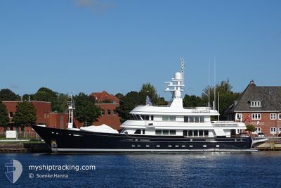
MOONSHADOW
Yacht

Current Trip
| Trip Time | 1 day |
|---|---|
| Trip Distance | 187.92 nm |
| AVG Speed | 10.2 Knop |
| MAX Speed | 13.7 Knop |
| Djupgående | 2.8 m |
| AVG Wind | 13.3 knots |
| MAX Wind | 16.8 knots |
| MIN Temp | 25°C / 77°F |
| MAX Temp | 27.1°C / 80.78°F |
| Position mottagen | 32 m sen |
Current Position
| Longitud | --- |
|---|---|
| Latitude | --- |
| Status | Moored |
| Fart | |
| Kurs | 82° |
| Område | Caribbean Sea |
| Station | T-AIS |
| Position mottagen | 32 m sen |
Information
The current position of MOONSHADOW is in Caribbean Sea with coordinates 17.00853° / -61.76384° as reported on 2025-03-08 00:53 by AIS to our vessel tracker app. The vessel's current speed is 0 Knop and is currently inside the port of ENGLISH HARBOUR.
The vessel MOONSHADOW (IMO: 1007419, MMSI: 319887000) is a Yacht that was built in 2003 ( 22 År gammal ). It's sailing under the flag of [KY] Cayman Is.
In this page you can find informations about the vessels current position, last detected port calls, and current voyage information. If the vessels is not in coverage by AIS you will find the latest position.
The current position of MOONSHADOW is detected by our AIS receivers and we are not responsible for the reliability of the data. The last position was recorded while the vessel was in Coverage by the Ais receivers of our vessel tracking app.
The current draught of MOONSHADOW as reported by AIS is 2.8 meters
Weather
| Temperature | 26°C / 78.8°F |
|---|---|
| Wind Speed | 10 knots |
| Direction | 86° E |
| Pressure | 1017 hPa |
| Humidity | 72.5 % |
| Cloud Coverage | 8 % |


Featured Company
Last Port Calls
| Port | Arrival | Departure | Time In Port |
|---|---|---|---|
| 2025-03-03 11:40 | |||
| 2025-03-01 19:27 | 2025-03-02 10:30 | 15 h | |
| 2025-02-22 18:33 | |||
| 2025-02-17 21:08 | 2025-02-18 11:20 | 14 h | |
| 2025-02-17 18:09 | |||
| 2025-02-15 18:37 | 2025-02-15 23:07 | 4 h | |
| 2025-02-11 21:02 | 2025-02-12 07:11 | 10 h | |
| 2025-02-06 19:33 | 2025-02-11 20:58 | 5 d | |
| 2025-01-24 11:58 | 2025-01-24 15:14 | 3 h | |
| 2025-01-22 08:31 |
Most Visited Ports (Last year)
| Port | Arrivals | |
|---|---|---|
| 9 | ||
| 4 | ||
| 3 | ||
| 2 | ||
| 2 | ||
| 2 |
Last Trips
| Origin | Departure | Destination | Arrival | Distance | |
|---|---|---|---|---|---|
| 2025-03-02 06:30 | 2025-03-03 07:40 | 187.92 nm | |||
| 2025-02-22 14:33 | 2025-03-01 15:27 | 93.28 nm | |||
| 2025-02-17 14:09 | 2025-02-17 17:08 | 17.20 nm | |||
| 2025-02-12 03:11 | 2025-02-15 14:37 | 104.66 nm | |||
| 2025-02-11 16:58 | 2025-02-11 17:02 | 0.25 nm | |||
| 2025-01-24 16:14 | 2025-02-06 15:33 | 3271.75 nm | |||
| 2025-01-22 09:31 | 2025-01-24 12:58 | 526.90 nm |
Events
| Tid | Event | Detaljer | Position / Dest | Information |
|---|---|---|---|---|
| 2025-03-08 00:53 | I täckningsområde |
17.00853 / -61.76384
Caribbean Sea
[AG] ENGLISH HARBOUR
|
Fart: Kurs: 184° |
|
| 2025-03-07 22:17 | UTANFÖR täckningsområde |
17.00853 / -61.76384
Caribbean Sea
[AG] ENGLISH HARBOUR
|
Fart: Kurs: 186° |
|
| 2025-03-07 20:35 | I täckningsområde |
17.00853 / -61.76383
Caribbean Sea
[AG] ENGLISH HARBOUR
|
Fart: Kurs: 170° |
|
| 2025-03-07 15:38 | UTANFÖR täckningsområde |
17.00852 / -61.76383
Caribbean Sea
[AG] ENGLISH HARBOUR
|
Fart: Kurs: 155° |
|
| 2025-03-07 13:53 | I täckningsområde |
17.00851 / -61.76381
Caribbean Sea
[AG] ENGLISH HARBOUR
|
Fart: Kurs: 179.5° |
|
| 2025-03-06 21:46 | UTANFÖR täckningsområde |
17.00855 / -61.76385
Caribbean Sea
[AG] ENGLISH HARBOUR
|
Fart: Kurs: 170.4° |
|
| 2025-03-06 20:34 | I täckningsområde |
17.00856 / -61.76383
Caribbean Sea
[AG] ENGLISH HARBOUR
|
Fart: Kurs: 177.4° |
|
| 2025-03-06 16:55 | UTANFÖR täckningsområde |
17.00852 / -61.76383
Caribbean Sea
[AG] ENGLISH HARBOUR
|
Fart: Kurs: 181.8° |
|
| 2025-03-06 15:22 | I täckningsområde |
17.00851 / -61.76382
Caribbean Sea
[AG] ENGLISH HARBOUR
|
Fart: Kurs: 186.1° |
|
| 2025-03-04 21:55 | UTANFÖR täckningsområde |
17.00856 / -61.76385
Caribbean Sea
[AG] ENGLISH HARBOUR
|
Fart: Kurs: 172.1° |