
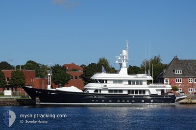
MOONSHADOW
Yacht
Current Trip
| Time Travelled | 3 days |
|---|---|
| Remaining Time | 1 h, 41 mins |
| Distance Travelled | 751.19 nm |
| Remaining Distance | 20.68 nm |
| AVG Speed | 10.4 Knopen |
| MAX Speed | 12.8 Knopen |
| AVG Wind | 5.7 knots |
| MAX Wind | 20.3 knots |
| MIN Temp | 16.6°C / 61.88°F |
| MAX Temp | 21.3°C / 70.34°F |
| Diepgang | 2.8 M |
| Positie ontvangen | 1 m geleden |
Current Position
| Lengtegraad | 6.94576° |
|---|---|
| Breedtegraat | 43.35854° |
| Status | Under way using engine |
| Snelheid | 10 Knopen |
| Koers | 38.3° |
| Gebied | Mediterranean Sea - Western Basin |
| Station | T-AIS |
| Positie ontvangen | 1 m geleden |
Info
Information
The current position of MOONSHADOW is in Mediterranean Sea - Western Basin with coordinates 43.35854° / 6.94576° as reported on 2024-05-15 09:38 by AIS to our vessel tracker app. The vessel's current speed is 10 Knopen and is heading at the port of ANTIBES. The estimated time of arrival as calculated by MyShipTracking vessel tracking app is 2024-05-15 11:20 LT
The vessel MOONSHADOW (IMO: 1007419, MMSI: 319887000) is a Yacht that was built in 2003 ( 21 Jaar oud ). It's sailing under the flag of [KY] Cayman Is.
In this page you can find informations about the vessels current position, last detected port calls, and current voyage information. If the vessels is not in coverage by AIS you will find the latest position.
The current position of MOONSHADOW is detected by our AIS receivers and we are not responsible for the reliability of the data. The last position was recorded while the vessel was in Coverage by the Ais receivers of our vessel tracking app.
The current draught of MOONSHADOW as reported by AIS is 2.8 meters
Weather
| Temperature | 16.8°C / 62.24°F |
|---|---|
| Wind Speed | 20 knots |
| Direction | 72° ENE |
| Pressure | 1006.3 hPa |
| Humidity | 83.9 % |
| Cloud Coverage | 100 % |
Featured Company
Last Port Calls
| Port | Arrival | Departure | Time In Port |
|---|---|---|---|
| 2024-05-12 05:20 | 2024-05-12 09:38 | 4 h | |
| 2024-04-28 14:25 | |||
| 2024-03-06 15:50 | 2024-04-25 17:07 | ||
| 2024-03-05 01:17 | 2024-03-05 13:18 | 12 h |
Last Trips
| Origin | Departure | Destination | Arrival | Distance | |
|---|---|---|---|---|---|
| 2024-04-28 10:25 | 2024-05-12 07:20 | 3209.42 nm | |||
| 2024-03-05 09:18 | 2024-03-06 11:50 | 194.92 nm | |||
| 2024-02-23 07:41 | 2024-03-04 21:17 | 246.67 nm |
Events
| Tijd | Evenement | Details | Positie / Bestemming | Info |
|---|---|---|---|---|
| 2024-05-15 08:14 | Gevonden in zee | French part of the Mediterranean Sea - Western Basin |
43.19100 / 6.75330
Mediterranean Sea - Western Basin
ANTIBES
|
Snelheid: 8.8 kn Koers: 37.9° |
| 2024-05-15 08:14 | Binnenbereik |
43.19100 / 6.75330
Mediterranean Sea - Western Basin
ANTIBES
|
Snelheid: 8.8 kn Koers: 37.9° |
|
| 2024-05-15 08:09 | ETA Changed | 2024/05/15 15:00 2024/05/15 16:00 |
39.31012 / 1.35455
ANTIBES
|
Snelheid: 11 kn Koers: 47.9° |
| 2024-05-13 22:29 | Buitenbereik |
39.31012 / 1.35455
Balearic Sea
ANTIBES
|
Snelheid: 11 kn Koers: 47.9° |
|
| 2024-05-13 19:37 | Binnenbereik |
38.94264 / .83016
Balearic Sea
ANTIBES
|
Snelheid: 11.3 kn Koers: 46.3° |
|
| 2024-05-13 18:01 | Buitenbereik |
38.73234 / .53152
Balearic Sea
ANTIBES
|
Snelheid: 12.1 kn Koers: 47.8° |
|
| 2024-05-13 18:01 | Gevonden in zee | Spanish part of the Balearic Sea |
38.73234 / .53152
Balearic Sea
ANTIBES
|
Snelheid: 12.1 kn Koers: 47.8° |
| 2024-05-13 18:01 | Binnenbereik |
38.73234 / .53152
Balearic Sea
ANTIBES
|
Snelheid: 12.1 kn Koers: 47.8° |
|
| 2024-05-13 15:14 | Draught Changed | 2.8 2 |
38.30484 / .13623
ANTIBES
|
Snelheid: 9.9 kn Koers: 32° |
| 2024-05-13 15:14 | Buitenbereik |
38.30484 / .13623
Mediterranean Sea - Western Basin
ANTIBES
|
Snelheid: 9.9 kn Koers: 32° |