
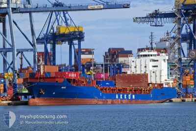
MAX
General Cargo
Current Trip
DZAAE
| Time Travelled | 2 days |
|---|---|
| Remaining Time | --- |
| Distance Travelled | 590.17 nm |
| Remaining Distance | --- |
| AVG Speed | 14.3 Knop |
| MAX Speed | 15.9 Knop |
| AVG Wind | 16.9 knots |
| MAX Wind | 26 knots |
| MIN Temp | 13.4°C / 56.12°F |
| MAX Temp | 15.6°C / 60.08°F |
| Djupgående | 7.6 m |
| Position mottagen | 22 h, 51 m sen |
Current Position
| Longitud | --- |
|---|---|
| Latitude | --- |
| Status | Under way using engine |
| Fart | 15.2 Knop |
| Kurs | 102.8° |
| Område | Mediterranean Sea - Eastern Basin |
| Station | T-AIS |
| Position mottagen | 22 h, 51 m sen |
Info
Information
The current position of MAX is in Mediterranean Sea - Eastern Basin with coordinates 36.62216° / 14.57541° as reported on 2025-03-16 19:45 by AIS to our vessel tracker app. The vessel's current speed is 15.2 Knop
The vessel MAX (IMO: 9351098, MMSI: 636020515) is a General Cargo that was built in 2006 ( 19 År gammal ). It's sailing under the flag of [LR] Liberia.
In this page you can find informations about the vessels current position, last detected port calls, and current voyage information. If the vessels is not in coverage by AIS you will find the latest position.
The current position of MAX is detected by our AIS receivers and we are not responsible for the reliability of the data. The last position was recorded while the vessel was in Coverage by the Ais receivers of our vessel tracking app.
The current draught of MAX as reported by AIS is 7.6 meters
Weather
| Temperature | 15.1°C / 59.18°F |
|---|---|
| Wind Speed | 21 knots |
| Direction | 322° NW |
| Pressure | 1016.7 hPa |
| Humidity | 60.9 % |
| Cloud Coverage | 2 % |
Featured Company
Last Port Calls
| Port | Arrival | Departure | Time In Port |
|---|---|---|---|
| 2025-03-11 00:29 | 2025-03-15 04:59 | 4 d | |
| 2025-03-08 03:14 | 2025-03-10 05:12 | 2 d | |
| 2025-02-24 10:40 | 2025-02-25 10:50 | 1 d | |
| 2025-02-23 16:14 | 2025-02-24 02:14 | 9 h | |
| 2025-02-19 06:30 | |||
| 2025-02-06 20:52 | 2025-02-07 13:27 | 16 h | |
| 2025-02-05 10:40 | 2025-02-06 08:24 | 21 h | |
| 2025-01-29 22:48 | 2025-02-02 19:28 | 3 d | |
| 2025-01-22 08:33 | 2025-01-22 19:57 | 11 h | |
| 2025-01-21 00:23 | 2025-01-21 11:29 | 11 h |
Last Trips
| Origin | Departure | Destination | Arrival | Distance | |
|---|---|---|---|---|---|
| 2025-03-10 05:12 | 2025-03-11 00:29 | 244.15 nm | |||
| 2025-02-25 10:50 | 2025-03-08 03:14 | 1193.38 nm | |||
| 2025-02-24 02:14 | 2025-02-24 10:40 | 46.77 nm | |||
| 2025-02-19 06:30 | 2025-02-23 16:14 | 1380.07 nm | |||
| 2025-02-06 08:24 | 2025-02-06 20:52 | 61.38 nm | |||
| 2025-02-02 19:28 | 2025-02-05 10:40 | 707.28 nm | |||
| 2025-01-22 19:57 | 2025-01-29 22:48 | 550.60 nm | |||
| 2025-01-21 11:29 | 2025-01-22 08:33 | 269.31 nm | |||
| 2025-01-20 13:36 | 2025-01-21 00:23 | 63.70 nm | |||
| 2025-01-14 00:57 | 2025-01-19 17:01 | 1390.81 nm |
Events
| Tid | Event | Detaljer | Position / Dest | Information |
|---|---|---|---|---|
| 2025-03-16 20:01 | Status ändrad | Default Under way using engine |
36.60925 / 14.65741
DZAAE
|
Fart: 15.2 kn Kurs: 102.8° |
| 2025-03-16 19:45 | UTANFÖR täckningsområde |
36.62216 / 14.57541
Mediterranean Sea - Eastern Basin
|
Fart: 15.2 kn Kurs: 102.8° |
|
| 2025-03-16 18:59 | Upptäckt i hav | Italian part of the Mediterranean Sea - Eastern Basin |
36.65699 / 14.34445
Mediterranean Sea - Eastern Basin
|
Fart: 14.4 kn Kurs: 101° |
| 2025-03-16 18:59 | Status ändrad | Under way using engine Default |
36.65699 / 14.34445
DZAAE
|
Fart: 14.3 kn Kurs: 99° |
| 2025-03-16 18:59 | I täckningsområde |
36.65699 / 14.34445
Mediterranean Sea - Eastern Basin
|
Fart: 14.4 kn Kurs: 101° |
|
| 2025-03-15 04:08 | STARTAR förflyttning | 1.44 nm, South East of ALGER |
36.76100 / 3.09881
DZAAE
|
Fart: 12.6 kn Kurs: 74° |
| 2025-03-15 03:59 | AVGÅTT HAMN |
|
36.76100 / 3.09881
DZAAE
|
Fart: 2.8 kn Kurs: 282° |
| 2025-03-10 23:57 | STOPPAR förflyttning |
36.76700 / 3.06142
[DZ] ALGER
|
Fart: 0.2 kn Kurs: 280° |
|
| 2025-03-10 23:29 | ANLÄNDER HAMN |
|
36.76196 / 3.07919
[DZ] ALGER
|
Fart: 4 kn Kurs: 251° |
| 2025-03-10 04:12 | AVGÅTT HAMN |
|
36.92125 / 7.81607
DZAAE
|
Fart: 3.1 kn Kurs: 118° |