
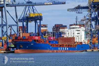
MAX
General Cargo
Current Trip
| Trip Time | 14 h, 44 mins |
|---|---|
| Trip Distance | 85.68 nm |
| AVG Speed | 8.5 Knots |
| MAX Speed | 13.7 Knots |
| Dybgang | 6.9 m |
| AVG Wind | 9.1 knots |
| MAX Wind | 13 knots |
| MIN Temp | 11.8°C / 53.24°F |
| MAX Temp | 15.1°C / 59.18°F |
| Position Modtaget | 1 m siden |
Current Position
| Longitude | --- |
|---|---|
| Latitude | --- |
| Status | Moored |
| Fart | |
| Kurs | 263° |
| Område | Sea of Marmara |
| Station | T-AIS |
| Position Modtaget | 1 m siden |
Info
Information
The current position of MAX is in Sea of Marmara with coordinates 40.74763° / 29.83775° as reported on 2026-01-07 10:23 by AIS to our vessel tracker app. The vessel's current speed is 0 Knots and is currently inside the port of DERINCE.
The vessel MAX (IMO: 9351098, MMSI: 636020515) is a General Cargo that was built in 2006 ( 20 år gamle ). It's sailing under the flag of [LR] Liberia.
In this page you can find informations about the vessels current position, last detected port calls, and current voyage information. If the vessels is not in coverage by AIS you will find the latest position.
The current position of MAX is detected by our AIS receivers and we are not responsible for the reliability of the data. The last position was recorded while the vessel was in Coverage by the Ais receivers of our vessel tracking app.
The current draught of MAX as reported by AIS is 6.9 meters
Weather
| Temperature | 14.5°C / 58.1°F |
|---|---|
| Wind Speed | 6 knots |
| Direction | 184° S |
| Pressure | 1013.6 hPa |
| Humidity | 65.9 % |
| Cloud Coverage | 81 % |
Featured Company
Last Port Calls
| Port | Arrival | Departure | Time In Port |
|---|---|---|---|
| 2026-01-07 11:49 | |||
| 2026-01-06 05:30 | 2026-01-06 21:05 | 15 h | |
| 2025-12-27 23:28 | 2025-12-30 16:12 | 2 d | |
| 2025-12-24 10:46 | 2025-12-25 18:16 | 1 d | |
| 2025-12-20 09:37 | 2025-12-20 15:46 | 6 h | |
| 2025-12-19 03:46 | 2025-12-19 11:21 | 7 h | |
| 2025-12-18 01:56 | 2025-12-18 21:28 | 19 h | |
| 2025-12-17 03:31 | 2025-12-17 19:59 | 16 h | |
| 2025-12-10 00:05 | 2025-12-12 16:33 | 2 d | |
| 2025-12-07 10:25 | 2025-12-08 22:52 | 1 d |
Last Trips
| Origin | Departure | Destination | Arrival | Distance | |
|---|---|---|---|---|---|
| 2026-01-06 21:05 | 2026-01-07 11:49 | 85.68 nm | |||
| 2025-12-30 16:12 | 2026-01-06 05:30 | 1534.36 nm | |||
| 2025-12-25 18:16 | 2025-12-27 23:28 | 255.62 nm | |||
| 2025-12-20 15:46 | 2025-12-24 10:46 | 1010.11 nm | |||
| 2025-12-19 11:21 | 2025-12-20 09:37 | 280.37 nm | |||
| 2025-12-18 21:28 | 2025-12-19 03:46 | 71.01 nm | |||
| 2025-12-17 19:59 | 2025-12-18 01:56 | 61.43 nm | |||
| 2025-12-12 16:33 | 2025-12-17 03:31 | 1396.55 nm | |||
| 2025-12-08 22:52 | 2025-12-10 00:05 | 247.87 nm | |||
| 2025-12-03 08:29 | 2025-12-07 10:25 | 1213.36 nm |
Events
| Tid | Hændelsen | Detaljer | Position / Dest | Info |
|---|---|---|---|---|
| 2026-01-07 08:59 | Status er ændret | Moored Under way using engine |
40.74752 / 29.83775
[TR] DERINCE
|
Fart: 0.3 kn Kurs: 270° |
| 2026-01-07 08:58 | STOP Sejllads |
40.74737 / 29.83774
[TR] DERINCE
|
Fart: 0.2 kn Kurs: 273° |
|
| 2026-01-07 08:49 | Skibe i havn |
|
40.74507 / 29.83961
[TR] DERINCE
|
Fart: 1.2 kn Kurs: 332° |
| 2026-01-07 06:04 | START Sejllads | 3.31 nm, North West of YALOVA |
40.69810 / 29.22025
TRDRC
|
Fart: 3.1 kn Kurs: 312° |
| 2026-01-07 05:50 | STOP Sejllads | 3.16 nm, North West of YALOVA |
40.69681 / 29.22292
TRDRC
|
Fart: 0.3 kn Kurs: 137° |
| 2026-01-07 04:56 | START Sejllads | 5.98 nm, South West of TUZLA |
40.78699 / 29.14980
TRDRC
|
Fart: 3.3 kn Kurs: 165° |
| 2026-01-06 22:30 | STOP Sejllads | 4.23 nm, North West of YALOVA |
40.69188 / 29.19129
TRDRC
|
Fart: 0.2 kn Kurs: 128° |
| 2026-01-06 18:52 | Status er ændret | Under way using engine Default |
40.44978 / 28.87942
TRDRC
|
Fart: 11.5 kn Kurs: 285° |
| 2026-01-06 18:49 | Status er ændret | Default Under way using engine |
40.44618 / 28.89163
TRDRC
|
Fart: 11.9 kn Kurs: 280.9° |
| 2026-01-06 18:05 | Afsejlet fra sidste havn |
|
40.41778 / 29.07363
TRDRC
|
Fart: 5.5 kn Kurs: 280° |