
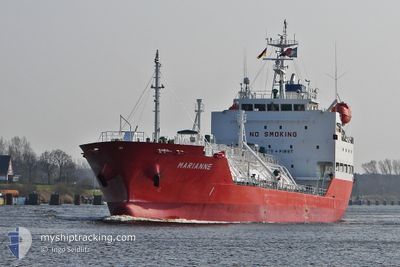
MARIANNE
Lpg Tanker
Current Trip
| Time Travelled | 1 day |
|---|---|
| Remaining Time | --- |
| Distance Travelled | 387.49 nm |
| Remaining Distance | 6.64 nm |
| AVG Speed | 10.8 Knop |
| MAX Speed | 14.2 Knop |
| AVG Wind | 14.6 knots |
| MAX Wind | 24 knots |
| MIN Temp | 7°C / 44.6°F |
| MAX Temp | 13.7°C / 56.66°F |
| Djupgående | 5.5 m |
| Position mottagen | 2 m sen |
Current Position
| Longitud | -8.76643° |
|---|---|
| Latitude | 41.15225° |
| Status | At anchor |
| Fart | |
| Kurs | 353° |
| Område | North Atlantic Ocean |
| Station | T-AIS |
| Position mottagen | 2 m sen |
Info
Information
The current position of MARIANNE is in North Atlantic Ocean with coordinates 41.15225° / -8.76643° as reported on 2024-04-25 06:05 by AIS to our vessel tracker app. The vessel's current speed is 0 Knop and is heading at the port of LEIXOES. The estimated time of arrival as calculated by MyShipTracking vessel tracking app is 2024-04-25 05:30 LT
The vessel MARIANNE (IMO: 9474539, MMSI: 205769000) is a Lpg Tanker that was built in 2009 ( 15 År gammal ). It's sailing under the flag of [BE] Belgium.
In this page you can find informations about the vessels current position, last detected port calls, and current voyage information. If the vessels is not in coverage by AIS you will find the latest position.
The current position of MARIANNE is detected by our AIS receivers and we are not responsible for the reliability of the data. The last position was recorded while the vessel was in Coverage by the Ais receivers of our vessel tracking app.
The current draught of MARIANNE as reported by AIS is 5.5 meters
Weather
| Temperature | 12.3°C / 54.14°F |
|---|---|
| Wind Speed | 17 knots |
| Direction | 348° NNW |
| Pressure | 1014.3 hPa |
| Humidity | 80.2 % |
| Cloud Coverage | 99 % |
Featured Company
Last Port Calls
| Port | Arrival | Departure | Time In Port |
|---|---|---|---|
| 2024-04-23 04:24 | 2024-04-23 22:36 | 18 h | |
| 2024-04-17 20:37 | 2024-04-19 07:39 | 1 d | |
| 2024-04-14 23:15 | 2024-04-16 14:34 | 1 d | |
| 2024-04-13 08:39 | 2024-04-14 20:57 | 1 d | |
| 2024-04-08 07:27 | 2024-04-09 07:41 | 1 d | |
| 2024-03-27 23:23 | 2024-04-01 08:16 | 4 d | |
| 2024-03-20 11:23 | 2024-03-21 20:54 | 1 d | |
| 2024-03-16 14:08 | 2024-03-17 11:19 | 21 h | |
| 2024-03-13 13:33 | 2024-03-14 12:49 | 23 h | |
| 2024-03-10 16:09 | 2024-03-11 15:04 | 22 h |
Last Trips
| Origin | Departure | Destination | Arrival | Distance | |
|---|---|---|---|---|---|
| 2024-04-19 09:39 | 2024-04-23 06:24 | 1017.19 nm | |||
| 2024-04-16 16:34 | 2024-04-17 22:37 | 334.08 nm | |||
| 2024-04-14 22:57 | 2024-04-15 01:15 | 31.57 nm | |||
| 2024-04-09 08:41 | 2024-04-13 10:39 | 1155.56 nm | |||
| 2024-04-01 10:16 | 2024-04-08 08:27 | 1236.16 nm | |||
| 2024-03-21 21:54 | 2024-03-28 00:23 | 130.92 nm | |||
| 2024-03-17 12:19 | 2024-03-20 12:23 | 652.98 nm | |||
| 2024-03-14 13:49 | 2024-03-16 15:08 | 620.36 nm | |||
| 2024-03-11 16:04 | 2024-03-13 14:33 | 552.87 nm | |||
| 2024-03-05 11:11 | 2024-03-10 17:09 | 1384.03 nm |
Events
| Tid | Event | Detaljer | Position / Dest | Information |
|---|---|---|---|---|
| 2024-04-25 05:14 | STOPPAR förflyttning | 3.32 nm, South West of LEIXOES |
41.15232 / -8.76641
ESGIJ>PTLEI
|
Fart: Kurs: 357° |
| 2024-04-25 05:02 | Status ändrad | At anchor Under way using engine |
41.15335 / -8.76646
ESGIJ>PTLEI
|
Fart: 1 kn Kurs: 10° |
| 2024-04-25 02:49 | ETA ändrat | 2024/04/25 05:30 2024/04/25 06:00 |
41.37535 / -9.13280
ESGIJ>PTLEI
|
Fart: 12.3 kn Kurs: 125.8° |
| 2024-04-25 02:37 | Byter havsområde | Portuguese part of the North Atlantic Ocean Spanish part of the North Atlantic Ocean |
41.39699 / -9.17013
North Atlantic Ocean
ESGIJ>PTLEI
|
Fart: 12.2 kn Kurs: 127.9° |
| 2024-04-25 02:36 | Status ändrad | Under way using engine Default |
41.39905 / -9.17364
ESGIJ>PTLEI
|
Fart: 11.9 kn Kurs: 128° |
| 2024-04-25 02:33 | I täckningsområde |
41.39699 / -9.17013
North Atlantic Ocean
ESGIJ>PTLEI
|
Fart: 12.2 kn Kurs: 127.9° |
|
| 2024-04-24 13:09 | UTANFÖR täckningsområde |
43.89011 / -9.69896
North Atlantic Ocean
ESGIJ>PTLEI
|
Fart: 12.6 kn Kurs: 254° |
|
| 2024-04-24 13:09 | Upptäckt i hav | Spanish part of the North Atlantic Ocean |
43.89011 / -9.69896
North Atlantic Ocean
ESGIJ>PTLEI
|
Fart: 12.6 kn Kurs: 254° |
| 2024-04-24 13:09 | Status ändrad | Under way using engine Default |
43.89011 / -9.69896
ESGIJ>PTLEI
|
Fart: 12.7 kn Kurs: 254° |
| 2024-04-24 13:09 | I täckningsområde |
43.89011 / -9.69896
North Atlantic Ocean
ESGIJ>PTLEI
|
Fart: 12.6 kn Kurs: 254° |