
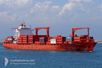
MARGARETE SCHULTE
Container Ship
Current Trip
| Trip Time | 3 days |
|---|---|
| Trip Distance | 822.06 nm |
| AVG Speed | 11.3 Knop |
| MAX Speed | 12.7 Knop |
| Djupgående | 9.5 m |
| AVG Wind | 12.5 knots |
| MAX Wind | 31.8 knots |
| MIN Temp | 26.2°C / 79.16°F |
| MAX Temp | 29.8°C / 85.64°F |
| Position mottagen | 3 d sen |
Current Position
| Longitud | -87.12031° |
|---|---|
| Latitude | 16.18481° |
| Status | Under way using engine |
| Fart | 11 Knop |
| Kurs | 82° |
| Område | Caribbean Sea |
| Station | T-AIS |
| Position mottagen | 3 d sen |
Info
Information
The current position of MARGARETE SCHULTE is in Caribbean Sea with coordinates 16.18481° / -87.12031° as reported on 2024-05-13 21:16 by AIS to our vessel tracker app. The vessel's current speed is 11 Knop and is currently inside the port of MANZANILLO.
The vessel MARGARETE SCHULTE (IMO: 9302944, MMSI: 249837000) is a Container Ship that was built in 2006 ( 18 År gammal ). It's sailing under the flag of [MT] Malta.
In this page you can find informations about the vessels current position, last detected port calls, and current voyage information. If the vessels is not in coverage by AIS you will find the latest position.
The current position of MARGARETE SCHULTE is detected by our AIS receivers and we are not responsible for the reliability of the data. The last position was recorded while the vessel was in Coverage by the Ais receivers of our vessel tracking app.
The current draught of MARGARETE SCHULTE as reported by AIS is 9.5 meters
Weather
| Temperature | 25.6°C / 78.08°F |
|---|---|
| Wind Speed | 3 knots |
| Direction | 126° SE |
| Pressure | 1009.8 hPa |
| Humidity | 92.1 % |
| Cloud Coverage | 100 % |
Featured Company
Last Port Calls
| Port | Arrival | Departure | Time In Port |
|---|---|---|---|
| 2024-05-16 08:09 | |||
| 2024-05-12 07:22 | 2024-05-13 06:18 | 22 h | |
| 2024-05-06 13:21 | 2024-05-07 01:03 | 11 h | |
| 2024-04-17 05:23 | 2024-04-18 13:11 | 1 d | |
| 2024-04-14 10:07 | 2024-04-16 03:37 | 1 d | |
| 2024-04-12 05:29 | 2024-04-13 12:06 | 1 d | |
| 2024-03-28 16:59 | 2024-03-29 22:21 | 1 d | |
| 2024-03-26 07:31 | 2024-03-26 16:51 | 9 h | |
| 2024-03-22 14:36 | 2024-03-23 05:45 | 15 h | |
| 2024-03-04 05:38 | 2024-03-04 22:30 | 16 h |
Most Visited Ports (Last year)
| Port | Arrivals | |
|---|---|---|
| 9 | ||
| 7 | ||
| 7 | ||
| 7 | ||
| 7 | ||
| 7 |
Last Trips
| Origin | Departure | Destination | Arrival | Distance | |
|---|---|---|---|---|---|
| 2024-05-13 06:18 | 2024-05-16 08:09 | 822.06 nm | |||
| 2024-05-07 01:03 | 2024-05-12 07:22 | 1171.62 nm | |||
| 2024-04-18 13:11 | 2024-05-06 13:21 | 5718.75 nm | |||
| 2024-04-16 03:37 | 2024-04-17 05:23 | 396.94 nm | |||
| 2024-04-13 12:06 | 2024-04-14 10:07 | 266.70 nm | |||
| 2024-03-29 22:21 | 2024-04-12 05:29 | 4919.35 nm | |||
| 2024-03-26 16:51 | 2024-03-28 16:59 | 822.45 nm | |||
| 2024-03-23 05:45 | 2024-03-26 07:31 | 1135.65 nm | |||
| 2024-03-04 22:30 | 2024-03-22 14:36 | 5841.38 nm | |||
| 2024-03-03 07:34 | 2024-03-04 05:38 | 367.00 nm |
Events
| Tid | Event | Detaljer | Position / Dest | Information |
|---|---|---|---|---|
| 2024-05-16 13:09 | STOPPAR förflyttning |
9.36196 / -79.88515
[PA] MANZANILLO
|
Fart: Kurs: 337° |
|
| 2024-05-16 13:09 | ANLÄNDER HAMN |
|
9.36196 / -79.88515
[PA] MANZANILLO
|
Fart: 1.5 kn Kurs: 332° |
| 2024-05-16 12:27 | STARTAR förflyttning | 2.58 nm, North of COLON |
9.41356 / -79.90175
BZBGK
|
Fart: 7.3 kn Kurs: 169° |
| 2024-05-16 12:11 | STOPPAR förflyttning | 3.01 nm, North of COLON |
9.42099 / -79.90144
BZBGK
|
Fart: 0.3 kn Kurs: 214° |
| 2024-05-16 11:34 | STARTAR förflyttning | 4.07 nm, North of COLON |
9.43963 / -79.89654
BZBGK
|
Fart: 3.7 kn Kurs: 190° |
| 2024-05-16 11:19 | STOPPAR förflyttning | 4.39 nm, North of COLON |
9.44506 / -79.89605
BZBGK
|
Fart: 0.3 kn Kurs: 186° |
| 2024-05-16 10:38 | STARTAR förflyttning | 6.46 nm, North West of SAMBA BONITA |
9.48336 / -79.89266
BZBGK
|
Fart: 4.8 kn Kurs: 190° |
| 2024-05-16 10:06 | STOPPAR förflyttning | 6.8 nm, North West of SAMBA BONITA |
9.48999 / -79.89262
BZBGK
|
Fart: 0.2 kn Kurs: 190° |
| 2024-05-13 21:22 | Status ändrad | Default Under way using engine |
16.18800 / -87.09772
BZBGK
|
Fart: 11 kn Kurs: 82° |
| 2024-05-13 21:16 | UTANFÖR täckningsområde |
16.18481 / -87.12031
Caribbean Sea
|
Fart: 11 kn Kurs: 82° |