
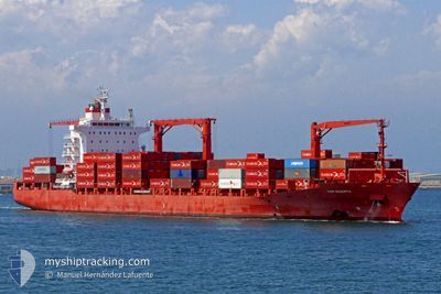
MARGARETE SCHULTE
Container Ship
Current Trip
| Time Travelled | 1 day |
|---|---|
| Remaining Time | --- |
| Distance Travelled | 412.98 nm |
| Remaining Distance | --- |
| AVG Speed | 16.8 Knopen |
| MAX Speed | 18.1 Knopen |
| AVG Wind | 11.2 knots |
| MAX Wind | 14.6 knots |
| MIN Temp | 22.1°C / 71.78°F |
| MAX Temp | 24.7°C / 76.46°F |
| Diepgang | 9.1 M |
| Positie ontvangen | 23 h, 58 m geleden |
Current Position
| Lengtegraad | --- |
|---|---|
| Breedtegraat | --- |
| Status | Under way using engine |
| Snelheid | 17.2 Knopen |
| Koers | 93.6° |
| Gebied | Gulf of Mexico |
| Station | T-AIS |
| Positie ontvangen | 23 h, 58 m geleden |
Info
Information
The current position of MARGARETE SCHULTE is in Gulf of Mexico with coordinates 22.47499° / -97.65589° as reported on 2024-11-21 15:16 by AIS to our vessel tracker app. The vessel's current speed is 17.2 Knopen and is heading at the port of BIG CREEK. The estimated time of arrival as calculated by MyShipTracking vessel tracking app is 2024-11-24 12:00 LT
The vessel MARGARETE SCHULTE (IMO: 9302944, MMSI: 249837000) is a Container Ship that was built in 2006 ( 18 Jaar oud ). It's sailing under the flag of [MT] Malta.
In this page you can find informations about the vessels current position, last detected port calls, and current voyage information. If the vessels is not in coverage by AIS you will find the latest position.
The current position of MARGARETE SCHULTE is detected by our AIS receivers and we are not responsible for the reliability of the data. The last position was recorded while the vessel was in Coverage by the Ais receivers of our vessel tracking app.
The current draught of MARGARETE SCHULTE as reported by AIS is 9.1 meters
Weather
| Temperature | 23.1°C / 73.58°F |
|---|---|
| Wind Speed | 13 knots |
| Direction | 6° N |
| Pressure | 1021 hPa |
| Humidity | 57.1 % |
| Cloud Coverage | 3 % |
Featured Company
Last Port Calls
| Port | Arrival | Departure | Time In Port |
|---|---|---|---|
| 2024-11-19 19:11 | 2024-11-21 14:31 | 1 d | |
| 2024-10-30 03:06 | 2024-10-31 12:54 | 1 d | |
| 2024-10-27 17:11 | 2024-10-28 20:02 | 1 d | |
| 2024-10-25 03:39 | 2024-10-25 23:33 | 19 h | |
| 2024-10-10 14:04 | 2024-10-11 19:16 | 1 d | |
| 2024-10-06 14:06 | 2024-10-07 13:11 | 23 h | |
| 2024-10-01 23:18 | 2024-10-02 17:25 | 18 h | |
| 2024-09-11 06:00 | 2024-09-12 10:27 | 1 d | |
| 2024-09-08 13:07 | 2024-09-09 20:47 | 1 d | |
| 2024-09-06 03:29 | 2024-09-07 07:20 | 1 d |
Most Visited Ports (Last year)
| Port | Arrivals | |
|---|---|---|
| 7 | ||
| 7 | ||
| 7 | ||
| 7 | ||
| 6 | ||
| 6 |
Last Trips
| Origin | Departure | Destination | Arrival | Distance | |
|---|---|---|---|---|---|
| 2024-10-31 13:54 | 2024-11-19 13:11 | 5952.41 nm | |||
| 2024-10-28 21:02 | 2024-10-30 04:06 | 370.06 nm | |||
| 2024-10-26 00:33 | 2024-10-27 18:11 | 268.70 nm | |||
| 2024-10-11 14:16 | 2024-10-25 04:39 | 4940.00 nm | |||
| 2024-10-07 07:11 | 2024-10-10 09:04 | 838.89 nm | |||
| 2024-10-02 12:25 | 2024-10-06 08:06 | 1133.76 nm | |||
| 2024-09-12 12:27 | 2024-10-01 18:18 | 5877.19 nm | |||
| 2024-09-09 22:47 | 2024-09-11 08:00 | 382.76 nm | |||
| 2024-09-07 08:20 | 2024-09-08 15:07 | 279.54 nm | |||
| 2024-08-23 10:20 | 2024-09-06 04:29 | 4917.65 nm |
Events
| Tijd | Evenement | Details | Positie / Bestemming | Info |
|---|---|---|---|---|
| 2024-11-21 15:23 | Status Changed | Default Under way using engine |
22.47371 / -97.62162
BZBGK
|
Snelheid: 17.2 kn Koers: 93.6° |
| 2024-11-21 15:16 | Buitenbereik |
22.47499 / -97.65589
Gulf of Mexico
BZBGK
|
Snelheid: 17.2 kn Koers: 93.6° |
|
| 2024-11-21 14:31 | Vertrekhaven |
|
22.48744 / -97.85671
BZBGK
|
Snelheid: 8.6 kn Koers: 90° |
| 2024-11-21 14:12 | Start beweging |
22.48053 / -97.88656
[MX] ALTAMIRA
|
Snelheid: 3.8 kn Koers: 350° |
|
| 2024-11-21 14:07 | Status Changed | Under way using engine Moored |
22.47844 / -97.88559
[MX] ALTAMIRA
|
Snelheid: Koers: 348° |
| 2024-11-20 23:19 | Status Changed | Moored Default |
22.47843 / -97.88563
[MX] ALTAMIRA
|
Snelheid: Koers: 348° |
| 2024-11-20 23:16 | Status Changed | Default Moored |
22.47841 / -97.88563
[MX] ALTAMIRA
|
Snelheid: Koers: 348° |
| 2024-11-20 22:21 | Draught Changed | 9.1 9.7 |
22.47842 / -97.88557
[MX] ALTAMIRA
|
Snelheid: Koers: 348° |
| 2024-11-20 07:46 | Destination Changed | BZBGK MXATM |
22.47854 / -97.88564
[MX] ALTAMIRA
|
Snelheid: Koers: 348° |
| 2024-11-20 07:46 | ETA Changed | 2024/11/24 12:00 2024/11/19 16:00 |
22.47854 / -97.88564
[MX] ALTAMIRA
|
Snelheid: Koers: 348° |