
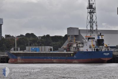
MARATONA
General Cargo
Current Trip
| Trip Time | 4 days |
|---|---|
| Trip Distance | 474.54 nm |
| AVG Speed | 8.4 Knop |
| MAX Speed | 12.9 Knop |
| Djupgående | 5.2 m |
| AVG Wind | 16.6 knots |
| MAX Wind | 22.5 knots |
| MIN Temp | 1.7°C / 35.06°F |
| MAX Temp | 9.6°C / 49.28°F |
| Position mottagen | 3 m sen |
Current Position
| Longitud | --- |
|---|---|
| Latitude | --- |
| Status | Moored |
| Fart | |
| Kurs | 275° |
| Område | English Channel |
| Station | T-AIS |
| Position mottagen | 3 m sen |
Info
Information
The current position of MARATONA is in English Channel with coordinates 50.83054° / -0.24026° as reported on 2026-01-06 00:02 by AIS to our vessel tracker app. The vessel's current speed is 0 Knop and is currently inside the port of SHOREHAM.
The vessel MARATONA (IMO: 9081344, MMSI: 355719000) is a General Cargo that was built in 1993 ( 33 År gammal ). It's sailing under the flag of [PA] Panama.
In this page you can find informations about the vessels current position, last detected port calls, and current voyage information. If the vessels is not in coverage by AIS you will find the latest position.
The current position of MARATONA is detected by our AIS receivers and we are not responsible for the reliability of the data. The last position was recorded while the vessel was in Coverage by the Ais receivers of our vessel tracking app.
The current draught of MARATONA as reported by AIS is 5.2 meters
Weather
| Temperature | 1.7°C / 35.06°F |
|---|---|
| Wind Speed | 13 knots |
| Direction | 345° NNW |
| Pressure | 1018.4 hPa |
| Humidity | 75.3 % |
| Cloud Coverage | 4 % |
Featured Company
Last Port Calls
| Port | Arrival | Departure | Time In Port |
|---|---|---|---|
| 2026-01-05 12:21 | |||
| 2025-12-27 13:59 | 2026-01-01 08:08 | 4 d | |
| 2025-12-17 20:10 | 2025-12-20 19:57 | 2 d | |
| 2025-12-12 16:11 | 2025-12-14 18:42 | 2 d | |
| 2025-12-08 13:43 | 2025-12-12 03:48 | 3 d | |
| 2025-12-07 10:46 | 2025-12-08 10:33 | 23 h | |
| 2025-12-04 21:27 | 2025-12-06 22:50 | 2 d | |
| 2025-11-30 02:46 | 2025-12-01 19:20 | 1 d | |
| 2025-11-22 10:59 | 2025-11-26 02:06 | 3 d | |
| 2025-11-15 07:55 | 2025-11-20 22:01 | 5 d |
Most Visited Ports (Last year)
| Port | Arrivals | |
|---|---|---|
| 23 | ||
| 11 | ||
| 11 | ||
| 9 | ||
| 8 | ||
| 7 |
Last Trips
| Origin | Departure | Destination | Arrival | Distance | |
|---|---|---|---|---|---|
| 2026-01-01 08:08 | 2026-01-05 12:21 | 474.54 nm | |||
| 2025-12-20 19:57 | 2025-12-27 13:59 | 670.37 nm | |||
| 2025-12-14 18:42 | 2025-12-17 20:10 | 628.49 nm | |||
| 2025-12-12 03:48 | 2025-12-12 16:11 | 128.22 nm | |||
| 2025-12-06 22:50 | 2025-12-08 13:43 | 135.99 nm | |||
| 2025-12-06 22:50 | 2025-12-07 10:46 | 106.56 nm | |||
| 2025-12-01 19:20 | 2025-12-04 21:27 | 650.89 nm | |||
| 2025-11-26 02:06 | 2025-11-30 02:46 | 662.00 nm | |||
| 2025-11-20 22:01 | 2025-11-22 10:59 | 130.55 nm | |||
| 2025-11-13 17:36 | 2025-11-15 07:55 | 137.73 nm |
Events
| Tid | Event | Detaljer | Position / Dest | Information |
|---|---|---|---|---|
| 2026-01-05 19:23 | Status ändrad | Moored Default |
50.83044 / -.24022
[GB] SHOREHAM
|
Fart: Kurs: 275° |
| 2026-01-05 19:20 | Status ändrad | Default Moored |
50.83044 / -.24022
[GB] SHOREHAM
|
Fart: Kurs: 275° |
| 2026-01-05 16:59 | Status ändrad | Moored Default |
50.83052 / -.24026
[GB] SHOREHAM
|
Fart: Kurs: 275° |
| 2026-01-05 16:56 | Status ändrad | Default Moored |
50.83047 / -.24024
[GB] SHOREHAM
|
Fart: Kurs: 275° |
| 2026-01-05 14:38 | Status ändrad | Moored Under way using engine |
50.83054 / -.24021
[GB] SHOREHAM
|
Fart: Kurs: 275° |
| 2026-01-05 12:36 | STOPPAR förflyttning |
50.83044 / -.24031
[GB] SHOREHAM
|
Fart: 0.3 kn Kurs: 231° |
|
| 2026-01-05 12:21 | ANLÄNDER HAMN |
|
50.82515 / -.24741
[GB] SHOREHAM
|
Fart: 4.9 kn Kurs: 1° |
| 2026-01-05 12:03 | STARTAR förflyttning | 1.98 nm, South of SHOREHAM |
50.79464 / -.24719
GBSHO
|
Fart: 3.1 kn Kurs: 358° |
| 2026-01-05 11:41 | Status ändrad | Under way using engine At anchor |
50.79189 / -.25698
GBSHO
|
Fart: 0.6 kn Kurs: 25° |
| 2026-01-05 10:12 | Status ändrad | At anchor Default |
50.79248 / -.25579
GBSHO
|
Fart: Kurs: 259° |