

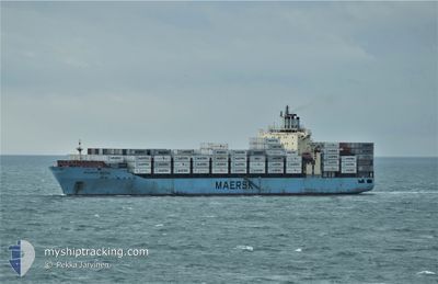
MAERSK BATUR
Container Ship

Current Trip
| Time Travelled | 7 h, 0 mins |
|---|---|
| Remaining Time | 10 days |
| Distance Travelled | 79.90 nm |
| Remaining Distance | 4093.52 nm |
| AVG Speed | 13.2 Knop |
| MAX Speed | 16.6 Knop |
| AVG Wind | 19 knots |
| MAX Wind | 20.3 knots |
| MIN Temp | 15.8°C / 60.44°F |
| MAX Temp | 16.5°C / 61.7°F |
| Djupgående | 12.1 m |
| Position mottagen | 5 h, 8 m sen |
Current Position
| Longitud | --- |
|---|---|
| Latitude | --- |
| Status | Under way using engine |
| Fart | 15.7 Knop |
| Kurs | 259.6° |
| Område | Strait of Gibraltar |
| Station | T-AIS |
| Position mottagen | 5 h, 8 m sen |
Information
The current position of MAERSK BATUR is in Strait of Gibraltar with coordinates 35.93591° / -5.91622° as reported on 2025-03-11 15:03 by AIS to our vessel tracker app. The vessel's current speed is 15.7 Knop and is heading at the port of CARTAGENA. The estimated time of arrival as calculated by MyShipTracking vessel tracking app is 2025-03-22 10:18 LT
The vessel MAERSK BATUR (IMO: 9402029, MMSI: 564398000) is a Container Ship that was built in 2009 ( 16 År gammal ). It's sailing under the flag of [SG] Singapore.
In this page you can find informations about the vessels current position, last detected port calls, and current voyage information. If the vessels is not in coverage by AIS you will find the latest position.
The current position of MAERSK BATUR is detected by our AIS receivers and we are not responsible for the reliability of the data. The last position was recorded while the vessel was in Coverage by the Ais receivers of our vessel tracking app.
The current draught of MAERSK BATUR as reported by AIS is 12.1 meters
Weather
| Temperature | 16.5°C / 61.7°F |
|---|---|
| Wind Speed | 17 knots |
| Direction | 276° W |
| Pressure | 1009.7 hPa |
| Humidity | 79.6 % |
| Cloud Coverage | --- |


Featured Company
Last Port Calls
| Port | Arrival | Departure | Time In Port |
|---|---|---|---|
| 2025-03-11 00:09 | 2025-03-11 13:12 | 13 h | |
| 2025-03-03 12:08 | 2025-03-04 10:46 | 22 h | |
| 2025-03-02 17:06 | 2025-03-03 03:05 | 9 h | |
| 2025-02-27 19:46 | 2025-03-01 00:59 | 1 d | |
| 2025-02-10 18:35 | 2025-02-11 05:03 | 10 h | |
| 2025-02-08 15:46 | 2025-02-09 14:25 | 22 h | |
| 2025-02-07 01:12 | 2025-02-08 06:07 | 1 d | |
| 2025-02-03 21:53 | 2025-02-04 09:36 | 11 h | |
| 2025-01-29 05:13 | 2025-01-30 07:36 | 1 d | |
| 2025-01-24 11:34 | 2025-01-25 05:30 | 17 h |
Most Visited Ports (Last year)
| Port | Arrivals | |
|---|---|---|
| 10 | ||
| 8 | ||
| 6 | ||
| 5 | ||
| 5 | ||
| 5 |
Last Trips
| Origin | Departure | Destination | Arrival | Distance | |
|---|---|---|---|---|---|
| 2025-03-04 10:46 | 2025-03-11 00:09 | 1941.03 nm | |||
| 2025-03-03 03:05 | 2025-03-03 12:08 | 116.08 nm | |||
| 2025-03-01 00:59 | 2025-03-02 17:06 | 388.60 nm | |||
| 2025-02-11 05:03 | 2025-02-27 19:46 | 5155.74 nm | |||
| 2025-02-09 14:25 | 2025-02-10 18:35 | 362.82 nm | |||
| 2025-02-08 06:07 | 2025-02-08 15:46 | 43.67 nm | |||
| 2025-02-04 09:36 | 2025-02-07 01:12 | 801.63 nm | |||
| 2025-01-30 07:36 | 2025-02-03 21:53 | 1944.94 nm | |||
| 2025-01-25 05:30 | 2025-01-29 05:13 | 1309.71 nm | |||
| 2025-01-21 09:15 | 2025-01-24 11:34 | 1370.16 nm |
Events
| Tid | Event | Detaljer | Position / Dest | Information |
|---|---|---|---|---|
| 2025-03-11 15:04 | Status ändrad | Default Under way using engine |
35.93516 / -5.92098
MAPTM>COCTG
|
Fart: 15.7 kn Kurs: 259.6° |
| 2025-03-11 15:03 | Status ändrad | Under way using engine Default |
35.93591 / -5.91622
MAPTM>COCTG
|
Fart: 15.7 kn Kurs: 260° |
| 2025-03-11 15:03 | UTANFÖR täckningsområde |
35.93591 / -5.91622
Strait of Gibraltar
MAPTM>COCTG
|
Fart: 15.7 kn Kurs: 259.6° |
|
| 2025-03-11 14:56 | Status ändrad | Default Under way using engine |
35.94163 / -5.87911
MAPTM>COCTG
|
Fart: 14.6 kn Kurs: 250.9° |
| 2025-03-11 14:49 | Byter havsområde | Moroccan part of the Strait of Gibraltar Spanish part of the Strait of Gibraltar |
35.94791 / -5.84469
Strait of Gibraltar
MAPTM>COCTG
|
Fart: 14.6 kn Kurs: 250.9° |
| 2025-03-11 14:45 | Status ändrad | Under way using engine Default |
35.95651 / -5.82740
MAPTM>COCTG
|
Fart: 15.5 kn Kurs: 260° |
| 2025-03-11 14:28 | Status ändrad | Default Under way using engine |
35.96161 / -5.73786
MAPTM>COCTG
|
Fart: 14.7 kn Kurs: 274.5° |
| 2025-03-11 14:16 | Status ändrad | Under way using engine Default |
35.95949 / -5.67955
MAPTM>COCTG
|
Fart: 14.6 kn Kurs: 273° |
| 2025-03-11 14:16 | Status ändrad | Default Under way using engine |
35.95941 / -5.67805
MAPTM>COCTG
|
Fart: 14.9 kn Kurs: 274.2° |
| 2025-03-11 14:08 | Status ändrad | Under way using engine Default |
35.95769 / -5.63879
MAPTM>COCTG
|
Fart: 15.5 kn Kurs: 268° |