
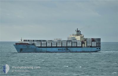
MAERSK BATUR
Container Ship
Current Trip
| Time Travelled | 4 days |
|---|---|
| Remaining Time | 12 days |
| Distance Travelled | 1833.66 nm |
| Remaining Distance | 5248.15 nm |
| AVG Speed | 15.7 Knopen |
| MAX Speed | 19.8 Knopen |
| AVG Wind | 13.9 knots |
| MAX Wind | 31.8 knots |
| MIN Temp | 3.2°C / 37.76°F |
| MAX Temp | 20.9°C / 69.62°F |
| Diepgang | 12.1 M |
| Positie ontvangen | 1 d geleden |
Current Position
| Lengtegraad | 141.62316° |
|---|---|
| Breedtegraat | 41.67218° |
| Status | Under way using engine |
| Snelheid | 12.8 Knopen |
| Koers | 89.1° |
| Gebied | North Pacific Ocean |
| Station | T-AIS |
| Positie ontvangen | 1 d geleden |
Info
Information
The current position of MAERSK BATUR is in North Pacific Ocean with coordinates 41.67218° / 141.62316° as reported on 2024-05-13 05:41 by AIS to our vessel tracker app. The vessel's current speed is 12.8 Knopen and is heading at the port of LAZARO CARDENAS. The estimated time of arrival as calculated by MyShipTracking vessel tracking app is 2024-05-27 13:14 LT
The vessel MAERSK BATUR (IMO: 9402029, MMSI: 564398000) is a Container Ship that was built in 2009 ( 15 Jaar oud ). It's sailing under the flag of [SG] Singapore.
In this page you can find informations about the vessels current position, last detected port calls, and current voyage information. If the vessels is not in coverage by AIS you will find the latest position.
The current position of MAERSK BATUR is detected by our AIS receivers and we are not responsible for the reliability of the data. The last position was recorded while the vessel was in Coverage by the Ais receivers of our vessel tracking app.
The current draught of MAERSK BATUR as reported by AIS is 12.1 meters
Weather
| Temperature | 4°C / 39.2°F |
|---|---|
| Wind Speed | 5 knots |
| Direction | 66° ENE |
| Pressure | 1024 hPa |
| Humidity | 95.1 % |
| Cloud Coverage | 100 % |
Featured Company
Events
| Tijd | Evenement | Details | Positie / Bestemming | Info |
|---|---|---|---|---|
| 2024-05-13 05:47 | Status Changed | Default Under way using engine |
41.67166 / 141.64833
CN YSA > MX LZC
|
Snelheid: 12.8 kn Koers: 89.1° |
| 2024-05-13 05:41 | Buitenbereik |
41.67218 / 141.62316
North Pacific Ocean
CN YSA > MX LZC
|
Snelheid: 12.8 kn Koers: 89.1° |
|
| 2024-05-13 05:40 | Status Changed | Under way using engine Default |
41.67213 / 141.61834
CN YSA > MX LZC
|
Snelheid: 13.2 kn Koers: 89° |
| 2024-05-13 05:27 | Status Changed | Default Under way using engine |
41.67272 / 141.55333
CN YSA > MX LZC
|
Snelheid: 13.7 kn Koers: 90.9° |
| 2024-05-13 04:50 | Wijzig zee gebeid | Japanese part of the North Pacific Ocean Japanese part of the Japan Sea |
41.67002 / 141.36909
North Pacific Ocean
CN YSA > MX LZC
|
Snelheid: 13.3 kn Koers: 83° |
| 2024-05-13 04:49 | Status Changed | Under way using engine Default |
41.66969 / 141.36583
CN YSA > MX LZC
|
Snelheid: 13 kn Koers: 77° |
| 2024-05-13 04:32 | Status Changed | Default Under way using engine |
41.65500 / 141.28166
CN YSA > MX LZC
|
Snelheid: 12.7 kn Koers: 77.3° |
| 2024-05-13 03:56 | Status Changed | Under way using engine Default |
41.62986 / 141.10803
CN YSA > MX LZC
|
Snelheid: 14 kn Koers: 83° |
| 2024-05-13 03:31 | Status Changed | Default Under way using engine |
41.61958 / 140.97494
CN YSA > MX LZC
|
Snelheid: 15.4 kn Koers: 89.4° |
| 2024-05-13 03:02 | Status Changed | Under way using engine Default |
41.60636 / 140.81431
CN YSA > MX LZC
|
Snelheid: 14.2 kn Koers: 66° |