

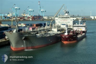
LARGO EVOLUTION
Tanker

Current Trip
TG FLW
| Time Travelled | 9 days |
|---|---|
| Remaining Time | --- |
| Distance Travelled | 2364.83 nm |
| Remaining Distance | --- |
| AVG Speed | 11.2 Knop |
| MAX Speed | 14 Knop |
| AVG Wind | 13.6 knots |
| MAX Wind | 27 knots |
| MIN Temp | 7.5°C / 45.5°F |
| MAX Temp | 19.2°C / 66.56°F |
| Djupgående | 11.4 m |
| Position mottagen | 2 d sen |
Current Position
| Longitud | --- |
|---|---|
| Latitude | --- |
| Status | Under way using engine |
| Fart | 12.2 Knop |
| Kurs | 188.6° |
| Område | North Atlantic Ocean |
| Station | T-AIS |
| Position mottagen | 2 d sen |
Information
The current position of LARGO EVOLUTION is in North Atlantic Ocean with coordinates 27.58358° / -15.20814° as reported on 2025-03-04 00:29 by AIS to our vessel tracker app. The vessel's current speed is 12.2 Knop
The vessel LARGO EVOLUTION (IMO: 9687942, MMSI: 538005271) is a Tanker It's sailing under the flag of [MH] Marshall Is.
In this page you can find informations about the vessels current position, last detected port calls, and current voyage information. If the vessels is not in coverage by AIS you will find the latest position.
The current position of LARGO EVOLUTION is detected by our AIS receivers and we are not responsible for the reliability of the data. The last position was recorded while the vessel was in Coverage by the Ais receivers of our vessel tracking app.
The current draught of LARGO EVOLUTION as reported by AIS is 11.4 meters
Weather
| Temperature | 19.2°C / 66.56°F |
|---|---|
| Wind Speed | 18 knots |
| Direction | 18° NNE |
| Pressure | 1017.2 hPa |
| Humidity | 69.7 % |
| Cloud Coverage | 98 % |


Featured Company
Last Port Calls
| Port | Arrival | Departure | Time In Port |
|---|---|---|---|
| 2025-02-23 10:03 | 2025-02-25 10:25 | 2 d | |
| 2025-02-16 04:52 | 2025-02-22 05:16 | 6 d | |
| 2025-02-12 11:44 | 2025-02-14 08:29 | 1 d | |
| 2025-01-22 07:50 | 2025-01-22 17:29 | 9 h | |
| 2025-01-16 22:33 | 2025-01-18 22:30 | 1 d | |
| 2025-01-03 05:49 | 2025-01-03 15:06 | 9 h |
Most Visited Ports (Last year)
| Port | Arrivals | |
|---|---|---|
| 4 | ||
| 4 | ||
| 2 | ||
| 2 | ||
| 1 | ||
| 1 |
Last Trips
| Origin | Departure | Destination | Arrival | Distance | |
|---|---|---|---|---|---|
| 2025-02-22 06:16 | 2025-02-23 11:03 | 176.09 nm | |||
| 2025-02-14 08:29 | 2025-02-16 05:52 | 178.84 nm | |||
| 2025-01-19 01:30 | 2025-02-12 11:44 | 4125.47 nm | |||
| 2025-01-19 01:30 | 2025-01-22 09:50 | 510.09 nm | |||
| 2024-12-29 21:25 | 2025-01-17 01:33 | 1756.56 nm | |||
| 2024-12-29 21:25 | 2025-01-03 07:49 | 935.19 nm |
Events
| Tid | Event | Detaljer | Position / Dest | Information |
|---|---|---|---|---|
| 2025-03-05 16:42 | STARTAR förflyttning |
20.96584 / -18.64261
TG FLW
|
Fart: 4.4 kn Kurs: 161° |
|
| 2025-03-05 14:28 | STOPPAR förflyttning |
20.98996 / -18.67384
TG FLW
|
Fart: 0.2 kn Kurs: 70° |
|
| 2025-03-04 00:35 | Status ändrad | Default Under way using engine |
27.56205 / -15.21210
TG FLW
|
Fart: 12.2 kn Kurs: 188.6° |
| 2025-03-04 00:29 | UTANFÖR täckningsområde |
27.58358 / -15.20814
North Atlantic Ocean
TG FLW
|
Fart: 12.2 kn Kurs: 188.6° |
|
| 2025-03-03 19:00 | ETA ändrat | 2025/03/13 02:30 2025/03/12 19:00 |
28.62988 / -14.81621
TG FLW
|
Fart: 11.7 kn Kurs: 196.2° |
| 2025-03-03 18:24 | Status ändrad | Under way using engine Default |
28.73959 / -14.77744
TG FLW
|
Fart: 11.8 kn Kurs: 195° |
| 2025-03-03 18:23 | Status ändrad | Default Under way using engine |
28.74269 / -14.77642
TG FLW
|
Fart: 11.6 kn Kurs: 195° |
| 2025-03-03 18:09 | Byter havsområde | Spanish (Canary Islands) part of the North Atlantic Ocean Portuguese part of the North Atlantic Ocean |
28.78658 / -14.76228
North Atlantic Ocean
TG FLW
|
Fart: 11.5 kn Kurs: 198.9° |
| 2025-03-03 18:09 | Status ändrad | Under way using engine Default |
28.78658 / -14.76228
TG FLW
|
Fart: 11.5 kn Kurs: 192° |
| 2025-03-03 17:56 | I täckningsområde |
28.78658 / -14.76228
North Atlantic Ocean
TG FLW
|
Fart: 11.5 kn Kurs: 198.9° |