
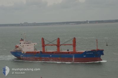
LADY LAGUNA
Cargo
Current Trip
| Time Travelled | 15 days |
|---|---|
| Remaining Time | 6 h, 5 mins |
| Distance Travelled | 3202.80 nm |
| Remaining Distance | 71.19 nm |
| AVG Speed | 8.9 Knop |
| MAX Speed | 8.9 Knop |
| AVG Wind | 13 knots |
| MAX Wind | 27 knots |
| MIN Temp | 16.9°C / 62.42°F |
| MAX Temp | 30.6°C / 87.08°F |
| Djupgående | 8.2 m |
| Position mottagen | 5 h, 26 m sen |
Current Position
| Longitud | 33.62877° |
|---|---|
| Latitude | 33.02466° |
| Status | Under way using engine |
| Fart | 10.5 Knop |
| Kurs | 31.7° |
| Område | Mediterranean Sea - Eastern Basin |
| Station | T-AIS |
| Position mottagen | 5 h, 26 m sen |
Info
Information
The current position of LADY LAGUNA is in Mediterranean Sea - Eastern Basin with coordinates 33.02466° / 33.62877° as reported on 2024-04-28 04:41 by AIS to our vessel tracker app. The vessel's current speed is 10.5 Knop and is heading at the port of BEIRUT. The estimated time of arrival as calculated by MyShipTracking vessel tracking app is 2024-04-28 16:13 LT
The vessel LADY LAGUNA (IMO: 93540400, MMSI: 314570000) is a Cargo It's sailing under the flag of [BB] Barbados.
In this page you can find informations about the vessels current position, last detected port calls, and current voyage information. If the vessels is not in coverage by AIS you will find the latest position.
The current position of LADY LAGUNA is detected by our AIS receivers and we are not responsible for the reliability of the data. The last position was recorded while the vessel was in Coverage by the Ais receivers of our vessel tracking app.
The current draught of LADY LAGUNA as reported by AIS is 8.2 meters
Weather
| Temperature | 21.1°C / 69.98°F |
|---|---|
| Wind Speed | 5 knots |
| Direction | 225° SW |
| Pressure | 1011.7 hPa |
| Humidity | 73 % |
| Cloud Coverage | 100 % |
Featured Company
Last Port Calls
| Port | Arrival | Departure | Time In Port |
|---|---|---|---|
| 2024-04-26 21:19 | 2024-04-27 16:00 | 18 h | |
| 2024-03-25 15:28 | 2024-04-12 21:32 | 18 d | |
| 2024-02-25 07:11 | 2024-02-26 23:16 | 1 d |
Most Visited Ports (Last year)
| Port | Arrivals | |
|---|---|---|
| 2 | ||
| 2 | ||
| 2 | ||
| 1 | ||
| 1 | ||
| 1 |
Events
| Tid | Event | Detaljer | Position / Dest | Information |
|---|---|---|---|---|
| 2024-04-28 05:00 | Status ändrad | Default Under way using engine |
33.06942 / 33.66884
BEIRUT
|
Fart: 10.5 kn Kurs: 31.7° |
| 2024-04-28 04:41 | UTANFÖR täckningsområde |
33.02466 / 33.62877
Mediterranean Sea - Eastern Basin
BEIRUT
|
Fart: 10.5 kn Kurs: 31.7° |
|
| 2024-04-28 04:04 | Djupgående ändrat | 8.2 7.1 |
32.93605 / 33.54893
BEIRUT
|
Fart: 10.8 kn Kurs: 34.6° |
| 2024-04-28 03:55 | Status ändrad | Under way using engine Default |
32.91440 / 33.53005
BEIRUT
|
Fart: 10.6 kn Kurs: 34° |
| 2024-04-28 03:55 | I täckningsområde |
32.91519 / 33.53077
Mediterranean Sea - Eastern Basin
BEIRUT
|
Fart: 10.7 kn Kurs: 37.2° |
|
| 2024-04-28 02:01 | Status ändrad | Default Under way using engine |
32.63918 / 33.30197
BEIRUT
|
Fart: 10.5 kn Kurs: 36° |
| 2024-04-28 01:56 | UTANFÖR täckningsområde |
32.62680 / 33.29118
Mediterranean Sea - Eastern Basin
BEIRUT
|
Fart: 10.5 kn Kurs: 36° |
|
| 2024-04-28 01:55 | Status ändrad | Under way using engine Default |
32.62497 / 33.28967
BEIRUT
|
Fart: 10.5 kn Kurs: 35° |
| 2024-04-28 01:52 | Status ändrad | Default Under way using engine |
32.61792 / 33.28337
BEIRUT
|
Fart: 10.4 kn Kurs: 37° |
| 2024-04-28 01:42 | Status ändrad | Under way using engine Default |
32.59550 / 33.26405
BEIRUT
|
Fart: 10.4 kn Kurs: 35° |