
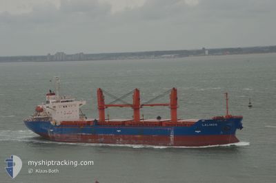
LADY LAGUNA
Cargo
Current Trip
| Trip Time | 29 days |
|---|---|
| Trip Distance | 3311.59 nm |
| AVG Speed | 8.8 Knots |
| MAX Speed | 8.8 Knots |
| Dybgang | 8.2 m |
| AVG Wind | 13 knots |
| MAX Wind | 27 knots |
| MIN Temp | 16.9°C / 62.42°F |
| MAX Temp | 30.6°C / 87.08°F |
| Position Modtaget | 17 h, 7 m siden |
Current Position
| Longitude | 35.82523° |
|---|---|
| Latitude | 34.49857° |
| Status | Under way using engine |
| Fart | 3.6 Knots |
| Kurs | 147° |
| Område | Mediterranean Sea - Eastern Basin |
| Station | T-AIS |
| Position Modtaget | 17 h, 7 m siden |
Info
Information
The current position of LADY LAGUNA is in Mediterranean Sea - Eastern Basin with coordinates 34.49857° / 35.82523° as reported on 2024-05-11 22:04 by AIS to our vessel tracker app. The vessel's current speed is 3.6 Knots and is currently inside the port of TRIPOLI.
The vessel LADY LAGUNA (IMO: 93540400, MMSI: 314570000) is a Cargo It's sailing under the flag of [BB] Barbados.
In this page you can find informations about the vessels current position, last detected port calls, and current voyage information. If the vessels is not in coverage by AIS you will find the latest position.
The current position of LADY LAGUNA is detected by our AIS receivers and we are not responsible for the reliability of the data. The last position was recorded while the vessel was in Coverage by the Ais receivers of our vessel tracking app.
The current draught of LADY LAGUNA as reported by AIS is 8.2 meters
Weather
| Temperature | 20.6°C / 69.08°F |
|---|---|
| Wind Speed | 22 knots |
| Direction | 226° SW |
| Pressure | 1010.5 hPa |
| Humidity | 76.3 % |
| Cloud Coverage | --- |
Featured Company
Last Port Calls
| Port | Arrival | Departure | Time In Port |
|---|---|---|---|
| 2024-05-12 04:34 | |||
| 2024-04-26 21:19 | 2024-04-27 16:00 | 18 h | |
| 2024-03-25 15:28 | 2024-04-12 21:32 | 18 d |
Most Visited Ports (Last year)
| Port | Arrivals | |
|---|---|---|
| 2 | ||
| 2 | ||
| 2 | ||
| 1 | ||
| 1 | ||
| 1 |
Events
| Tid | Hændelsen | Detaljer | Position / Dest | Info |
|---|---|---|---|---|
| 2024-05-12 04:34 | Skibe i havn |
|
34.46119 / 35.82456
[LB] TRIPOLI
|
Fart: 5.3 kn Kurs: 223° |
| 2024-05-11 22:25 | Status er ændret | Default Under way using engine |
34.48500 / 35.82834
BEIRUT
|
Fart: 3.6 kn Kurs: 147° |
| 2024-05-11 22:25 | STOP Sejllads | 1.28 nm, North of TRIPOLI |
34.48500 / 35.82834
BEIRUT
|
Fart: Kurs: -1° |
| 2024-05-11 22:04 | Udenfor Dækning |
34.49857 / 35.82523
Mediterranean Sea - Eastern Basin
|
Fart: 3.6 kn Kurs: 124.5° |
|
| 2024-05-11 19:43 | Ændre havområde | Lebanese part of the Mediterranean Sea - Eastern Basin Israeli part of the Mediterranean Sea - Eastern Basin |
34.59248 / 35.55071
Mediterranean Sea - Eastern Basin
|
Fart: 7.3 kn Kurs: 197.6° |
| 2024-05-11 19:42 | Indenfor Dækning |
34.59248 / 35.55071
Mediterranean Sea - Eastern Basin
|
Fart: 7.3 kn Kurs: 197.6° |