
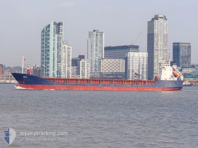
KAILI
General Cargo
Current Trip
| Time Travelled | 1 day |
|---|---|
| Remaining Time | 4 h, 55 mins |
| Distance Travelled | 491.78 nm |
| Remaining Distance | 60.10 nm |
| AVG Speed | 10.5 Knop |
| MAX Speed | 14.2 Knop |
| AVG Wind | 15.7 knots |
| MAX Wind | 19.1 knots |
| MIN Temp | 4.3°C / 39.74°F |
| MAX Temp | 8.6°C / 47.48°F |
| Djupgående | 6 m |
| Position mottagen | 1 m sen |
Current Position
| Longitud | 10.91085° |
|---|---|
| Latitude | 57.83878° |
| Status | Under way using engine |
| Fart | 11.4 Knop |
| Kurs | 88.3° |
| Område | Skaggerak |
| Station | T-AIS |
| Position mottagen | 1 m sen |
Info
Information
The current position of KAILI is in Skaggerak with coordinates 57.83878° / 10.91085° as reported on 2024-04-26 12:41 by AIS to our vessel tracker app. The vessel's current speed is 11.4 Knop and is heading at the port of UDDEVALLA. The estimated time of arrival as calculated by MyShipTracking vessel tracking app is 2024-04-26 17:37 LT
The vessel KAILI (IMO: 9114737, MMSI: 256295000) is a General Cargo that was built in 1996 ( 28 År gammal ). It's sailing under the flag of [MT] Malta.
In this page you can find informations about the vessels current position, last detected port calls, and current voyage information. If the vessels is not in coverage by AIS you will find the latest position.
The current position of KAILI is detected by our AIS receivers and we are not responsible for the reliability of the data. The last position was recorded while the vessel was in Coverage by the Ais receivers of our vessel tracking app.
The current draught of KAILI as reported by AIS is 6 meters
Weather
| Temperature | 7.3°C / 45.14°F |
|---|---|
| Wind Speed | 8 knots |
| Direction | 57° ENE |
| Pressure | 1008 hPa |
| Humidity | 64.9 % |
| Cloud Coverage | 58 % |
Featured Company
Last Port Calls
| Port | Arrival | Departure | Time In Port |
|---|---|---|---|
| 2024-04-23 21:54 | 2024-04-24 16:26 | 18 h | |
| 2024-04-22 01:30 | 2024-04-22 21:07 | 19 h | |
| 2024-04-17 13:20 | 2024-04-17 22:49 | 9 h | |
| 2024-04-11 18:24 | 2024-04-16 10:30 | 4 d | |
| 2024-04-08 06:24 | 2024-04-10 15:27 | 2 d | |
| 2024-04-06 02:09 | 2024-04-06 02:21 | 11 m | |
| 2024-04-04 20:46 | 2024-04-06 01:20 | 1 d | |
| 2024-04-04 19:55 | 2024-04-04 19:59 | 3 m | |
| 2024-04-02 23:09 | 2024-04-04 07:49 | 1 d | |
| 2024-03-20 11:42 | 2024-03-20 11:48 | 6 m |
Last Trips
| Origin | Departure | Destination | Arrival | Distance | |
|---|---|---|---|---|---|
| 2024-04-22 23:07 | 2024-04-23 23:54 | 105.31 nm | |||
| 2024-04-18 01:49 | 2024-04-22 03:30 | 1028.42 nm | |||
| 2024-04-16 12:30 | 2024-04-17 16:20 | 335.62 nm | |||
| 2024-04-10 17:27 | 2024-04-11 20:24 | 303.90 nm | |||
| 2024-04-06 05:21 | 2024-04-08 08:24 | 525.90 nm | |||
| 2024-04-06 04:20 | 2024-04-06 05:09 | 3.28 nm | |||
| 2024-04-04 22:59 | 2024-04-04 23:46 | 4.42 nm | |||
| 2024-04-04 10:49 | 2024-04-04 22:55 | 130.82 nm | |||
| 2024-03-20 12:48 | 2024-04-03 02:09 | 1503.25 nm | |||
| 2024-03-20 11:22 | 2024-03-20 12:42 | 6.34 nm |
Events
| Tid | Event | Detaljer | Position / Dest | Information |
|---|---|---|---|---|
| 2024-04-26 06:34 | ETA ändrat | 2024/04/26 14:15 2024/04/26 15:00 |
57.32866 / 8.97949
UDDEVALLA
|
Fart: 11.7 kn Kurs: 57.1° |
| 2024-04-26 05:04 | Byter havsområde | Danish part of the Skaggerak Danish part of the North Sea |
57.17703 / 8.53058
Skaggerak
UDDEVALLA
|
Fart: 11.3 kn Kurs: 57.7° |
| 2024-04-25 20:02 | Byter havsområde | Danish part of the North Sea Dutch part of the North Sea |
55.69578 / 6.83915
North Sea
UDDEVALLA
|
Fart: 11.7 kn Kurs: 30.5° |
| 2024-04-25 20:02 | Status ändrad | Under way using engine Default |
55.69578 / 6.83915
UDDEVALLA
|
Fart: 11.7 kn Kurs: 31° |
| 2024-04-25 19:50 | I täckningsområde |
55.69578 / 6.83915
North Sea
UDDEVALLA
|
Fart: 11.7 kn Kurs: 30.5° |
|
| 2024-04-25 07:27 | Status ändrad | Default Under way using engine |
53.61167 / 4.84167
UDDEVALLA
|
Fart: 11.5 kn Kurs: 22.7° |
| 2024-04-25 07:21 | Status ändrad | Under way using engine Default |
53.59722 / 4.83289
UDDEVALLA
|
Fart: 11.4 kn Kurs: 22° |
| 2024-04-25 07:21 | UTANFÖR täckningsområde |
53.59722 / 4.83289
North Sea
UDDEVALLA
|
Fart: 11.5 kn Kurs: 22.7° |
|
| 2024-04-25 07:14 | Status ändrad | Default Under way using engine |
53.57500 / 4.81833
UDDEVALLA
|
Fart: 11.6 kn Kurs: 21.9° |
| 2024-04-25 05:50 | Status ändrad | Under way using engine Default |
53.32406 / 4.64284
UDDEVALLA
|
Fart: 12 kn Kurs: 24° |