
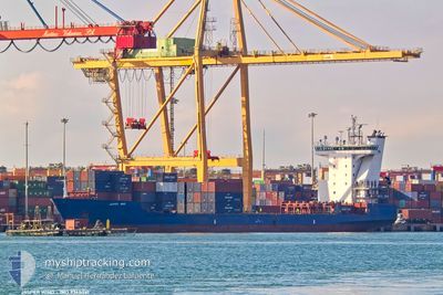
JASPER WIND
Container Ship
Current Trip
| Time Travelled | 9 h, 7 mins |
|---|---|
| Remaining Time | 2 days |
| Distance Travelled | 39.99 nm |
| Remaining Distance | 458.39 nm |
| AVG Speed | 8.3 Knop |
| MAX Speed | 14.1 Knop |
| AVG Wind | 4.9 knots |
| MAX Wind | 10 knots |
| MIN Temp | 12.8°C / 55.04°F |
| MAX Temp | 13.8°C / 56.84°F |
| Djupgående | 6.1 m |
| Position mottagen | 1 m sen |
Current Position
| Longitud | --- |
|---|---|
| Latitude | --- |
| Status | Under way using engine |
| Fart | 12.9 Knop |
| Kurs | 5.9° |
| Område | Sea of Marmara |
| Station | T-AIS |
| Position mottagen | 1 m sen |
Info
Information
The current position of JASPER WIND is in Sea of Marmara with coordinates 41.02185° / 28.99973° as reported on 2026-01-07 18:29 by AIS to our vessel tracker app. The vessel's current speed is 12.9 Knop and is heading at the port of NOVOROSSIYSK. The estimated time of arrival as calculated by MyShipTracking vessel tracking app is 2026-01-10 06:46 LT
The vessel JASPER WIND (IMO: 9368041, MMSI: 305643000) is a Container Ship that was built in 2009 ( 17 År gammal ). It's sailing under the flag of [AG] Antigua Barbuda.
In this page you can find informations about the vessels current position, last detected port calls, and current voyage information. If the vessels is not in coverage by AIS you will find the latest position.
The current position of JASPER WIND is detected by our AIS receivers and we are not responsible for the reliability of the data. The last position was recorded while the vessel was in Coverage by the Ais receivers of our vessel tracking app.
The current draught of JASPER WIND as reported by AIS is 6.1 meters
Weather
| Temperature | 13.6°C / 56.48°F |
|---|---|
| Wind Speed | 3 knots |
| Direction | 132° SE |
| Pressure | 1010.2 hPa |
| Humidity | 73.4 % |
| Cloud Coverage | 27 % |
Featured Company
Last Port Calls
| Port | Arrival | Departure | Time In Port |
|---|---|---|---|
| 2026-01-06 14:30 | 2026-01-07 12:23 | 21 h | |
| 2025-12-22 07:22 | 2025-12-24 10:13 | 2 d | |
| 2025-12-14 04:13 | 2025-12-14 19:29 | 15 h | |
| 2025-12-06 05:09 | 2025-12-06 14:19 | 9 h | |
| 2025-11-25 09:43 | 2025-11-26 15:48 | 1 d | |
| 2025-11-23 16:04 | 2025-11-23 22:40 | 6 h | |
| 2025-11-14 05:18 | 2025-11-14 21:24 | 16 h | |
| 2025-11-07 11:32 | 2025-11-08 02:12 | 14 h | |
| 2025-11-01 05:35 | 2025-11-01 05:51 | 15 m | |
| 2025-11-01 04:26 | 2025-11-01 05:08 | 42 m |
Most Visited Ports (Last year)
| Port | Arrivals | |
|---|---|---|
| 17 | ||
| 15 | ||
| 7 | ||
| 6 | ||
| 5 | ||
| 5 |
Last Trips
| Origin | Departure | Destination | Arrival | Distance | |
|---|---|---|---|---|---|
| 2025-12-24 10:13 | 2026-01-06 14:30 | 1109.32 nm | |||
| 2025-12-14 19:29 | 2025-12-22 07:22 | 998.88 nm | |||
| 2025-12-06 14:19 | 2025-12-14 04:13 | 1085.49 nm | |||
| 2025-11-26 15:48 | 2025-12-06 05:09 | 1807.68 nm | |||
| 2025-11-23 22:40 | 2025-11-25 09:43 | 93.64 nm | |||
| 2025-11-14 21:24 | 2025-11-23 16:04 | 1870.16 nm | |||
| 2025-11-08 02:12 | 2025-11-14 05:18 | 1038.73 nm | |||
| 2025-11-01 05:51 | 2025-11-07 11:32 | 626.75 nm | |||
| 2025-11-01 05:08 | 2025-11-01 05:35 | 11.98 nm | |||
| 2025-11-01 04:00 | 2025-11-01 04:26 | 6.78 nm |
Events
| Tid | Event | Detaljer | Position / Dest | Information |
|---|---|---|---|---|
| 2026-01-07 16:16 | STARTAR förflyttning | 12.11 nm, South of YESILKOY |
40.75440 / 28.85131
RUNVS
|
Fart: 3.2 kn Kurs: 80° |
| 2026-01-07 13:37 | STOPPAR förflyttning | 14.29 nm, South of YESILKOY |
40.71720 / 28.83091
RUNVS
|
Fart: 0.2 kn Kurs: 192° |
| 2026-01-07 13:16 | STARTAR förflyttning | 12.9 nm, South of YESILKOY |
40.74174 / 28.85833
RUNVS
|
Fart: 3.9 kn Kurs: 146° |
| 2026-01-07 11:11 | STOPPAR förflyttning | 13.59 nm, South of YESILKOY |
40.72913 / 28.84267
RUNVS
|
Fart: 0.3 kn Kurs: 171° |
| 2026-01-07 09:23 | AVGÅTT HAMN |
|
40.95629 / 28.67991
RUNVS
|
Fart: 6.4 kn Kurs: 160° |
| 2026-01-07 09:19 | STARTAR förflyttning |
40.96222 / 28.67776
[TR] AMBARLI
|
Fart: 6 kn Kurs: 160° |
|
| 2026-01-07 09:17 | Status ändrad | Under way using engine Moored |
40.96401 / 28.67690
[TR] AMBARLI
|
Fart: 0.3 kn Kurs: 174° |
| 2026-01-07 08:12 | Djupgående ändrat | 6.1 6.7 |
40.96419 / 28.67660
[TR] AMBARLI
|
Fart: Kurs: 175° |
| 2026-01-07 08:12 | Destination ändrad | RUNVS TRMAD |
40.96419 / 28.67660
[TR] AMBARLI
|
Fart: Kurs: 175° |
| 2026-01-07 08:12 | ETA ändrat | 2026/01/08 17:00 2026/01/06 11:00 |
40.96419 / 28.67660
[TR] AMBARLI
|
Fart: Kurs: 175° |