
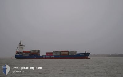
JSP MISTRAL
Container Ship
Current Trip
| Time Travelled | 4 days |
|---|---|
| Remaining Time | --- |
| Distance Travelled | 861.48 nm |
| Remaining Distance | 4.21 nm |
| AVG Speed | 14.1 Knopen |
| MAX Speed | 16.2 Knopen |
| AVG Wind | 11 knots |
| MAX Wind | 18.6 knots |
| MIN Temp | -9.4°C / 15.08°F |
| MAX Temp | 1.5°C / 34.7°F |
| Diepgang | 6.8 M |
| Positie ontvangen | 1 d geleden |
Current Position
| Lengtegraad | --- |
|---|---|
| Breedtegraat | --- |
| Status | Under way using engine |
| Snelheid | 16.2 Knopen |
| Koers | 233.9° |
| Gebied | Baltic Sea |
| Station | T-AIS |
| Positie ontvangen | 1 d geleden |
Info
Information
The current position of JSP MISTRAL is in Baltic Sea with coordinates 59.40638° / 22.31750° as reported on 2025-02-15 06:11 by AIS to our vessel tracker app. The vessel's current speed is 16.2 Knopen and is heading at the port of RIGA. The estimated time of arrival as calculated by MyShipTracking vessel tracking app is 2025-02-15 20:00 LT
The vessel JSP MISTRAL (IMO: 9368041, MMSI: 305643000) is a Container Ship that was built in 2009 ( 16 Jaar oud ). It's sailing under the flag of [AG] Antigua Barbuda.
In this page you can find informations about the vessels current position, last detected port calls, and current voyage information. If the vessels is not in coverage by AIS you will find the latest position.
The current position of JSP MISTRAL is detected by our AIS receivers and we are not responsible for the reliability of the data. The last position was recorded while the vessel was in Coverage by the Ais receivers of our vessel tracking app.
The current draught of JSP MISTRAL as reported by AIS is 6.8 meters
Weather
| Temperature | -4.1°C / 24.62°F |
|---|---|
| Wind Speed | 7 knots |
| Direction | 270° W |
| Pressure | 1019.6 hPa |
| Humidity | 69.3 % |
| Cloud Coverage | 87 % |
Featured Company
Last Port Calls
| Port | Arrival | Departure | Time In Port |
|---|---|---|---|
| 2025-02-11 10:53 | 2025-02-12 09:15 | 22 h | |
| 2025-02-04 14:35 | 2025-02-05 12:48 | 22 h | |
| 2025-01-26 05:30 | 2025-01-26 21:33 | 16 h | |
| 2025-01-20 00:29 | 2025-01-20 17:07 | 16 h | |
| 2025-01-17 11:39 | 2025-01-17 23:21 | 11 h | |
| 2025-01-15 02:57 | 2025-01-15 15:05 | 12 h | |
| 2025-01-13 04:21 | 2025-01-13 21:15 | 16 h | |
| 2025-01-13 04:08 | |||
| 2025-01-12 05:45 | 2025-01-12 15:18 | 9 h | |
| 2025-01-12 05:23 | 2025-01-12 05:30 | 6 m |
Most Visited Ports (Last year)
| Port | Arrivals | |
|---|---|---|
| 61 | ||
| 31 | ||
| 17 | ||
| 15 | ||
| 15 | ||
| 10 |
Last Trips
| Origin | Departure | Destination | Arrival | Distance | |
|---|---|---|---|---|---|
| 2025-02-05 13:48 | 2025-02-11 11:53 | 1196.24 nm | |||
| 2025-01-26 22:33 | 2025-02-04 15:35 | 1227.37 nm | |||
| 2025-01-20 18:07 | 2025-01-26 06:30 | 1175.29 nm | |||
| 2025-01-18 00:21 | 2025-01-20 01:29 | 317.24 nm | |||
| 2025-01-15 16:05 | 2025-01-17 12:39 | 652.18 nm | |||
| 2025-01-13 22:15 | 2025-01-15 03:57 | 123.74 nm | |||
| 2025-01-12 15:18 | 2025-01-13 05:21 | 151.93 nm | |||
| 2025-01-12 15:18 | 2025-01-13 05:08 | 151.77 nm | |||
| 2025-01-12 05:30 | 2025-01-12 05:45 | 0.75 nm | |||
| 2025-01-09 19:56 | 2025-01-12 05:23 | 737.19 nm |
Events
| Tijd | Evenement | Details | Positie / Bestemming | Info |
|---|---|---|---|---|
| 2025-02-16 16:45 | Start beweging | 3.9 nm, North of RIGA |
57.01305 / 24.09011
LVRIX
|
Snelheid: 8.6 kn Koers: 349° |
| 2025-02-15 21:53 | Stop beweging | 3.66 nm, North of RIGA |
57.00905 / 24.09576
LVRIX
|
Snelheid: Koers: 172° |
| 2025-02-15 06:19 | Status Changed | Default Under way using engine |
59.38576 / 22.26448
LVRIX
|
Snelheid: 16.2 kn Koers: 233.9° |
| 2025-02-15 06:11 | Buitenbereik |
59.40638 / 22.31750
Baltic Sea
LVRIX
|
Snelheid: 16.2 kn Koers: 233.9° |
|
| 2025-02-15 04:31 | Wijzig zee gebeid | Finnish part of the Baltic Sea Finnish part of the Gulf of Finland |
59.57608 / 23.10755
Baltic Sea
LVRIX
|
Snelheid: 15.8 kn Koers: 253° |
| 2025-02-15 01:22 | Wijzig zee gebeid | Finnish part of the Gulf of Finland Estonian part of the Gulf of Finland |
59.80273 / 24.65661
Gulf of Finland
LVRIX
|
Snelheid: 15.1 kn Koers: 259.5° |
| 2025-02-14 23:55 | Wijzig zee gebeid | Estonian part of the Gulf of Finland Finnish part of the Gulf of Finland |
59.87810 / 25.37949
Gulf of Finland
LVRIX
|
Snelheid: 15.5 kn Koers: 262.6° |
| 2025-02-14 23:32 | Status Changed | Under way using engine Default |
59.89182 / 25.57950
LVRIX
|
Snelheid: 15.8 kn Koers: 261° |
| 2025-02-14 23:25 | Binnenbereik |
59.89102 / 25.56730
Gulf of Finland
LVRIX
|
Snelheid: 15.7 kn Koers: 262.6° |
|
| 2025-02-14 22:09 | Buitenbereik |
60.06359 / 26.20861
Gulf of Finland
LVRIX
|
Snelheid: 16.2 kn Koers: 227.3° |