

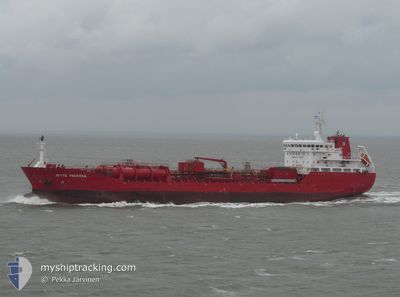
JETTE THERESA
Oil/Chemical Tanker

Current Trip
| Time Travelled | 9 h, 47 mins |
|---|---|
| Remaining Time | 2 days |
| Distance Travelled | 105.58 nm |
| Remaining Distance | 632.01 nm |
| AVG Speed | 10.5 Knop |
| MAX Speed | 13.2 Knop |
| AVG Wind | 21 knots |
| MAX Wind | 29.5 knots |
| MIN Temp | 12.5°C / 54.5°F |
| MAX Temp | 16.4°C / 61.52°F |
| Djupgående | 7.8 m |
| Position mottagen | 18 m sen |
Current Position
| Longitud | --- |
|---|---|
| Latitude | --- |
| Status | Under way using engine |
| Fart | 11.6 Knop |
| Kurs | 83.1° |
| Område | Alboran Sea |
| Station | T-AIS |
| Position mottagen | 18 m sen |
Information
The current position of JETTE THERESA is in Alboran Sea with coordinates 36.22492° / -3.37072° as reported on 2025-03-18 08:39 by AIS to our vessel tracker app. The vessel's current speed is 11.6 Knop and is heading at the port of TOULON. The estimated time of arrival as calculated by MyShipTracking vessel tracking app is 2025-03-20 19:38 LT
The vessel JETTE THERESA (IMO: 9406582, MMSI: 220624000) is a Oil/Chemical Tanker that was built in 2009 ( 16 År gammal ). It's sailing under the flag of [DK] Denmark.
In this page you can find informations about the vessels current position, last detected port calls, and current voyage information. If the vessels is not in coverage by AIS you will find the latest position.
The current position of JETTE THERESA is detected by our AIS receivers and we are not responsible for the reliability of the data. The last position was recorded while the vessel was in Coverage by the Ais receivers of our vessel tracking app.
The current draught of JETTE THERESA as reported by AIS is 7.8 meters
Weather
| Temperature | 15.7°C / 60.26°F |
|---|---|
| Wind Speed | 27 knots |
| Direction | 245° WSW |
| Pressure | 1013.7 hPa |
| Humidity | 79.9 % |
| Cloud Coverage | 73 % |


Featured Company
Last Port Calls
| Port | Arrival | Departure | Time In Port |
|---|---|---|---|
| 2025-03-16 16:14 | 2025-03-18 00:10 | 1 d | |
| 2025-02-22 19:11 | 2025-02-24 10:29 | 1 d | |
| 2025-02-07 02:08 | 2025-02-08 17:46 | 1 d | |
| 2025-02-02 13:52 | 2025-02-05 15:23 | 3 d | |
| 2025-01-27 19:39 | 2025-01-29 14:20 | 1 d | |
| 2025-01-26 10:05 | 2025-01-27 10:03 | 23 h | |
| 2025-01-24 12:35 | 2025-01-25 16:45 | 1 d | |
| 2025-01-21 20:06 | 2025-01-23 01:09 | 1 d | |
| 2025-01-18 19:23 | 2025-01-19 23:17 | 1 d | |
| 2025-01-13 07:53 | 2025-01-14 19:40 | 1 d |
Last Trips
| Origin | Departure | Destination | Arrival | Distance | |
|---|---|---|---|---|---|
| 2025-02-24 10:29 | 2025-03-16 16:14 | 2267.15 nm | |||
| 2025-02-08 17:46 | 2025-02-22 19:11 | 3364.69 nm | |||
| 2025-02-05 15:23 | 2025-02-07 02:08 | 98.86 nm | |||
| 2025-01-29 14:20 | 2025-02-02 13:52 | 599.13 nm | |||
| 2025-01-27 10:03 | 2025-01-27 19:39 | 103.60 nm | |||
| 2025-01-25 16:45 | 2025-01-26 10:05 | 180.12 nm | |||
| 2025-01-23 01:09 | 2025-01-24 12:35 | 325.88 nm | |||
| 2025-01-19 23:17 | 2025-01-21 20:06 | 459.55 nm | |||
| 2025-01-14 19:40 | 2025-01-18 19:23 | 777.11 nm | |||
| 2025-01-05 04:23 | 2025-01-13 07:53 | 1920.00 nm |
Events
| Tid | Event | Detaljer | Position / Dest | Information |
|---|---|---|---|---|
| 2025-03-18 08:39 | Status ändrad | Default Under way using engine |
36.22510 / -3.36876
FR TLN
|
Fart: 11.6 kn Kurs: 83.1° |
| 2025-03-18 08:23 | Status ändrad | Under way using engine Default |
36.21892 / -3.43136
FR TLN
|
Fart: 11.2 kn Kurs: 83° |
| 2025-03-18 08:08 | Status ändrad | Default Under way using engine |
36.21263 / -3.49214
FR TLN
|
Fart: 11.1 kn Kurs: 83.8° |
| 2025-03-18 08:04 | Status ändrad | Under way using engine Default |
36.21131 / -3.50740
FR TLN
|
Fart: 11.1 kn Kurs: 84° |
| 2025-03-18 07:44 | Status ändrad | Default Under way using engine |
36.20453 / -3.58157
FR TLN
|
Fart: 11.1 kn Kurs: 85.8° |
| 2025-03-18 07:32 | Status ändrad | Under way using engine Default |
36.20047 / -3.62756
FR TLN
|
Fart: 10.9 kn Kurs: 84° |
| 2025-03-18 07:09 | Status ändrad | Default Under way using engine |
36.19432 / -3.71296
FR TLN
|
Fart: 10.8 kn Kurs: 83.7° |
| 2025-03-18 07:02 | Status ändrad | Under way using engine Default |
36.19258 / -3.73970
FR TLN
|
Fart: 10.7 kn Kurs: 85° |
| 2025-03-18 06:52 | Status ändrad | Default Under way using engine |
36.19046 / -3.77536
FR TLN
|
Fart: 10.7 kn Kurs: 85° |
| 2025-03-18 06:44 | Status ändrad | Under way using engine Default |
36.18833 / -3.80499
FR TLN
|
Fart: 11.2 kn Kurs: 61° |