

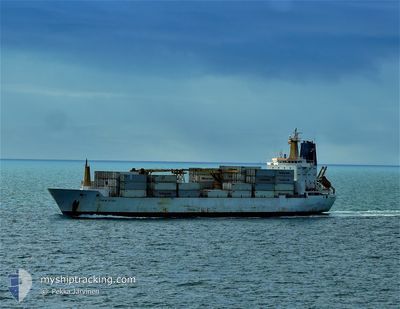
ITALIA STREAM
Reefer

Current Trip
| Time Travelled | 9 days |
|---|---|
| Remaining Time | --- |
| Distance Travelled | 2066.18 nm |
| Remaining Distance | --- |
| AVG Speed | 14.6 Knop |
| MAX Speed | 20.6 Knop |
| AVG Wind | 12.3 knots |
| MAX Wind | 30 knots |
| MIN Temp | 0.7°C / 33.26°F |
| MAX Temp | 27.9°C / 82.22°F |
| Djupgående | 7.7 m |
| Position mottagen | 6 h, 35 m sen |
Current Position
| Longitud | --- |
|---|---|
| Latitude | --- |
| Status | At anchor |
| Fart | 11.4 Knop |
| Kurs | 91.5° |
| Område | Caribbean Sea |
| Station | T-AIS |
| Position mottagen | 6 h, 35 m sen |
Information
The current position of ITALIA STREAM is in Caribbean Sea with coordinates 9.17973° / -79.86709° as reported on 2025-03-18 02:33 by AIS to our vessel tracker app. The vessel's current speed is 11.4 Knop
The vessel ITALIA STREAM (IMO: 9030137, MMSI: 308438000) is a Reefer that was built in 1992 ( 33 År gammal ). It's sailing under the flag of [BS] Bahamas.
In this page you can find informations about the vessels current position, last detected port calls, and current voyage information. If the vessels is not in coverage by AIS you will find the latest position.
The current position of ITALIA STREAM is detected by our AIS receivers and we are not responsible for the reliability of the data. The last position was recorded while the vessel was in Coverage by the Ais receivers of our vessel tracking app.
The current draught of ITALIA STREAM as reported by AIS is 7.7 meters
Weather
| Temperature | 23.7°C / 74.66°F |
|---|---|
| Wind Speed | 5 knots |
| Direction | 340° NNW |
| Pressure | 1012.9 hPa |
| Humidity | 79.9 % |
| Cloud Coverage | 100 % |


Featured Company
Last Port Calls
| Port | Arrival | Departure | Time In Port |
|---|---|---|---|
| 2025-03-04 04:15 | 2025-03-08 22:48 | 4 d | |
| 2025-02-19 10:32 | 2025-02-20 18:09 | 1 d | |
| 2025-02-11 13:32 | 2025-02-17 20:09 | 6 d | |
| 2025-01-16 11:54 | 2025-01-17 17:18 | 1 d | |
| 2025-01-07 22:51 | 2025-01-12 16:49 | 4 d |
Most Visited Ports (Last year)
| Port | Arrivals | |
|---|---|---|
| 5 | ||
| 5 | ||
| 4 | ||
| 4 | ||
| 4 | ||
| 4 |
Last Trips
| Origin | Departure | Destination | Arrival | Distance | |
|---|---|---|---|---|---|
| 2025-02-20 18:09 | 2025-03-04 04:15 | 3321.22 nm | |||
| 2025-02-17 20:09 | 2025-02-19 10:32 | 365.43 nm | |||
| 2025-01-17 17:18 | 2025-02-11 13:32 | 6875.40 nm | |||
| 2025-01-12 16:49 | 2025-01-16 11:54 | 367.30 nm | |||
| 2024-12-23 11:15 | 2025-01-07 22:51 | 3185.11 nm |
Events
| Tid | Event | Detaljer | Position / Dest | Information |
|---|---|---|---|---|
| 2025-03-18 04:34 | STOPPAR förflyttning | 12.19 nm, North West of RODMAN |
9.11200 / -79.70546
PA CTB
|
Fart: 0.1 kn Kurs: 105° |
| 2025-03-18 02:36 | Status ändrad | Default At anchor |
9.18213 / -79.85761
PA CTB
|
Fart: 11.4 kn Kurs: 91.5° |
| 2025-03-18 02:33 | Status ändrad | At anchor Default |
9.17973 / -79.86709
PA CTB
|
Fart: 12.2 kn Kurs: 117° |
| 2025-03-18 02:33 | UTANFÖR täckningsområde |
9.17973 / -79.86709
Caribbean Sea
|
Fart: 11.4 kn Kurs: 91.5° |
|
| 2025-03-18 02:19 | Status ändrad | Default At anchor |
9.20194 / -79.90861
PA CTB
|
Fart: 11.5 kn Kurs: 160.1° |
| 2025-03-18 02:13 | Status ändrad | At anchor Default |
9.21655 / -79.92459
PA CTB
|
Fart: 12.4 kn Kurs: 180° |
| 2025-03-18 02:08 | Status ändrad | Default At anchor |
9.23187 / -79.92432
PA CTB
|
Fart: 6.7 kn Kurs: 179.6° |
| 2025-03-18 01:49 | STARTAR förflyttning | 4.89 nm, South of CRISTOBAL |
9.26582 / -79.92413
PA CTB
|
Fart: 3.9 kn Kurs: 187° |
| 2025-03-18 01:40 | Status ändrad | At anchor Default |
9.26780 / -79.92380
PA CTB
|
Fart: Kurs: 188° |
| 2025-03-18 01:34 | Status ändrad | Default At anchor |
9.26783 / -79.92384
PA CTB
|
Fart: Kurs: 188° |