
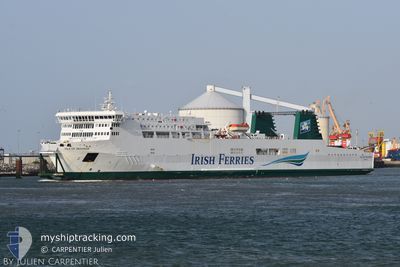
ISLE OF INISHEER
Ro-Ro/Passenger Ship
Current Trip
| Time Travelled | 59 mins |
|---|---|
| Remaining Time | 28 mins |
| Distance Travelled | 14.00 nm |
| Remaining Distance | 12.22 nm |
| AVG Speed | 15.6 Knop |
| MAX Speed | 16.1 Knop |
| AVG Wind | 5.3 knots |
| MAX Wind | 6.4 knots |
| MIN Temp | 10.8°C / 51.44°F |
| MAX Temp | 12.4°C / 54.32°F |
| Djupgående | 5.9 m |
| Position mottagen | 1 m sen |
Current Position
| Longitud | 1.66381° |
|---|---|
| Latitude | 50.97674° |
| Status | Under way using engine |
| Fart | 15.8 Knop |
| Kurs | 111° |
| Område | English Channel |
| Station | T-AIS |
| Position mottagen | 1 m sen |
Info
Information
The current position of ISLE OF INISHEER is in English Channel with coordinates 50.97674° / 1.66381° as reported on 2024-05-04 12:41 by AIS to our vessel tracker app. The vessel's current speed is 15.8 Knop and is heading at the port of CALAIS. The estimated time of arrival as calculated by MyShipTracking vessel tracking app is 2024-05-04 13:10 LT
The vessel ISLE OF INISHEER (IMO: 9181091, MMSI: 210780000) is a Ro-Ro/Passenger Ship that was built in 2000 ( 24 År gammal ). It's sailing under the flag of [CY] Cyprus.
In this page you can find informations about the vessels current position, last detected port calls, and current voyage information. If the vessels is not in coverage by AIS you will find the latest position.
The current position of ISLE OF INISHEER is detected by our AIS receivers and we are not responsible for the reliability of the data. The last position was recorded while the vessel was in Coverage by the Ais receivers of our vessel tracking app.
The current draught of ISLE OF INISHEER as reported by AIS is 5.9 meters
Weather
| Temperature | 12.3°C / 54.14°F |
|---|---|
| Wind Speed | 4 knots |
| Direction | 278° W |
| Pressure | 1011.6 hPa |
| Humidity | 74.9 % |
| Cloud Coverage | 84 % |
Featured Company
Last Port Calls
| Port | Arrival | Departure | Time In Port |
|---|---|---|---|
| 2024-05-04 10:48 | 2024-05-04 11:43 | 54 m | |
| 2024-05-04 08:10 | 2024-05-04 09:21 | 1 h | |
| 2024-05-04 05:44 | 2024-05-04 06:46 | 1 h | |
| 2024-05-04 03:20 | 2024-05-04 04:21 | 1 h | |
| 2024-05-04 01:04 | 2024-05-04 02:01 | 56 m | |
| 2024-05-03 22:46 | 2024-05-03 23:47 | 1 h | |
| 2024-05-03 20:28 | 2024-05-03 21:35 | 1 h | |
| 2024-05-03 17:56 | 2024-05-03 19:09 | 1 h | |
| 2024-05-03 15:36 | 2024-05-03 16:31 | 55 m | |
| 2024-05-03 13:14 | 2024-05-03 14:15 | 1 h |
Last Trips
| Origin | Departure | Destination | Arrival | Distance | |
|---|---|---|---|---|---|
| 2024-05-04 11:21 | 2024-05-04 11:48 | 21.88 nm | |||
| 2024-05-04 07:46 | 2024-05-04 10:10 | 22.04 nm | |||
| 2024-05-04 06:21 | 2024-05-04 06:44 | 21.77 nm | |||
| 2024-05-04 03:01 | 2024-05-04 05:20 | 22.08 nm | |||
| 2024-05-04 01:47 | 2024-05-04 02:04 | 21.92 nm | |||
| 2024-05-03 22:35 | 2024-05-04 00:46 | 21.57 nm | |||
| 2024-05-03 21:09 | 2024-05-03 21:28 | 21.90 nm | |||
| 2024-05-03 17:31 | 2024-05-03 19:56 | 22.22 nm | |||
| 2024-05-03 16:15 | 2024-05-03 16:36 | 22.70 nm | |||
| 2024-05-03 12:49 | 2024-05-03 15:14 | 22.23 nm |
Events
| Tid | Event | Detaljer | Position / Dest | Information |
|---|---|---|---|---|
| 2024-05-04 12:40 | Byter havsområde | French part of the North Sea French part of the English Channel |
50.97841 / 1.65677
North Sea
CALAIS<-->DOVER
|
Fart: 15.8 kn Kurs: 110.2° |
| 2024-05-04 12:20 | Byter havsområde | French part of the English Channel United Kingdom part of the English Channel |
51.01503 / 1.53387
English Channel
CALAIS<-->DOVER
|
Fart: 15.6 kn Kurs: 137.1° |
| 2024-05-04 11:53 | ETA ändrat | 2024/05/04 14:20 2024/05/04 11:50 |
51.10101 / 1.39960
CALAIS<-->DOVER
|
Fart: 15.4 kn Kurs: 123.2° |
| 2024-05-04 11:43 | AVGÅTT HAMN |
|
51.11979 / 1.34672
CALAIS<-->DOVER
|
Fart: 10.6 kn Kurs: 109° |
| 2024-05-04 11:42 | STARTAR förflyttning |
51.12154 / 1.33983
[GB] DOVER
|
Fart: 7.1 kn Kurs: 115° |
|
| 2024-05-04 11:36 | Status ändrad | Under way using engine Default |
51.12453 / 1.33653
[GB] DOVER
|
Fart: Kurs: 158° |
| 2024-05-04 11:12 | Status ändrad | Default Moored |
51.12454 / 1.33652
[GB] DOVER
|
Fart: Kurs: 158° |
| 2024-05-04 11:09 | Status ändrad | Moored Default |
51.12454 / 1.33653
[GB] DOVER
|
Fart: Kurs: 158° |
| 2024-05-04 11:00 | STOPPAR förflyttning |
51.12455 / 1.33653
[GB] DOVER
|
Fart: Kurs: 158° |
|
| 2024-05-04 10:48 | Status ändrad | Default Under way using engine |
51.12189 / 1.33730
[GB] DOVER
|
Fart: 11.3 kn Kurs: 273.5° |