
ISLE OF INISHEER
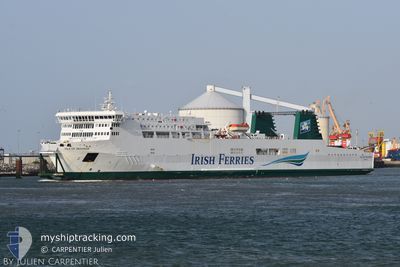
Ro-Ro/Passenger Ship
Current Trip
| Time Travelled | 16 h, 24 mins |
|---|---|
| Remaining Time | 3 h, 13 mins |
| Distance Travelled | 312.16 nm |
| Remaining Distance | 68.70 nm |
| AVG Speed | 18.8 Knots |
| MAX Speed | 20.8 Knots |
| AVG Wind | 12.9 knots |
| MAX Wind | 18.7 knots |
| MIN Temp | 5.6°C / 42.08°F |
| MAX Temp | 11.6°C / 52.88°F |
| Draught | 6.5 m |
| Position Received | 12 h, 31 m ago |
Current Position
| Longitude | --- |
|---|---|
| Latitude | --- |
| Status | Under way using engine |
| Speed | 19.2 Knots |
| Course | 181.1° |
| Area | Irish Sea and St. George's Channel |
| Station | T-AIS |
| Position Received | 12 h, 31 m ago |
Info
Information
The current position of ISLE OF INISHEER is in Irish Sea and St. George's Channel with coordinates 52.22997° / -5.89680° as reported on 2025-12-13 04:41 by AIS to our vessel tracker app. The vessel's current speed is 19.2 Knots and is heading at the port of CHERBOURG. The estimated time of arrival as calculated by MyShipTracking vessel tracking app is 2025-12-13 21:25 LT
The vessel ISLE OF INISHEER (IMO: 9181091, MMSI: 210780000) is a Ro-Ro/Passenger Ship that was built in 2000 ( 25 years old ). It's sailing under the flag of [CY] Cyprus.
In this page you can find informations about the vessels current position, last detected port calls, and current voyage information. If the vessels is not in coverage by AIS you will find the latest position.
The current position of ISLE OF INISHEER is detected by our AIS receivers and we are not responsible for the reliability of the data. The last position was recorded while the vessel was in Coverage by the Ais receivers of our vessel tracking app.
The current draught of ISLE OF INISHEER as reported by AIS is 6.5 meters
Weather
| Temperature | 11.4°C / 52.52°F |
|---|---|
| Wind Speed | 11 knots |
| Direction | 220° SW |
| Pressure | 1027 hPa |
| Humidity | 71.4 % |
| Cloud Coverage | 72 % |
Featured Company
Last Port Calls
| Port | Arrival | Departure | Time In Port |
|---|---|---|---|
| 2025-12-12 19:37 | 2025-12-13 00:48 | 5 h | |
| 2025-12-11 20:09 | 2025-12-11 23:29 | 3 h | |
| 2025-12-10 15:46 | 2025-12-10 20:07 | 4 h | |
| 2025-12-08 17:49 | 2025-12-09 16:41 | 22 h | |
| 2025-12-05 16:52 | 2025-12-07 18:08 | 2 d | |
| 2025-12-04 16:14 | 2025-12-04 19:57 | 3 h | |
| 2025-12-03 13:48 | 2025-12-03 17:46 | 3 h | |
| 2025-12-01 23:22 | 2025-12-02 17:58 | 18 h | |
| 2025-11-30 18:32 | 2025-11-30 21:59 | 3 h | |
| 2025-11-29 19:11 | 2025-11-30 00:19 | 5 h |
Last Trips
| Origin | Departure | Destination | Arrival | Distance | |
|---|---|---|---|---|---|
| 2025-12-11 23:29 | 2025-12-12 19:37 | 386.09 nm | |||
| 2025-12-10 20:07 | 2025-12-11 20:09 | 387.78 nm | |||
| 2025-12-09 16:41 | 2025-12-10 15:46 | 388.48 nm | |||
| 2025-12-07 18:08 | 2025-12-08 17:49 | 383.86 nm | |||
| 2025-12-04 19:57 | 2025-12-05 16:52 | 385.88 nm | |||
| 2025-12-03 17:46 | 2025-12-04 16:14 | 400.73 nm | |||
| 2025-12-02 17:58 | 2025-12-03 13:48 | 388.51 nm | |||
| 2025-11-30 21:59 | 2025-12-01 23:22 | 388.26 nm | |||
| 2025-11-30 00:19 | 2025-11-30 18:32 | 382.23 nm | |||
| 2025-11-28 20:45 | 2025-11-29 19:11 | 416.69 nm |
Events
| Time | Event | Details | Position / Dest | Info |
|---|---|---|---|---|
| 2025-12-13 05:14 | Status Changed | Default Under way using engine |
52.05262 / -5.89871
FRCER
|
Speed: 19.2 kn Course: 181.1° |
| 2025-12-13 04:41 | OUT of Coverage |
52.22997 / -5.89680
Irish Sea and St. George's Channel
FRCER
|
Speed: 19.2 kn Course: 181.1° |
|
| 2025-12-13 04:32 | Status Changed | Under way using engine Default |
52.27400 / -5.89645
FRCER
|
Speed: 19.2 kn Course: 180° |
| 2025-12-13 04:27 | Status Changed | Default Under way using engine |
52.30227 / -5.89614
FRCER
|
Speed: 19.2 kn Course: 180° |
| 2025-12-13 04:20 | Status Changed | Under way using engine Default |
52.33975 / -5.89582
FRCER
|
Speed: 19.1 kn Course: 180° |
| 2025-12-13 04:15 | IN Coverage |
52.33662 / -5.89586
Irish Sea and St. George's Channel
FRCER
|
Speed: 19.2 kn Course: 180° |
|
| 2025-12-13 03:03 | Status Changed | Default Under way using engine |
52.74777 / -5.89060
FRCER
|
Speed: 18.7 kn Course: 181.7° |
| 2025-12-13 02:57 | OUT of Coverage |
52.77732 / -5.88952
Irish Sea and St. George's Channel
FRCER
|
Speed: 18.7 kn Course: 181.7° |
|
| 2025-12-13 01:44 | ETA Changed | 2025/12/14 22:00 2025/12/14 23:00 |
53.14427 / -5.97009
FRCER
|
Speed: 18.8 kn Course: 162° |
| 2025-12-13 01:42 | ETA Changed | 2025/12/14 23:00 2025/12/14 13:00 |
53.15390 / -5.97502
FRCER
|
Speed: 19.3 kn Course: 164.1° |