

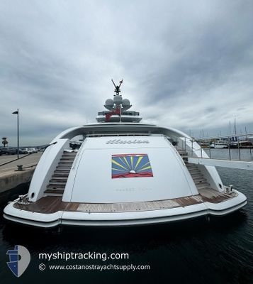
ILLUSION
Yacht

Current Trip
BVI
| Time Travelled | 1 day |
|---|---|
| Remaining Time | --- |
| Distance Travelled | 115.98 nm |
| Remaining Distance | --- |
| AVG Speed | 13.1 Knop |
| MAX Speed | 15.6 Knop |
| AVG Wind | 15.9 knots |
| MAX Wind | 19.2 knots |
| MIN Temp | 25.7°C / 78.26°F |
| MAX Temp | 26.6°C / 79.88°F |
| Djupgående | 3.2 m |
| Position mottagen | 3 m sen |
Current Position
| Longitud | --- |
|---|---|
| Latitude | --- |
| Status | At anchor |
| Fart | |
| Kurs | 99° |
| Område | Caribbean Sea |
| Station | T-AIS |
| Position mottagen | 3 m sen |
Information
The current position of ILLUSION is in Caribbean Sea with coordinates 18.45595° / -64.53289° as reported on 2025-03-27 16:47 by AIS to our vessel tracker app. The vessel's current speed is 0 Knop
The vessel ILLUSION (IMO: 9679830, MMSI: 319744000) is a Yacht that was built in 2013 ( 12 År gammal ). It's sailing under the flag of [KY] Cayman Is.
In this page you can find informations about the vessels current position, last detected port calls, and current voyage information. If the vessels is not in coverage by AIS you will find the latest position.
The current position of ILLUSION is detected by our AIS receivers and we are not responsible for the reliability of the data. The last position was recorded while the vessel was in Coverage by the Ais receivers of our vessel tracking app.
The current draught of ILLUSION as reported by AIS is 3.2 meters
Weather
| Temperature | 26.6°C / 79.88°F |
|---|---|
| Wind Speed | 14 knots |
| Direction | 129° SE |
| Pressure | 1017.6 hPa |
| Humidity | 78 % |
| Cloud Coverage | 55 % |


Featured Company
Last Port Calls
| Port | Arrival | Departure | Time In Port |
|---|---|---|---|
| 2025-03-24 12:07 | 2025-03-26 07:46 | 1 d | |
| 2025-02-17 12:59 | 2025-03-02 12:59 | 12 d | |
| 2025-02-06 09:33 | 2025-02-07 12:47 | 1 d | |
| 2025-01-04 07:09 | 2025-01-17 01:10 | 12 d |
Last Trips
| Origin | Departure | Destination | Arrival | Distance | |
|---|---|---|---|---|---|
| 2025-03-02 12:59 | 2025-03-24 12:07 | 415.08 nm | |||
| 2025-02-07 12:47 | 2025-02-17 12:59 | 46.52 nm | |||
| 2025-01-17 01:10 | 2025-02-06 09:33 | 339.28 nm | |||
| 2024-12-26 10:15 | 2025-01-04 07:09 | 241.02 nm |
Events
| Tid | Event | Detaljer | Position / Dest | Information |
|---|---|---|---|---|
| 2025-03-27 14:35 | STOPPAR förflyttning | 0.56 nm, North of BEEF ISLAND |
18.45578 / -64.53293
BVI
|
Fart: Kurs: 134° |
| 2025-03-27 13:50 | STARTAR förflyttning | 1.04 nm, South East of ROAD TOWN |
18.41097 / -64.59565
BVI
|
Fart: 13.6 kn Kurs: 120.4° |
| 2025-03-27 05:58 | Status ändrad | At anchor Under way using engine |
18.41149 / -64.59917
BVI
|
Fart: 0.3 kn Kurs: 115° |
| 2025-03-27 05:42 | STOPPAR förflyttning | 0.88 nm, South East of ROAD TOWN |
18.41155 / -64.59852
BVI
|
Fart: 0.2 kn Kurs: 107° |
| 2025-03-27 02:24 | Byter havsområde | British Virgin Islands part of the Caribbean Sea Anguilla part of the Caribbean Sea |
18.21625 / -63.84474
Caribbean Sea
BVI
|
Fart: 15.2 kn Kurs: 283.9° |
| 2025-03-27 00:22 | Upptäckt i hav | Anguilla part of the Caribbean Sea |
18.07621 / -63.33680
Caribbean Sea
BVI
|
Fart: 14.6 kn Kurs: 286.5° |
| 2025-03-26 23:41 | Byter havsområde | Saint-Martin part of the Caribbean Sea Sint-Maarten part of the Caribbean Sea |
18.02969 / -63.16818
Caribbean Sea
BVI
|
Fart: 14.9 kn Kurs: 286.3° |
| 2025-03-26 23:25 | STARTAR förflyttning | 1.16 nm, West of ST MAARTEN |
18.03261 / -63.11188
BVI
|
Fart: 3.5 kn Kurs: 157° |
| 2025-03-26 22:41 | Destination ändrad | BVI SXM |
18.03459 / -63.10823
BVI
|
Fart: Kurs: 164° |
| 2025-03-26 22:41 | ETA ändrat | 2025/03/27 02:00 2025/03/26 10:30 |
18.03459 / -63.10823
BVI
|
Fart: Kurs: 164° |