
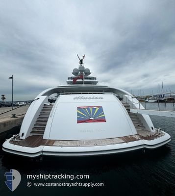
ILLUSION
Yacht
Current Trip
| Time Travelled | 8 days |
|---|---|
| Remaining Time | --- |
| Distance Travelled | 25.14 nm |
| Remaining Distance | --- |
| AVG Speed | 8.8 Noeuds |
| MAX Speed | 15.2 Noeuds |
| AVG Wind | 18.7 knots |
| MAX Wind | 23.4 knots |
| MIN Temp | 25.1°C / 77.18°F |
| MAX Temp | 26.6°C / 79.88°F |
| Tirant d eau | 3.2 m |
| Position reçue | 9 m depuis |
Current Position
| Longitude | --- |
|---|---|
| Latitude | --- |
| Etat | At anchor |
| Vitesse | 0.1 Noeuds |
| Parcours | 114° |
| Zone | Caribbean Sea |
| Station | T-AIS |
| Position reçue | 9 m depuis |
Info
Information
The current position of ILLUSION is in Caribbean Sea with coordinates 17.90307° / -62.86170° as reported on 2025-02-16 12:03 by AIS to our vessel tracker app. The vessel's current speed is 0.1 Noeuds
The vessel ILLUSION (IMO: 9679830, MMSI: 319744000) is a Yacht that was built in 2013 ( 12 Age ). It's sailing under the flag of [KY] Cayman Is.
In this page you can find informations about the vessels current position, last detected port calls, and current voyage information. If the vessels is not in coverage by AIS you will find the latest position.
The current position of ILLUSION is detected by our AIS receivers and we are not responsible for the reliability of the data. The last position was recorded while the vessel was in Coverage by the Ais receivers of our vessel tracking app.
The current draught of ILLUSION as reported by AIS is 3.2 meters
Weather
| Temperature | 25.3°C / 77.54°F |
|---|---|
| Wind Speed | 19 knots |
| Direction | 92° E |
| Pressure | 1018.3 hPa |
| Humidity | 70.7 % |
| Cloud Coverage | --- |
Featured Company
Last Port Calls
| Port | Arrival | Departure | Time In Port |
|---|---|---|---|
| 2025-02-06 09:33 | 2025-02-07 12:47 | 1 d | |
| 2025-01-04 07:09 | 2025-01-17 01:10 | 12 d | |
| 2024-12-23 15:40 | 2024-12-26 10:15 | 2 d | |
| 2024-12-01 15:15 | 2024-12-05 09:02 | 3 d |
Last Trips
| Origin | Departure | Destination | Arrival | Distance | |
|---|---|---|---|---|---|
| 2025-01-17 01:10 | 2025-02-06 09:33 | 339.28 nm | |||
| 2024-12-26 10:15 | 2025-01-04 07:09 | 241.02 nm | |||
| 2024-12-05 09:02 | 2024-12-23 15:40 | 440.35 nm | |||
| 2024-11-23 12:41 | 2024-12-01 15:15 | 88.23 nm |
Events
| Heure | Evenement | Détails | Position/ Destination | Info |
|---|---|---|---|---|
| 2025-02-16 11:09 | Dans la zone couverte |
17.90300 / -62.86173
Caribbean Sea
|
Vitesse: 0.1 kn Parcours: 134.1° |
|
| 2025-02-15 18:24 | Hors de la zone couverte |
17.90302 / -62.86170
Caribbean Sea
|
Vitesse: 0.3 kn Parcours: 303.3° |
|
| 2025-02-15 16:42 | Dans la zone couverte |
17.90293 / -62.86165
Caribbean Sea
|
Vitesse: 0.4 kn Parcours: 282.9° |
|
| 2025-02-15 15:12 | Hors de la zone couverte |
17.90309 / -62.86184
Caribbean Sea
|
Vitesse: 0.3 kn Parcours: 163.5° |
|
| 2025-02-15 14:03 | Dans la zone couverte |
17.90287 / -62.86160
Caribbean Sea
|
Vitesse: 0.2 kn Parcours: 137.6° |
|
| 2025-02-15 09:42 | Hors de la zone couverte |
17.90311 / -62.86174
Caribbean Sea
|
Vitesse: 0.2 kn Parcours: 237.3° |
|
| 2025-02-15 09:42 | Dans la zone couverte |
17.90311 / -62.86174
Caribbean Sea
|
Vitesse: 0.2 kn Parcours: 237.3° |
|
| 2025-02-14 19:48 | Hors de la zone couverte |
17.90300 / -62.86180
Caribbean Sea
|
Vitesse: 0.2 kn Parcours: 126.1° |
|
| 2025-02-14 19:48 | Dans la zone couverte |
17.90300 / -62.86180
Caribbean Sea
|
Vitesse: 0.2 kn Parcours: 126.1° |
|
| 2025-02-14 18:33 | Hors de la zone couverte |
17.90302 / -62.86185
Caribbean Sea
|
Vitesse: Parcours: 222.5° |