
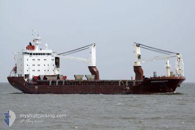
HUMBERGRACHT
General Cargo
Current Trip
| Time Travelled | 15 days |
|---|---|
| Remaining Time | 1 h, 17 mins |
| Distance Travelled | 4682.92 nm |
| Remaining Distance | 17.07 nm |
| AVG Speed | 12.5 Knop |
| MAX Speed | 16 Knop |
| AVG Wind | 12.4 knots |
| MAX Wind | 24.9 knots |
| MIN Temp | 18.6°C / 65.48°F |
| MAX Temp | 29.4°C / 84.92°F |
| Djupgående | 7.5 m |
| Position mottagen | 18 m sen |
Current Position
| Longitud | 136.84718° |
|---|---|
| Latitude | 34.70067° |
| Status | Under way using engine |
| Fart | 10.7 Knop |
| Kurs | 328.1° |
| Område | Philippine Sea |
| Station | T-AIS |
| Position mottagen | 18 m sen |
Info
Information
The current position of HUMBERGRACHT is in Philippine Sea with coordinates 34.70067° / 136.84718° as reported on 2024-06-01 05:38 by AIS to our vessel tracker app. The vessel's current speed is 10.7 Knop and is heading at the port of YOKKAICHI. The estimated time of arrival as calculated by MyShipTracking vessel tracking app is 2024-06-01 07:13 LT
The vessel HUMBERGRACHT (IMO: 9433274, MMSI: 244040000) is a General Cargo that was built in 2009 ( 15 År gammal ). It's sailing under the flag of [NL] Netherlands.
In this page you can find informations about the vessels current position, last detected port calls, and current voyage information. If the vessels is not in coverage by AIS you will find the latest position.
The current position of HUMBERGRACHT is detected by our AIS receivers and we are not responsible for the reliability of the data. The last position was recorded while the vessel was in Coverage by the Ais receivers of our vessel tracking app.
The current draught of HUMBERGRACHT as reported by AIS is 7.5 meters
Weather
| Temperature | 20.6°C / 69.08°F |
|---|---|
| Wind Speed | 5 knots |
| Direction | 146° SE |
| Pressure | 1008.3 hPa |
| Humidity | 62 % |
| Cloud Coverage | 41 % |
Featured Company
Last Port Calls
| Port | Arrival | Departure | Time In Port |
|---|---|---|---|
| 2024-05-16 04:05 | 2024-05-17 05:35 | 1 d | |
| 2024-04-10 00:58 | 2024-05-06 08:36 | 26 d | |
| 2024-04-02 02:20 | 2024-04-04 22:50 | 2 d |
Most Visited Ports (Last year)
| Port | Arrivals | |
|---|---|---|
| 3 | ||
| 2 | ||
| 2 | ||
| 2 | ||
| 1 | ||
| 1 |
Last Trips
| Origin | Departure | Destination | Arrival | Distance | |
|---|---|---|---|---|---|
| 2024-05-06 16:36 | 2024-05-16 12:05 | 2367.32 nm | |||
| 2024-04-05 06:50 | 2024-04-10 08:58 | 1394.27 nm | |||
| 2024-03-18 23:31 | 2024-04-02 10:20 | 4032.63 nm |
Events
| Tid | Event | Detaljer | Position / Dest | Information |
|---|---|---|---|---|
| 2024-06-01 05:42 | Status ändrad | Default Under way using engine |
34.71107 / 136.83946
JPYKK
|
Fart: 10.7 kn Kurs: 328.1° |
| 2024-06-01 05:29 | Status ändrad | Under way using engine Default |
34.67836 / 136.86396
JPYKK
|
Fart: 10.5 kn Kurs: 326° |
| 2024-06-01 05:06 | Status ändrad | Default Under way using engine |
34.62600 / 136.91202
JPYKK
|
Fart: 9.7 kn Kurs: 301.1° |
| 2024-06-01 05:02 | Byter havsområde | Japanese part of the Philippine Sea Australian part of the Indian Ocean |
34.61943 / 136.92399
Philippine Sea
|
Fart: 9.6 kn Kurs: 302.1° |
| 2024-06-01 05:00 | Status ändrad | Under way using engine Default |
34.61677 / 136.92954
JPYKK
|
Fart: 9.9 kn Kurs: 306° |
| 2024-06-01 05:00 | I täckningsområde |
34.61943 / 136.92399
Philippine Sea
|
Fart: 9.6 kn Kurs: 302.1° |