
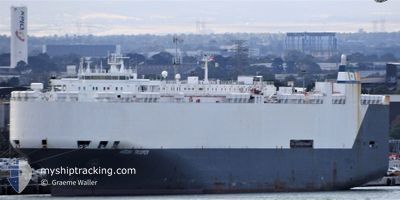
HOEGH TROOPER
Vehicles Carrier
Current Trip
MUPLU>MGTMM
| Time Travelled | 6 days |
|---|---|
| Remaining Time | --- |
| Distance Travelled | 2367.58 nm |
| Remaining Distance | --- |
| AVG Speed | 16 Knop |
| MAX Speed | 19.1 Knop |
| AVG Wind | 11 knots |
| MAX Wind | 18.5 knots |
| MIN Temp | 25.2°C / 77.36°F |
| MAX Temp | 28.4°C / 83.12°F |
| Djupgående | 7.8 m |
| Position mottagen | 8 d sen |
Current Position
| Longitud | --- |
|---|---|
| Latitude | --- |
| Status | Under way using engine |
| Fart | 8.1 Knop |
| Kurs | 308° |
| Område | Indian Ocean |
| Station | T-AIS |
| Position mottagen | 8 d sen |
Info
Information
The current position of HOEGH TROOPER is in Indian Ocean with coordinates -20.13938° / 57.47337° as reported on 2025-01-05 11:31 by AIS to our vessel tracker app. The vessel's current speed is 8.1 Knop
The vessel HOEGH TROOPER (IMO: 9075711, MMSI: 257714000) is a Vehicles Carrier that was built in 1995 ( 30 År gammal ). It's sailing under the flag of [NO] Norway.
In this page you can find informations about the vessels current position, last detected port calls, and current voyage information. If the vessels is not in coverage by AIS you will find the latest position.
The current position of HOEGH TROOPER is detected by our AIS receivers and we are not responsible for the reliability of the data. The last position was recorded while the vessel was in Coverage by the Ais receivers of our vessel tracking app.
The current draught of HOEGH TROOPER as reported by AIS is 7.8 meters
Weather
| Temperature | 25.3°C / 77.54°F |
|---|---|
| Wind Speed | 11 knots |
| Direction | 39° NE |
| Pressure | 1009.3 hPa |
| Humidity | 81.9 % |
| Cloud Coverage | 97 % |
Featured Company
Last Port Calls
| Port | Arrival | Departure | Time In Port |
|---|---|---|---|
| 2025-01-07 06:42 | 2025-01-08 02:11 | 19 h | |
| 2025-01-05 04:54 | 2025-01-05 15:36 | 10 h | |
| 2024-12-30 11:29 | 2025-01-04 10:57 | 4 d | |
| 2024-12-19 10:08 | 2024-12-26 14:55 | 7 d | |
| 2024-12-17 04:43 | 2024-12-18 05:12 | 1 d | |
| 2024-12-02 09:47 | 2024-12-02 22:15 | 12 h | |
| 2024-11-29 07:26 | 2024-11-29 15:01 | 7 h | |
| 2024-11-26 05:26 | 2024-11-27 18:05 | 1 d | |
| 2024-11-25 07:00 | 2024-11-25 20:26 | 13 h | |
| 2024-11-20 02:52 | 2024-11-22 10:59 | 2 d |
Most Visited Ports (Last year)
| Port | Arrivals | |
|---|---|---|
| 3 | ||
| 3 | ||
| 3 | ||
| 3 | ||
| 3 | ||
| 3 |
Last Trips
| Origin | Departure | Destination | Arrival | Distance | |
|---|---|---|---|---|---|
| 2025-01-05 15:36 | 2025-01-07 06:42 | 475.74 nm | |||
| 2025-01-04 10:57 | 2025-01-05 04:54 | 163.23 nm | |||
| 2024-12-26 14:55 | 2024-12-30 11:29 | 1428.63 nm | |||
| 2024-12-18 05:12 | 2024-12-19 10:08 | 400.54 nm | |||
| 2024-12-02 22:15 | 2024-12-17 04:43 | 5547.93 nm | |||
| 2024-11-29 15:01 | 2024-12-02 09:47 | 898.66 nm | |||
| 2024-11-27 18:05 | 2024-11-29 07:26 | 600.87 nm | |||
| 2024-11-25 20:26 | 2024-11-26 05:26 | 110.89 nm | |||
| 2024-11-22 10:59 | 2024-11-25 07:00 | 478.14 nm | |||
| 2024-11-18 17:46 | 2024-11-20 02:52 | 392.75 nm |
Events
| Tid | Event | Detaljer | Position / Dest | Information |
|---|---|---|---|---|
| 2025-01-07 23:11 | AVGÅTT HAMN |
|
-18.13993 / 49.42698
MUPLU>MGTMM
|
Fart: 4.6 kn Kurs: 39° |
| 2025-01-07 23:02 | STARTAR förflyttning |
-18.15223 / 49.42311
[MG] TOAMASINA
|
Fart: 3.7 kn Kurs: 349° |
|
| 2025-01-07 03:57 | STOPPAR förflyttning |
-18.14430 / 49.42483
[MG] TOAMASINA
|
Fart: 0.2 kn Kurs: 50° |
|
| 2025-01-07 03:42 | ANLÄNDER HAMN |
|
-18.14698 / 49.42718
[MG] TOAMASINA
|
Fart: 1.5 kn Kurs: 199° |
| 2025-01-07 03:04 | STARTAR förflyttning | 3.22 nm, North of TOAMASINA |
-18.09656 / 49.43744
MUPLU>MGTMM
|
Fart: 5.1 kn Kurs: 195° |
| 2025-01-07 02:55 | STOPPAR förflyttning | 3.44 nm, North of TOAMASINA |
-18.09298 / 49.43844
MUPLU>MGTMM
|
Fart: 0.1 kn Kurs: 221° |
| 2025-01-05 11:36 | Status ändrad | Default Under way using engine |
-20.13264 / 57.46160
MUPLU>MGTMM
|
Fart: 8.1 kn Kurs: 308° |
| 2025-01-05 11:36 | AVGÅTT HAMN |
|
-20.13264 / 57.46160
MUPLU>MGTMM
|
Fart: 8.1 kn Kurs: 308° |
| 2025-01-05 11:31 | UTANFÖR täckningsområde |
-20.13938 / 57.47337
Indian Ocean
MUPLU>MGTMM
|
Fart: 8.1 kn Kurs: 306.7° |
|
| 2025-01-05 11:23 | STARTAR förflyttning |
-20.14999 / 57.48802
[MU] PORT LOUIS
|
Fart: 5.9 kn Kurs: 309° |