
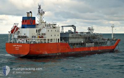
HAPPY PELICAN
Tanker D
Current Trip
GBTEE-ITVDA
| Time Travelled | 4 days |
|---|---|
| Remaining Time | --- |
| Distance Travelled | 1195.12 nm |
| Remaining Distance | --- |
| AVG Speed | 10.8 Knop |
| MAX Speed | 14.4 Knop |
| AVG Wind | 14 knots |
| MAX Wind | 20.9 knots |
| MIN Temp | 10.9°C / 51.62°F |
| MAX Temp | 17.4°C / 63.32°F |
| Djupgående | 7.1 m |
| Position mottagen | 5 m sen |
Current Position
| Longitud | -10.19876° |
|---|---|
| Latitude | 39.66698° |
| Status | Under way using engine |
| Fart | 11.5 Knop |
| Kurs | 178.3° |
| Område | English Channel |
| Station | T-AIS |
| Position mottagen | 5 m sen |
Info
Information
The current position of HAPPY PELICAN is in English Channel with coordinates 39.66698° / -10.19876° as reported on 2024-05-17 21:08 by AIS to our vessel tracker app. The vessel's current speed is 11.5 Knop
The vessel HAPPY PELICAN (IMO: 9618850, MMSI: 235094449) is a Tanker D It's sailing under the flag of [GB] United Kingdom.
In this page you can find informations about the vessels current position, last detected port calls, and current voyage information. If the vessels is not in coverage by AIS you will find the latest position.
The current position of HAPPY PELICAN is detected by our AIS receivers and we are not responsible for the reliability of the data. The last position was recorded while the vessel was in Coverage by the Ais receivers of our vessel tracking app.
The current draught of HAPPY PELICAN as reported by AIS is 7.1 meters
Weather
| Temperature | 15.4°C / 59.72°F |
|---|---|
| Wind Speed | 15 knots |
| Direction | 348° NNW |
| Pressure | 1016.5 hPa |
| Humidity | 76 % |
| Cloud Coverage | 2 % |
Featured Company
Most Visited Ports (Last year)
| Port | Arrivals | |
|---|---|---|
| 15 | ||
| 10 | ||
| 5 | ||
| 3 | ||
| 2 | ||
| 2 |
Last Trips
| Origin | Departure | Destination | Arrival | Distance | |
|---|---|---|---|---|---|
| 2024-05-04 10:20 | 2024-05-12 03:16 | 430.45 nm | |||
| 2024-04-29 21:18 | 2024-05-02 18:37 | 372.61 nm | |||
| 2024-04-15 09:28 | 2024-04-28 07:33 | 3134.66 nm | |||
| 2024-03-23 15:40 | 2024-04-14 11:17 | 3767.42 nm | |||
| 2024-02-15 19:20 | 2024-03-20 23:47 | 6852.86 nm |
Events
| Tid | Event | Detaljer | Position / Dest | Information |
|---|---|---|---|---|
| 2024-05-17 20:58 | Byter havsområde | Portuguese part of the North Atlantic Ocean United Kingdom part of the English Channel |
39.69658 / -10.19942
North Atlantic Ocean
GBTEE-ITVDA
|
Fart: 11.6 kn Kurs: 185.8° |
| 2024-05-17 20:58 | Status ändrad | Under way using engine Default |
39.69718 / -10.19937
GBTEE-ITVDA
|
Fart: 11.7 kn Kurs: 182° |
| 2024-05-17 20:54 | I täckningsområde |
39.69658 / -10.19942
North Atlantic Ocean
GBTEE-ITVDA
|
Fart: 11.6 kn Kurs: 185.8° |
|
| 2024-05-15 06:29 | Status ändrad | Default Under way using engine |
49.61113 / -3.95924
GBTEE-ITVDA
|
Fart: 10.7 kn Kurs: 245.5° |
| 2024-05-15 06:23 | Status ändrad | Under way using engine Default |
49.62014 / -3.93277
GBTEE-ITVDA
|
Fart: 10.6 kn Kurs: 243° |
| 2024-05-15 06:23 | UTANFÖR täckningsområde |
49.62014 / -3.93277
English Channel
GBTEE-ITVDA
|
Fart: 10.7 kn Kurs: 245.5° |
|
| 2024-05-15 06:14 | Status ändrad | Default Under way using engine |
49.63146 / -3.89898
GBTEE-ITVDA
|
Fart: 10.6 kn Kurs: 242° |
| 2024-05-15 05:43 | Status ändrad | Under way using engine Default |
49.67910 / -3.77344
GBTEE-ITVDA
|
Fart: 10.7 kn Kurs: 236° |
| 2024-05-15 05:23 | Status ändrad | Default Under way using engine |
49.71150 / -3.69421
GBTEE-ITVDA
|
Fart: 10.9 kn Kurs: 238.6° |
| 2024-05-15 05:15 | Status ändrad | Under way using engine Default |
49.72423 / -3.66362
GBTEE-ITVDA
|
Fart: 11 kn Kurs: 237° |