
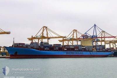
GUDRUN MAERSK
Container Ship
Current Trip
| Time Travelled | 3 days |
|---|---|
| Remaining Time | --- |
| Distance Travelled | 1312.88 nm |
| Remaining Distance | --- |
| AVG Speed | 16.2 Knop |
| MAX Speed | 19.5 Knop |
| AVG Wind | 8.2 knots |
| MAX Wind | 22 knots |
| MIN Temp | 27.5°C / 81.5°F |
| MAX Temp | 30.7°C / 87.26°F |
| Djupgående | 14.6 m |
| Position mottagen | 3 d sen |
Current Position
| Longitud | 103.50301° |
|---|---|
| Latitude | 1.21025° |
| Status | Under way using engine |
| Fart | 13.7 Knop |
| Kurs | 280° |
| Område | Singapore Strait |
| Station | T-AIS |
| Position mottagen | 3 d sen |
Info
Information
The current position of GUDRUN MAERSK is in Singapore Strait with coordinates 1.21025° / 103.50301° as reported on 2024-05-17 01:36 by AIS to our vessel tracker app. The vessel's current speed is 13.7 Knop and is heading at the port of NEW YORK. The estimated time of arrival as calculated by MyShipTracking vessel tracking app is 2024-06-13 12:00 LT
The vessel GUDRUN MAERSK (IMO: 9302877, MMSI: 220379000) is a Container Ship that was built in 2005 ( 19 År gammal ). It's sailing under the flag of [DK] Denmark.
In this page you can find informations about the vessels current position, last detected port calls, and current voyage information. If the vessels is not in coverage by AIS you will find the latest position.
The current position of GUDRUN MAERSK is detected by our AIS receivers and we are not responsible for the reliability of the data. The last position was recorded while the vessel was in Coverage by the Ais receivers of our vessel tracking app.
The current draught of GUDRUN MAERSK as reported by AIS is 14.6 meters
Weather
| Temperature | 29.3°C / 84.74°F |
|---|---|
| Wind Speed | 13 knots |
| Direction | 274° W |
| Pressure | 1006.2 hPa |
| Humidity | 74.2 % |
| Cloud Coverage | 100 % |
Featured Company
Last Port Calls
| Port | Arrival | Departure | Time In Port |
|---|---|---|---|
| 2024-05-16 00:56 | 2024-05-17 08:17 | 1 d | |
| 2024-05-04 15:16 | 2024-05-05 17:36 | 1 d | |
| 2024-05-03 08:56 | 2024-05-04 06:16 | 21 h | |
| 2024-05-01 14:18 | 2024-05-02 19:13 | 1 d | |
| 2024-04-25 21:00 | 2024-04-27 12:04 | 1 d | |
| 2024-03-25 08:23 | 2024-03-26 23:35 | 1 d | |
| 2024-03-17 09:04 | 2024-03-19 00:21 | 1 d | |
| 2024-03-14 12:16 | 2024-03-15 23:23 | 1 d | |
| 2024-03-13 03:33 | 2024-03-14 02:14 | 22 h | |
| 2024-03-09 04:44 | 2024-03-10 10:40 | 1 d |
Most Visited Ports (Last year)
| Port | Arrivals | |
|---|---|---|
| 5 | ||
| 4 | ||
| 4 | ||
| 3 | ||
| 3 | ||
| 3 |
Last Trips
| Origin | Departure | Destination | Arrival | Distance | |
|---|---|---|---|---|---|
| 2024-05-05 17:36 | 2024-05-16 00:56 | 1591.16 nm | |||
| 2024-05-04 06:16 | 2024-05-04 15:16 | 126.85 nm | |||
| 2024-05-02 19:13 | 2024-05-03 08:56 | 118.22 nm | |||
| 2024-04-27 12:04 | 2024-05-01 14:18 | 1499.32 nm | |||
| 2024-03-26 23:35 | 2024-04-25 21:00 | 12287.44 nm | |||
| 2024-03-19 00:21 | 2024-03-25 08:23 | 311.22 nm | |||
| 2024-03-15 23:23 | 2024-03-17 09:04 | 419.84 nm | |||
| 2024-03-14 02:14 | 2024-03-14 12:16 | 119.78 nm | |||
| 2024-03-10 10:40 | 2024-03-13 03:33 | 616.26 nm | |||
| 2024-02-10 18:49 | 2024-03-09 04:44 | 12469.96 nm |
Events
| Tid | Event | Detaljer | Position / Dest | Information |
|---|---|---|---|---|
| 2024-05-17 01:40 | Status ändrad | Default Under way using engine |
1.21330 / 103.48859
SGSIN > USNWK
|
Fart: 13.7 kn Kurs: 280° |
| 2024-05-17 01:36 | UTANFÖR täckningsområde |
1.21025 / 103.50301
Singapore Strait
SGSIN > USNWK
|
Fart: 13.7 kn Kurs: 280° |
|
| 2024-05-17 01:14 | Byter havsområde | Malaysian part of the Singapore Strait Indonesian part of the Singapore Strait |
1.19713 / 103.58442
Singapore Strait
SGSIN > USNWK
|
Fart: 12.3 kn Kurs: 276.1° |
| 2024-05-17 00:56 | Byter havsområde | Indonesian part of the Singapore Strait Singaporean part of the Singapore Strait |
1.19923 / 103.63898
Singapore Strait
SGSIN > USNWK
|
Fart: 8.8 kn Kurs: 266.1° |
| 2024-05-17 00:17 | AVGÅTT HAMN |
|
1.25610 / 103.64561
SGSIN > USNWK
|
Fart: 6.3 kn Kurs: 114° |
| 2024-05-17 00:10 | STARTAR förflyttning |
1.25693 / 103.63601
[SG] SINGAPORE
|
Fart: 3.2 kn Kurs: 95° |
|
| 2024-05-16 23:51 | Status ändrad | Under way using engine Default |
1.25562 / 103.63238
[SG] SINGAPORE
|
Fart: 0.5 kn Kurs: 266° |
| 2024-05-16 23:19 | Status ändrad | Default Moored |
1.25419 / 103.63219
[SG] SINGAPORE
|
Fart: Kurs: 271° |
| 2024-05-16 23:13 | Status ändrad | Moored Default |
1.25419 / 103.63220
[SG] SINGAPORE
|
Fart: Kurs: 271° |
| 2024-05-16 22:55 | Status ändrad | Default Moored |
1.25419 / 103.63219
[SG] SINGAPORE
|
Fart: Kurs: 271° |